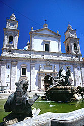
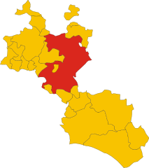
Marianopoli (Marianopoli)
.svg)
- Italian comune
 Hiking in Marianopoli
Marianopoli, a picturesque town located in Sicily, Italy, offers stunning landscapes and a variety of outdoor activities, including hiking. The surrounding areas provide several trails that cater to different skill levels, allowing hikers to explore the beautiful natural scenery.
Hiking Areas Near Marianopoli:
-
Parco dei Nebrodi: This regional park, located not too far from Marianopoli, is one of Sicily's largest protected areas. It features a mix of forests, mountains, and wildlife, with trails that vary in difficulty. Popular routes include those that lead to scenic viewpoints, waterfalls, and ancient ruins.
-
Monte Cammarata: This mountain area is known for its breathtaking views and diverse flora and fauna. The trails here range from easy walks to more challenging ascents, making it suitable for both beginner and experienced hikers.
-
The Sicilian Countryside: Many trails meander through the beautiful rural landscapes surrounding Marianopoli. Hikers can expect to see vineyards, olive groves, and historical sites along the way, all while enjoying the serene ambiance of the Sicilian countryside.
Tips for Hiking in Marianopoli:
-
Check Weather Conditions: The Sicilian weather can be hot in summer, so early morning or late afternoon hikes can be more comfortable. Be sure to check forecasts before heading out.
-
Wear Appropriate Gear: Invest in good hiking boots and pack plenty of water, especially during warmer months. A hat and sunscreen are also recommended to protect against the sun.
-
Take a Map or GPS: While many trails are marked, having a map or GPS device can help ensure you stay oriented on your hike.
-
Respect Nature: Follow Leave No Trace principles by staying on marked trails and carrying out any waste.
-
Local Guidance: If you're unfamiliar with the area, consider hiring a local guide who can provide insights into both the natural environment and cultural history.
With its beautiful landscapes and rich culture, hiking in and around Marianopoli can offer a memorable experience for adventurers and nature lovers alike.
- Country:

- Postal Code: 93010
- Local Dialing Code: 0934
- Licence Plate Code: CL
- Coordinates: 37° 36' 0" N, 13° 55' 0" E


- GPS tracks (wikiloc): [Link]
- AboveSeaLevel: 720 м m
- Area: 13.07 sq km
- Population: 1817
- Web site: http://www.comunemarianopoli.it/
- Wikipedia en: wiki(en)
- Wikipedia: wiki(it)
- Wikidata storage: Wikidata: Q477537
- Wikipedia Commons Category: [Link]
- Freebase ID: [/m/0gqgpt]
- GeoNames ID: Alt: [6539178]
- VIAF ID: Alt: [156876009]
- OSM relation ID: [39300]
- GND ID: Alt: [4777548-8]
- WOEID: [717883]
- TGN ID: [1045253]
- Digital Atlas of the Roman Empire ID: [30219]
- ISTAT ID: 085008
- Italian cadastre code: E953
Shares border with regions:
Caltanissetta
- Italian comune
Hiking in Caltanissetta
Caltanissetta, located in the heart of Sicily, is a region rich in natural beauty, historical significance, and diverse landscapes, making it an attractive destination for hikers. Here are some highlights about hiking in Caltanissetta:...
- Country:
- Postal Code: 93100
- Local Dialing Code: 0934
- Licence Plate Code: CL
- Coordinates: 37° 29' 25" N, 14° 3' 44" E
- GPS tracks (wikiloc): [Link]
- AboveSeaLevel: 568 м m
- Area: 421.25 sq km
- Population: 62317
- Web site: [Link]


Mussomeli
- Italian comune
Hiking in Mussomeli
Mussomeli, located in the province of Caltanissetta in Sicily, Italy, offers a unique hiking experience characterized by its beautiful landscapes, rich history, and diverse ecosystems. Here are some highlights and tips for hiking in and around Mussomeli:...
- Country:
- Postal Code: 93014
- Local Dialing Code: 0934
- Licence Plate Code: CL
- Coordinates: 37° 35' 0" N, 13° 45' 0" E
- GPS tracks (wikiloc): [Link]
- AboveSeaLevel: 650 м m
- Area: 164.43 sq km
- Population: 10556
- Web site: [Link]
Villalba, Sicily
- Italian comune
Hiking in Villalba, Sicily
Villalba, located in the heart of Sicily, offers a unique experience for hiking enthusiasts. The area is characterized by its picturesque landscapes, rolling hills, and rich history, making it a wonderful destination for outdoor activities....
- Country:
- Postal Code: 93010
- Local Dialing Code: 0934
- Licence Plate Code: CL
- Coordinates: 37° 39' 0" N, 13° 50' 0" E
- GPS tracks (wikiloc): [Link]
- AboveSeaLevel: 620 м m
- Area: 41.82 sq km
- Population: 1590
- Web site: [Link]


Petralia Sottana
- Italian comune
Hiking in Petralia Sottana
Petralia Sottana is a charming town situated in the Madonie Mountains of Sicily, Italy. It offers a variety of hiking opportunities for outdoor enthusiasts, making it a great destination for those looking to explore nature. Here are some key points and recommendations for hiking in the area:...
- Country:
- Postal Code: 90027
- Local Dialing Code: 0921
- Licence Plate Code: PA
- Coordinates: 37° 48' 0" N, 14° 5' 0" E
- GPS tracks (wikiloc): [Link]
- AboveSeaLevel: 1000 м m
- Area: 178.35 sq km
- Population: 2730
- Web site: [Link]