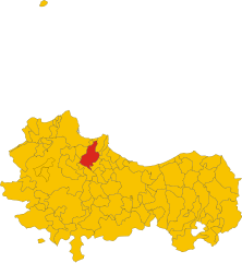
Marineo (Marineo)
.svg)
- Italian comune
 Hiking in Marineo
Marineo, a small town in Sicily, Italy, is surrounded by stunning natural landscapes that offer various hiking opportunities. Here are some highlights and tips for hiking in and around Marineo:
Hiking Trails
-
Monte Grifone: A prominent peak near Marineo, Monte Grifone provides several trails with varying levels of difficulty. The trails lead you through lush forests and offer panoramic views of the surrounding countryside.
-
Parks and Natural Reserves: The Madonie Regional Natural Park is not far from Marineo and features numerous hiking paths. You'll find diverse flora and fauna, lovely streams, and beautiful vistas.
-
Local Trails: There are smaller trails that can be found around Marineo that allow you to explore the rural landscape, including olive groves, vineyards, and ancient ruins.
Tips for Hiking in Marineo
-
Weather: Check the weather forecast before heading out. Sicily can experience significant temperature variations, so dress in layers and be prepared for sudden changes.
-
Footwear: Wear sturdy, comfortable hiking boots that provide good ankle support, especially if you plan to hike rocky or uneven terrain.
-
Stay Hydrated: Always carry enough water, particularly in the warmer months. There might be limited sources of freshwater on some trails.
-
Trail Maps: Familiarize yourself with trail maps or download them on your phone. Also, consider using apps that provide GPS features.
-
Respect Nature: Follow the Leave No Trace principles—stay on marked paths, pack out what you pack in, and do not disturb wildlife.
-
Local Guidance: If you're unsure about trails or conditions, consider contacting local hiking groups or tourist information centers in Marineo for guidance.
-
Safety: Hiking alone can be risky, so try to hike in groups when possible. Inform someone about your hiking plans, especially if you're going into more remote areas.
Scenic Views and Cultural Experiences
While hiking, take the time to enjoy not only the natural landscape but also the cultural heritage of Marineo. You may encounter ancient churches, historical sites, and the local lifestyle, enhancing your outdoor experience.
Hiking in Marineo can be a fantastic way to explore the Sicilian countryside, enjoy its diverse landscapes, and connect with nature. Whether you're a seasoned hiker or a beginner, there are plenty of options to enjoy!
- Country:

- Postal Code: 90035
- Local Dialing Code: 091
- Licence Plate Code: PA
- Coordinates: 37° 57' 0" N, 13° 25' 0" E


- GPS tracks (wikiloc): [Link]
- AboveSeaLevel: 550 м m
- Area: 33.43 sq km
- Population: 6541
- Web site: http://www.comune.marineo.pa.it
- Wikipedia en: wiki(en)
- Wikipedia: wiki(it)
- Wikidata storage: Wikidata: Q491398
- Wikipedia Commons Category: [Link]
- Freebase ID: [/m/0gqbdw]
- GeoNames ID: Alt: [6539866]
- VIAF ID: Alt: [158376507]
- OSM relation ID: [39410]
- GND ID: Alt: [4298437-3]
- Digital Atlas of the Roman Empire ID: [30176]
- ISTAT ID: 082046
- Italian cadastre code: E957
Shares border with regions:


Monreale
- Italian comune
Hiking in Monreale
Monreale, a charming town located just outside of Palermo in Sicily, Italy, is known for its stunning views, beautiful Norman cathedral, and rich history. While it is primarily famous for its architectural heritage, the surrounding areas offer some wonderful hiking opportunities that allow you to enjoy the natural beauty of Sicily....
- Country:
- Postal Code: 90046
- Local Dialing Code: 091
- Licence Plate Code: PA
- Coordinates: 38° 4' 54" N, 13° 17' 20" E
- GPS tracks (wikiloc): [Link]
- AboveSeaLevel: 310 м m
- Area: 530.18 sq km
- Population: 39047
- Web site: [Link]


Santa Cristina Gela
- Italian comune
Hiking in Santa Cristina Gela
Santa Cristina Gela, a picturesque village located in the Sicilian region of Italy, offers a range of hiking opportunities that make it a great destination for outdoor enthusiasts. The area is characterized by its stunning natural landscapes, rolling hills, and rich biodiversity, making it an ideal spot for both novice and experienced hikers....
- Country:
- Postal Code: 90030
- Local Dialing Code: 091
- Licence Plate Code: PA
- Coordinates: 37° 59' 5" N, 13° 19' 41" E
- GPS tracks (wikiloc): [Link]
- AboveSeaLevel: 670 м m
- Area: 38.74 sq km
- Population: 1008
- Web site: [Link]


Mezzojuso
- Italian comune
Hiking in Mezzojuso
Mezzojuso, located in Sicily, Italy, is a charming town surrounded by beautiful landscapes ideal for hiking enthusiasts. Here are some highlights for hiking in the area:...
- Country:
- Postal Code: 90030
- Local Dialing Code: 091
- Licence Plate Code: PA
- Coordinates: 37° 52' 0" N, 13° 28' 0" E
- GPS tracks (wikiloc): [Link]
- AboveSeaLevel: 570 м m
- Area: 49.27 sq km
- Population: 2877
- Web site: [Link]


Godrano
- Italian comune
Hiking in Godrano
Godrano is a quaint town located in Sicily, Italy, and is surrounded by stunning natural landscapes that offer various hiking opportunities. While the area is less known than other Sicilian destinations, it boasts beautiful trails that cater to different skill levels....
- Country:
- Postal Code: 90030
- Local Dialing Code: 091
- Licence Plate Code: PA
- Coordinates: 37° 54' 0" N, 13° 26' 0" E
- GPS tracks (wikiloc): [Link]
- AboveSeaLevel: 693 м m
- Area: 38.99 sq km
- Population: 1159
- Web site: [Link]

Misilmeri
- Italian comune
Hiking in Misilmeri
Misilmeri, located in Sicily, Italy, offers a variety of hiking opportunities that can be enjoyed by both beginners and experienced hikers. The surrounding natural landscapes are characterized by picturesque views, rugged hills, and historical sites that add to the charm of the region....
- Country:
- Postal Code: 90036
- Local Dialing Code: 091
- Licence Plate Code: PA
- Coordinates: 38° 2' 0" N, 13° 27' 0" E
- GPS tracks (wikiloc): [Link]
- AboveSeaLevel: 129 м m
- Area: 69.49 sq km
- Population: 29376
- Web site: [Link]
Cefalà Diana
- Italian comune
Hiking in Cefalà Diana
Cefalà Diana is a charming village located in the province of Palermo in Sicily, Italy. It lies nestled within the beautiful Sicilian landscape, providing a variety of opportunities for hiking and outdoor activities....
- Country:
- Postal Code: 90030
- Local Dialing Code: 091
- Licence Plate Code: PA
- Coordinates: 37° 55' 0" N, 13° 28' 0" E
- GPS tracks (wikiloc): [Link]
- AboveSeaLevel: 563 м m
- Area: 9.06 sq km
- Population: 1030
- Web site: [Link]
Bolognetta
- Italian comune
Hiking in Bolognetta
Bolognetta, a small town in Sicily, Italy, is surrounded by beautiful landscapes that offer great opportunities for hiking enthusiasts. While it may not be as widely recognized as some other hiking destinations, it provides a unique experience for those looking to explore the Sicilian countryside....
- Country:
- Postal Code: 90030
- Local Dialing Code: 091
- Licence Plate Code: PA
- Coordinates: 37° 57' 52" N, 13° 27' 22" E
- GPS tracks (wikiloc): [Link]
- AboveSeaLevel: 300 м m
- Area: 27.63 sq km
- Population: 4161
- Web site: [Link]


Villafrati
- Italian comune
Hiking in Villafrati
Villafrati is a charming town located in the Metropolitan City of Palermo in Sicily, Italy. The surrounding area offers a variety of hiking opportunities, showcasing the natural beauty and diverse landscapes of Sicily. Here are some key highlights for hiking in and around Villafrati:...
- Country:
- Postal Code: 90030
- Local Dialing Code: 091
- Licence Plate Code: PA
- Coordinates: 37° 54' 0" N, 13° 29' 0" E
- GPS tracks (wikiloc): [Link]
- AboveSeaLevel: 455 м m
- Area: 25.64 sq km
- Population: 3310
- Web site: [Link]