Maringues (Maringues)

- commune in Puy-de-Dôme, France
- Country:

- Postal Code: 63350
- Coordinates: 45° 55' 18" N, 3° 19' 49" E


- GPS tracks (wikiloc): [Link]
- Area: 22.11 sq km
- Population: 3088
- Web site: http://www.maringues.com
- Wikipedia en: wiki(en)
- Wikipedia: wiki(fr)
- Wikidata storage: Wikidata: Q285305
- Wikipedia Commons Category: [Link]
- Freebase ID: [/m/03qhbq2]
- GeoNames ID: Alt: [2995699]
- SIREN number: [216302109]
- BnF ID: [15269560v]
- VIAF ID: Alt: [237473987]
- WOEID: [610070]
- INSEE municipality code: 63210
Shares border with regions:

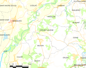
Crevant-Laveine
- commune in Puy-de-Dôme, France
- Country:
- Postal Code: 63350
- Coordinates: 45° 54' 53" N, 3° 22' 31" E
- GPS tracks (wikiloc): [Link]
- Area: 19.76 sq km
- Population: 971
- Web site: [Link]
Saint-Ignat
- commune in Puy-de-Dôme, France
- Country:
- Postal Code: 63720
- Coordinates: 45° 55' 23" N, 3° 16' 28" E
- GPS tracks (wikiloc): [Link]
- Area: 15.37 sq km
- Population: 857
- Web site: [Link]


Luzillat
- commune in Puy-de-Dôme, France
- Country:
- Postal Code: 63350
- Coordinates: 45° 56' 48" N, 3° 23' 24" E
- GPS tracks (wikiloc): [Link]
- Area: 23.19 sq km
- Population: 1089
- Web site: [Link]


Saint-Laure
- commune in Puy-de-Dôme, France
- Country:
- Postal Code: 63350
- Coordinates: 45° 54' 6" N, 3° 17' 31" E
- GPS tracks (wikiloc): [Link]
- Area: 6.89 sq km
- Population: 642
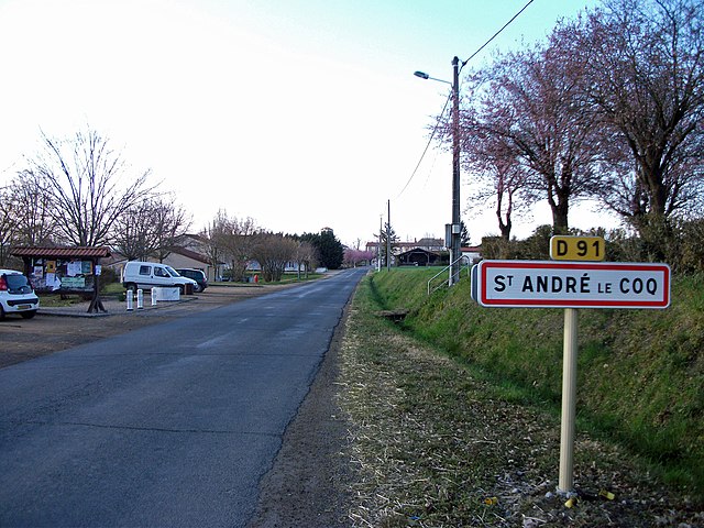

Saint-André-le-Coq
- commune in Puy-de-Dôme, France
- Country:
- Postal Code: 63310
- Coordinates: 45° 57' 50" N, 3° 18' 37" E
- GPS tracks (wikiloc): [Link]
- Area: 18.02 sq km
- Population: 522


Joze
- commune in Puy-de-Dôme, France
- Country:
- Postal Code: 63350
- Coordinates: 45° 51' 47" N, 3° 18' 8" E
- GPS tracks (wikiloc): [Link]
- Area: 19.35 sq km
- Population: 1104
- Web site: [Link]