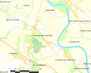
Marmande (Marmande)
- commune in Lot-et-Garonne, France
- Country:

- Postal Code: 47200
- Coordinates: 44° 30' 0" N, 0° 9' 55" E


- GPS tracks (wikiloc): [Link]
- AboveSeaLevel: 32 м m
- Area: 45.06 sq km
- Population: 17949
- Web site: http://www.mairie-marmande.fr
- Wikipedia en: wiki(en)
- Wikipedia: wiki(fr)
- Wikidata storage: Wikidata: Q210742
- Wikipedia Commons Category: [Link]
- Freebase ID: [/m/08sgb2]
- Freebase ID: [/m/08sgb2]
- GeoNames ID: Alt: [2995642]
- GeoNames ID: Alt: [2995642]
- SIREN number: [214701575]
- SIREN number: [214701575]
- BnF ID: [15261238x]
- BnF ID: [15261238x]
- VIAF ID: Alt: [238785745]
- VIAF ID: Alt: [238785745]
- GND ID: Alt: [4701102-6]
- GND ID: Alt: [4701102-6]
- Library of Congress authority ID: Alt: [n93014177]
- Library of Congress authority ID: Alt: [n93014177]
- MusicBrainz area ID: [fdbf5d65-735e-436f-a7fb-ccf36475cbdb]
- MusicBrainz area ID: [fdbf5d65-735e-436f-a7fb-ccf36475cbdb]
- Quora topic ID: [Marmande]
- Quora topic ID: [Marmande]
- Gran Enciclopèdia Catalana ID: [0040453]
- Gran Enciclopèdia Catalana ID: [0040453]
- INSEE municipality code: 47157
- INSEE municipality code: 47157
Shares border with regions:


Escassefort
- commune in Lot-et-Garonne, France
- Country:

- Postal Code: 47350
- Coordinates: 44° 32' 54" N, 0° 14' 15" E


- GPS tracks (wikiloc): [Link]
- Area: 13.92 sq km
- Population: 581
- Web site: [Link]


Montpouillan
- commune in Lot-et-Garonne, France
- Country:

- Postal Code: 47200
- Coordinates: 44° 28' 4" N, 0° 6' 18" E


- GPS tracks (wikiloc): [Link]
- Area: 12.07 sq km
- Population: 761
Saint-Pardoux-du-Breuil
- commune in Lot-et-Garonne, France
- Country:

- Postal Code: 47200
- Coordinates: 44° 28' 35" N, 0° 11' 35" E


- GPS tracks (wikiloc): [Link]
- Area: 7.3 sq km
- Population: 606


Fourques-sur-Garonne
- commune in Lot-et-Garonne, France
- Country:

- Postal Code: 47200
- Coordinates: 44° 26' 55" N, 0° 9' 30" E


- GPS tracks (wikiloc): [Link]
- Area: 13.96 sq km
- Population: 1298
- Web site: [Link]


Gaujac
- commune in Lot-et-Garonne, France
- Country:

- Postal Code: 47200
- Coordinates: 44° 29' 23" N, 0° 6' 39" E


- GPS tracks (wikiloc): [Link]
- Area: 7.33 sq km
- Population: 261


Beaupuy
- commune in Lot-et-Garonne, France
- Country:

- Postal Code: 47200
- Coordinates: 44° 32' 8" N, 0° 8' 45" E


- GPS tracks (wikiloc): [Link]
- Area: 8.17 sq km
- Population: 1666
- Web site: [Link]


Mauvezin-sur-Gupie
- commune in Lot-et-Garonne, France
- Country:

- Postal Code: 47200
- Coordinates: 44° 33' 21" N, 0° 9' 56" E


- GPS tracks (wikiloc): [Link]
- Area: 15.8 sq km
- Population: 582
- Web site: [Link]


Virazeil
- commune in Lot-et-Garonne, France
- Country:

- Postal Code: 47200
- Coordinates: 44° 30' 26" N, 0° 13' 7" E


- GPS tracks (wikiloc): [Link]
- Area: 19.87 sq km
- Population: 1729
- Web site: [Link]


Sainte-Bazeille
- commune in Lot-et-Garonne, France
- Country:

- Postal Code: 47180
- Coordinates: 44° 31' 51" N, 0° 5' 37" E


- GPS tracks (wikiloc): [Link]
- Area: 20.67 sq km
- Population: 3143
- Web site: [Link]
