Virazeil (Virazeil)

- commune in Lot-et-Garonne, France
- Country:

- Postal Code: 47200
- Coordinates: 44° 30' 26" N, 0° 13' 7" E


- GPS tracks (wikiloc): [Link]
- Area: 19.87 sq km
- Population: 1729
- Web site: http://www.virazeil.fr
- Wikipedia en: wiki(en)
- Wikipedia: wiki(fr)
- Wikidata storage: Wikidata: Q643625
- Wikipedia Commons Category: [Link]
- Freebase ID: [/m/03qm3kt]
- GeoNames ID: Alt: [6435119]
- SIREN number: [214703266]
- BnF ID: [15261405h]
- INSEE municipality code: 47326
Shares border with regions:


Escassefort
- commune in Lot-et-Garonne, France
- Country:
- Postal Code: 47350
- Coordinates: 44° 32' 54" N, 0° 14' 15" E
- GPS tracks (wikiloc): [Link]
- Area: 13.92 sq km
- Population: 581
- Web site: [Link]
Saint-Pardoux-du-Breuil
- commune in Lot-et-Garonne, France
- Country:
- Postal Code: 47200
- Coordinates: 44° 28' 35" N, 0° 11' 35" E
- GPS tracks (wikiloc): [Link]
- Area: 7.3 sq km
- Population: 606


Seyches
- commune in Lot-et-Garonne, France
- Country:
- Postal Code: 47350
- Coordinates: 44° 32' 59" N, 0° 18' 18" E
- GPS tracks (wikiloc): [Link]
- Area: 24.69 sq km
- Population: 1016


Marmande
- commune in Lot-et-Garonne, France
- Country:
- Postal Code: 47200
- Coordinates: 44° 30' 0" N, 0° 9' 55" E
- GPS tracks (wikiloc): [Link]
- AboveSeaLevel: 32 м m
- Area: 45.06 sq km
- Population: 17949
- Web site: [Link]


Puymiclan
- commune in Lot-et-Garonne, France
- Country:
- Postal Code: 47350
- Coordinates: 44° 30' 44" N, 0° 18' 57" E
- GPS tracks (wikiloc): [Link]
- Area: 25.74 sq km
- Population: 636

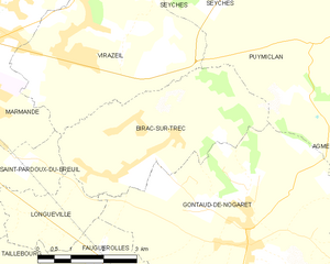
Birac-sur-Trec
- commune in Lot-et-Garonne, France
- Country:
- Postal Code: 47200
- Coordinates: 44° 29' 10" N, 0° 15' 53" E
- GPS tracks (wikiloc): [Link]
- Area: 14.34 sq km
- Population: 858