Marsac-sur-Don (Marsac-sur-Don)

- commune in Loire-Atlantique, France
- Country:

- Postal Code: 44170
- Coordinates: 47° 35' 44" N, 1° 40' 49" E


- GPS tracks (wikiloc): [Link]
- Area: 27.68 sq km
- Population: 1496
- Web site: http://www.mairie-marsacsurdon.fr
- Wikipedia en: wiki(en)
- Wikipedia: wiki(fr)
- Wikidata storage: Wikidata: Q666021
- Wikipedia Commons Category: [Link]
- Freebase ID: [/m/03nwc0p]
- Freebase ID: [/m/03nwc0p]
- GeoNames ID: Alt: [2995507]
- GeoNames ID: Alt: [2995507]
- SIREN number: [214400913]
- SIREN number: [214400913]
- BnF ID: [15260260v]
- BnF ID: [15260260v]
- INSEE municipality code: 44091
- INSEE municipality code: 44091
Shares border with regions:


Conquereuil
- commune in Loire-Atlantique, France
- Country:
- Postal Code: 44290
- Coordinates: 47° 37' 28" N, 1° 45' 5" E
- GPS tracks (wikiloc): [Link]
- Area: 32.87 sq km
- Population: 1099


Vay
- commune in Loire-Atlantique, France
- Country:
- Postal Code: 44170
- Coordinates: 47° 33' 17" N, 1° 42' 4" E
- GPS tracks (wikiloc): [Link]
- Area: 36.13 sq km
- Population: 2071
- Web site: [Link]

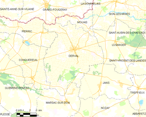
Derval
- commune in Loire-Atlantique, France
- Country:
- Postal Code: 44590
- Coordinates: 47° 40' 3" N, 1° 40' 17" E
- GPS tracks (wikiloc): [Link]
- Area: 63.51 sq km
- Population: 3487
- Web site: [Link]

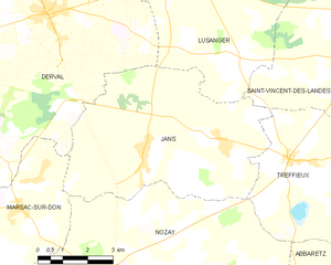
Jans
- commune in Loire-Atlantique, France
- Country:
- Postal Code: 44170
- Coordinates: 47° 37' 16" N, 1° 36' 50" E
- GPS tracks (wikiloc): [Link]
- Area: 33.21 sq km
- Population: 1314
- Web site: [Link]

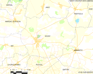
Nozay
- commune in Loire-Atlantique, France
- Country:
- Postal Code: 44170
- Coordinates: 47° 33' 52" N, 1° 37' 31" E
- GPS tracks (wikiloc): [Link]
- Area: 57.7 sq km
- Population: 4087
- Web site: [Link]


Guémené-Penfao
- commune in Loire-Atlantique, France
- Country:
- Postal Code: 44290
- Coordinates: 47° 37' 48" N, 1° 49' 57" E
- GPS tracks (wikiloc): [Link]
- Area: 105.51 sq km
- Population: 5231
- Web site: [Link]