Martigné-Briand (Martigné-Briand)

- former commune in Maine-et-Loire, France
- Country:

- Postal Code: 49540
- Coordinates: 47° 13' 59" N, 0° 25' 48" E


- GPS tracks (wikiloc): [Link]
- Area: 27.21 sq km
- Population: 1926
- Web site: http://www.martigne-briand.fr
- Wikipedia en: wiki(en)
- Wikipedia: wiki(fr)
- Wikidata storage: Wikidata: Q782647
- Wikipedia Commons Category: [Link]
- Freebase ID: [/m/03qcppk]
- GeoNames ID: Alt: [6435236]
- BnF ID: [152617923]
- VIAF ID: Alt: [147813258]
- Library of Congress authority ID: Alt: [n85154798]
- INSEE municipality code: 49191
Shares border with regions:


Aubigné-sur-Layon
- commune in Maine-et-Loire, France
- Country:
- Postal Code: 49540
- Coordinates: 47° 12' 43" N, 0° 27' 40" E
- GPS tracks (wikiloc): [Link]
- AboveSeaLevel: 44 м m
- Area: 5.32 sq km
- Population: 367
- Web site: [Link]
Brigné
- former commune in Maine-et-Loire, France
- Country:
- Postal Code: 49700
- Coordinates: 47° 14' 30" N, 0° 23' 3" E
- GPS tracks (wikiloc): [Link]
- Area: 14.63 sq km
- Population: 430

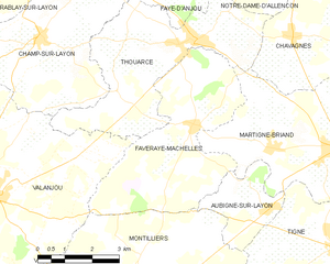
Faveraye-Mâchelles
- former commune in Maine-et-Loire, France
- Country:
- Postal Code: 49380
- Coordinates: 47° 15' 0" N, 0° 30' 0" E
- GPS tracks (wikiloc): [Link]
- Area: 18.6 sq km
- Population: 653
Chavagnes
- former commune in Maine-et-Loire, France
- Country:
- Postal Code: 49380
- Coordinates: 47° 16' 10" N, 0° 27' 19" E
- GPS tracks (wikiloc): [Link]
- Area: 16.21 sq km
- Population: 1277


Luigné
- former commune in Maine-et-Loire, France
- Country:
- Postal Code: 49320
- Coordinates: 47° 17' 6" N, 0° 23' 31" E
- GPS tracks (wikiloc): [Link]
- Area: 9.58 sq km
- Population: 266
- Web site: [Link]

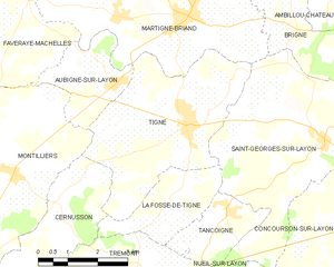
Tigné
- former commune in Maine-et-Loire, France
- Country:
- Postal Code: 49540
- Coordinates: 47° 12' 1" N, 0° 25' 39" E
- GPS tracks (wikiloc): [Link]
- Area: 16.78 sq km
- Population: 768
Saint-Georges-sur-Layon
- former commune in Maine-et-Loire, France
- Country:
- Postal Code: 49700
- Coordinates: 47° 11' 51" N, 0° 22' 6" E
- GPS tracks (wikiloc): [Link]
- Area: 22.5 sq km
- Population: 760