
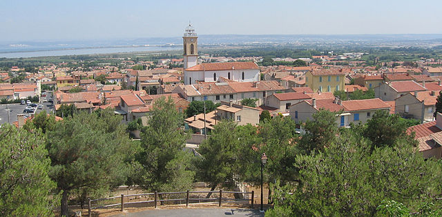
Martigues (Martigues)

- commune in Bouches-du-Rhône, France
- Country:

- Postal Code: 13117; 13500
- Coordinates: 43° 24' 19" N, 5° 2' 51" E


- GPS tracks (wikiloc): [Link]
- AboveSeaLevel: 1 м m
- Area: 71.44 sq km
- Population: 49403
- Web site: http://www.mairie-martigues.fr/accueil/
- Wikipedia en: wiki(en)
- Wikipedia: wiki(fr)
- Wikidata storage: Wikidata: Q237516
- Wikipedia Commons Gallery: [Link]
- Wikipedia Commons Category: [Link]
- Freebase ID: [/m/03034_]
- Freebase ID: [/m/03034_]
- Freebase ID: [/m/03034_]
- GeoNames ID: Alt: [2995387]
- GeoNames ID: Alt: [2995387]
- GeoNames ID: Alt: [2995387]
- SIREN number: [211300561]
- SIREN number: [211300561]
- SIREN number: [211300561]
- BnF ID: [152473387]
- BnF ID: [152473387]
- BnF ID: [152473387]
- VIAF ID: Alt: [147753093]
- VIAF ID: Alt: [147753093]
- VIAF ID: Alt: [147753093]
- OSM relation ID: [74266]
- OSM relation ID: [74266]
- OSM relation ID: [74266]
- GND ID: Alt: [4378910-9]
- GND ID: Alt: [4378910-9]
- GND ID: Alt: [4378910-9]
- Library of Congress authority ID: Alt: [n81022950]
- Library of Congress authority ID: Alt: [n81022950]
- Library of Congress authority ID: Alt: [n81022950]
- PACTOLS thesaurus ID: [pcrtaOUwWZcD3O]
- PACTOLS thesaurus ID: [pcrtaOUwWZcD3O]
- PACTOLS thesaurus ID: [pcrtaOUwWZcD3O]
- MusicBrainz area ID: [21eac7e6-f885-4d7f-bc7f-b69a27dd56c5]
- MusicBrainz area ID: [21eac7e6-f885-4d7f-bc7f-b69a27dd56c5]
- MusicBrainz area ID: [21eac7e6-f885-4d7f-bc7f-b69a27dd56c5]
- Quora topic ID: [Martigues]
- Quora topic ID: [Martigues]
- Quora topic ID: [Martigues]
- Encyclopædia Britannica Online ID: [place/Martigues]
- Encyclopædia Britannica Online ID: [place/Martigues]
- Encyclopædia Britannica Online ID: [place/Martigues]
- EMLO location ID: [35d5ca95-c952-4094-86cd-06da0ff32894]
- EMLO location ID: [35d5ca95-c952-4094-86cd-06da0ff32894]
- EMLO location ID: [35d5ca95-c952-4094-86cd-06da0ff32894]
- INSEE municipality code: 13056
- INSEE municipality code: 13056
- INSEE municipality code: 13056
Shares border with regions:


Berre-l'Étang
- commune in Bouches-du-Rhône, France
- Country:
- Postal Code: 13130
- Coordinates: 43° 28' 32" N, 5° 10' 5" E
- GPS tracks (wikiloc): [Link]
- Area: 43.64 sq km
- Population: 13477
- Web site: [Link]

Châteauneuf-les-Martigues
- commune in Bouches-du-Rhône, France
- Country:
- Postal Code: 13220
- Coordinates: 43° 22' 59" N, 5° 9' 51" E
- GPS tracks (wikiloc): [Link]
- Area: 31.65 sq km
- Population: 15057
- Web site: [Link]

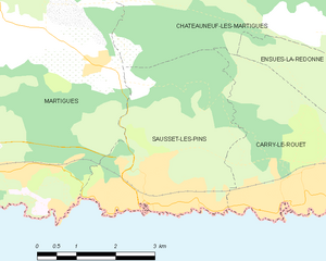
Sausset-les-Pins
- commune in Bouches-du-Rhône, France
- Country:
- Postal Code: 13960
- Coordinates: 43° 19' 56" N, 5° 6' 50" E
- GPS tracks (wikiloc): [Link]
- AboveSeaLevel: 2 м m
- Area: 12.1 sq km
- Population: 7624
- Web site: [Link]


Saint-Mitre-les-Remparts
- commune in Bouches-du-Rhône, France
- Country:
- Postal Code: 13920
- Coordinates: 43° 27' 18" N, 5° 0' 51" E
- GPS tracks (wikiloc): [Link]
- Area: 21.02 sq km
- Population: 5912
- Web site: [Link]


Port-de-Bouc
- commune in Bouches-du-Rhône, France
- Country:
- Postal Code: 13110
- Coordinates: 43° 24' 18" N, 4° 59' 19" E
- GPS tracks (wikiloc): [Link]
- AboveSeaLevel: 15 м m
- Area: 11.46 sq km
- Population: 17090
- Web site: [Link]