%20banner.jpg)
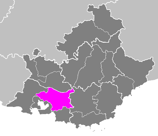
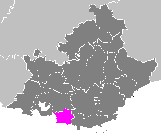
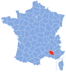
Bouches-du-Rhône (Bouches-du-Rhône)


- French department in Provence-Alpes-Côte d'Azur
 Hiking in Bouches-du-Rhône
Bouches-du-Rhône, located in the Provence-Alpes-Côte d'Azur region of southern France, offers diverse hiking opportunities amid stunning landscapes, rich history, and vibrant culture. Here are some key highlights for hiking in this beautiful area:
1.
- Camargue National Park: This unique wetland area is a UNESCO Biosphere Reserve, famous for its wild horses, pink flamingos, and diverse plant life. There are well-marked trails that offer a chance to experience the rich biodiversity.
- Calanques National Park: Stretching between Marseille and Cassis, the Calanques feature imposing limestone cliffs, turquoise waters, and hidden beaches. The hiking trails here vary in difficulty and offer breathtaking views of the Mediterranean Sea. Popular hikes include the trail to Calanque de Sugiton or the more challenging route to Calanque de En-Vau.
2.
- Historical Trails: Many hikes will lead you past ancient ruins, charming villages, and historic sites. For example, you can explore the trails around the ancient aqueduct of the Pont du Gard or the picturesque villages of L'Isle-sur-la-Sorgue or Les Baux-de-Provence.
3.
- Best Season: Spring (April to June) and fall (September to October) are ideal for hiking, as temperatures are milder and the landscapes are beautiful with blooming flowers or autumn colors. Summers can be hot, so early morning hikes are advisable.
- Equipment: Due to rugged terrain in many areas, good hiking shoes are essential. It's also wise to carry plenty of water, sunscreen, and a hat, especially in the hotter months.
4.
- Sentier des Douaniers (GR51): This coastal trail runs along the French Riviera, providing stunning views. It connects different coastal sections and can be accessed from various points.
- Route des Crêtes: A scenic hike offering panoramic views of the coastline and the Calanques, especially popular for photography.
5.
- Start Early: Starting your hikes early in the morning can help you avoid crowds and the heat, particularly in summer.
- Respect Nature: Follow marked paths, respect wildlife, and carry out whatever you bring in to keep the environment pristine.
- Local Markets and Cuisine: After a hike, take the opportunity to enjoy local Provençal cuisine, fresh produce, and cheese at local markets.
Hiking in Bouches-du-Rhône provides not only a workout but also a chance to immerse yourself in the beauty and culture of southern France. Be sure to plan your route based on your fitness level and interests. Happy hiking!
- Country:

- Capital: Marseille
- Coordinates: 43° 30' 0" N, 5° 5' 0" E


- GPS tracks (wikiloc): [Link]
- Area: 5087 sq km
- Population: 2016622
- Web site: http://www.bouches-du-rhone.pref.gouv.fr/
- Wikipedia en: wiki(en)
- Wikipedia: wiki(fr)
- Wikidata storage: Wikidata: Q3240
- Wikipedia Commons Gallery: [Link]
- Wikipedia Commons Category: [Link]
- Wikipedia Commons Maps Category: [Link]
- Freebase ID: [/m/0knd9]
- GeoNames ID: Alt: [3031359]
- SIREN number: [221300015]
- BnF ID: [11862497q]
- VIAF ID: Alt: [137908566]
- OSM relation ID: [7393]
- GND ID: Alt: [4080488-4]
- archINFORM location ID: [2733]
- Library of Congress authority ID: Alt: [n50051603]
- PACTOLS thesaurus ID: [pcrtVqtsfM4Yn0]
- MusicBrainz area ID: [f258f6b1-8767-4a9a-bbbd-a9d740d8e136]
- TGN ID: [7002915]
- SUDOC authorities ID: [02636221X]
- Encyclopædia Britannica Online ID: [place/Bouches-du-Rhone]
- Gran Enciclopèdia Catalana ID: [0011268]
- Twitter username: Alt: [departement13]
- NUTS code: [FR824]
- INSEE department code: [13]
- ISO 3166-2 code: FR-13
Includes regions:

Marseille
- commune in Bouches-du-Rhône, the second largest city of France
Hiking in Marseille
Hiking in Marseille offers a wonderful blend of stunning coastal views, dramatic landscapes, and rich natural biodiversity. The Calanques National Park, located just south of the city, is a highlight for hikers. Here are some key aspects to consider when hiking in Marseille:...
- Country:
- Postal Code: 13016; 13015; 13014; 13013; 13012; 13011; 13010; 13009; 13008; 13007; 13006; 13005; 13003; 13004; 13002; 13001; 13000
- Local Dialing Code: 496; 491
- Coordinates: 43° 17' 48" N, 5° 22' 35" E
- GPS tracks (wikiloc): [Link]
- AboveSeaLevel: 12 м m
- Area: 240.62 sq km
- Population: 855393
- Web site: [Link]
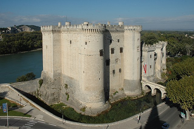
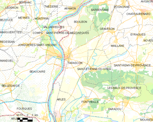
Tarascon
- commune in Bouches-du-Rhône, France
- Country:
- Postal Code: 13150
- Coordinates: 43° 48' 18" N, 4° 39' 34" E
- GPS tracks (wikiloc): [Link]
- Area: 73.97 sq km
- Population: 15056
- Web site: [Link]

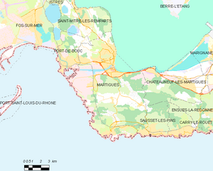
Martigues
- commune in Bouches-du-Rhône, France
- Country:
- Postal Code: 13117; 13500
- Coordinates: 43° 24' 19" N, 5° 2' 51" E
- GPS tracks (wikiloc): [Link]
- AboveSeaLevel: 1 м m
- Area: 71.44 sq km
- Population: 49403
- Web site: [Link]


Arles
- commune in Bouches-du-Rhône, France
- Country:
- Postal Code: 13200
- Coordinates: 43° 40' 37" N, 4° 37' 43" E
- GPS tracks (wikiloc): [Link]
- AboveSeaLevel: 57 м m
- Area: 758.93 sq km
- Population: 52886
- Web site: [Link]

arrondissement of Aix-en-Provence
- arrondissement of France
Hiking in arrondissement of Aix-en-Provence
The Arrondissement of Aix-en-Provence, located in the Provence-Alpes-Côte d'Azur region of southern France, offers a variety of stunning hiking trails set against a backdrop of picturesque landscapes, charming villages, and rich history. Here are some highlights for hiking in this area:...
- Country:
- Capital: Aix-en-Provence
- Coordinates: 43° 30' 0" N, 5° 20' 0" E
- GPS tracks (wikiloc): [Link]
- Area: 1532 sq km
- Population: 433315

arrondissement of Arles
- arrondissement of France
Hiking in arrondissement of Arles
The Arrondissement of Arles, located in the Bouches-du-Rhône department in the Provence-Alpes-Côte d'Azur region of southern France, offers a unique blend of natural beauty, historical significance, and diverse landscapes that make it an intriguing destination for hikers....
- Country:
- Capital: Arles
- Coordinates: 43° 40' 0" N, 4° 45' 0" E
- GPS tracks (wikiloc): [Link]
- Area: 2284 sq km
- Population: 207316


arrondissement of Istres
- arrondissement of France
- Country:
- Capital: Istres
- Coordinates: 43° 30' 15" N, 4° 59' 43" E
- GPS tracks (wikiloc): [Link]
- Area: 599 sq km
- Population: 313057

arrondissement of Marseille
- arrondissement of France
Hiking in arrondissement of Marseille
Hiking in the Arrondissement of Marseille offers stunning coastal views, rugged landscapes, and a rich diversity of flora and fauna. Here are some key highlights and popular hiking spots in the region:...
- Country:
- Capital: Marseille
- Coordinates: 43° 20' 0" N, 5° 30' 0" E
- GPS tracks (wikiloc): [Link]
- Area: 672 sq km
- Population: 1062934


Saint-Martin-de-Crau
- commune in Bouches-du-Rhône, France
- Country:
- Postal Code: 13310
- Coordinates: 43° 38' 23" N, 4° 48' 45" E
- GPS tracks (wikiloc): [Link]
- Area: 214.87 sq km
- Population: 13097
- Web site: [Link]
Shares border with regions:


Gard
- department located in southern France in the Occitanie region
- Country:
- Capital: Nîmes
- Coordinates: 44° 7' 41" N, 4° 4' 54" E
- GPS tracks (wikiloc): [Link]
- Area: 5853 sq km
- Population: 738189
- Web site: [Link]


Var
- department in France
Hiking in Var
Hiking in the Var department, located in the Provence-Alpes-Côte d'Azur region of southeastern France, offers a diverse range of landscapes and trails suitable for hikers of varying skill levels. Here are some key highlights and tips for hiking in Var:...
- Country:
- Capital: Toulon
- Coordinates: 43° 24' 3" N, 6° 12' 36" E
- GPS tracks (wikiloc): [Link]
- Area: 5973 sq km
- Population: 1048652
- Web site: [Link]
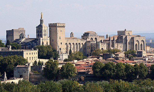
Vaucluse
- French department
Hiking in Vaucluse
Vaucluse, located in the Provence-Alpes-Côte d'Azur region of southeastern France, offers a diverse range of hiking opportunities, combining stunning landscapes, historical sites, and charming villages. Here are some highlights for hiking in Vaucluse:...
- Country:
- Capital: Avignon
- Licence Plate Code: 84
- Coordinates: 44° 0' 0" N, 5° 10' 0" E
- GPS tracks (wikiloc): [Link]
- Area: 3567 sq km
- Population: 557548
- Web site: [Link]