Mas-d'Orcières (Mas-d'Orcières)

- former commune in Lozère, France
- Country:

- Postal Code: 48190
- Coordinates: 44° 28' 47" N, 3° 42' 28" E


- GPS tracks (wikiloc): [Link]
- Area: 36.56 sq km
- Population: 101
- Wikipedia en: wiki(en)
- Wikipedia: wiki(fr)
- Wikidata storage: Wikidata: Q475842
- Wikipedia Commons Category: [Link]
- Freebase ID: [/m/02z0y00]
- Freebase ID: [/m/02z0y00]
- GeoNames ID: Alt: [6449382]
- GeoNames ID: Alt: [6449382]
- BnF ID: [15261499p]
- BnF ID: [15261499p]
- INSEE municipality code: 48093
- INSEE municipality code: 48093
Shares border with regions:


Saint-Étienne-du-Valdonnez
- commune in Lozère, France
- Country:
- Postal Code: 48000
- Coordinates: 44° 27' 20" N, 3° 33' 46" E
- GPS tracks (wikiloc): [Link]
- Area: 56.09 sq km
- Population: 648


Le Pont-de-Montvert
- former commune in Lozère, France
- Country:
- Postal Code: 48220
- Coordinates: 44° 21' 48" N, 3° 44' 37" E
- GPS tracks (wikiloc): [Link]
- Area: 90.25 sq km
- Population: 291


Le Bleymard
- former commune in Lozère, France
- Country:
- Postal Code: 48190
- Coordinates: 44° 29' 11" N, 3° 44' 6" E
- GPS tracks (wikiloc): [Link]
- Area: 16.36 sq km
- Population: 379


Saint-Julien-du-Tournel
- former commune in Lozère, France
- Country:
- Postal Code: 48190
- Coordinates: 44° 30' 3" N, 3° 41' 3" E
- GPS tracks (wikiloc): [Link]
- Area: 36.57 sq km
- Population: 125

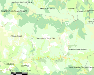
Fraissinet-de-Lozère
- former commune in Lozère, France
- Country:
- Postal Code: 48220
- Coordinates: 44° 22' 28" N, 3° 42' 2" E
- GPS tracks (wikiloc): [Link]
- Area: 38.58 sq km
- Population: 228


Les Bondons
- commune in Lozère, France
- Country:
- Postal Code: 48400
- Coordinates: 44° 23' 10" N, 3° 37' 9" E
- GPS tracks (wikiloc): [Link]
- Area: 45.54 sq km
- Population: 144

Cubières
- commune in Lozère, France
- Country:
- Postal Code: 48190
- Coordinates: 44° 28' 23" N, 3° 46' 21" E
- GPS tracks (wikiloc): [Link]
- Area: 48.88 sq km
- Population: 162