
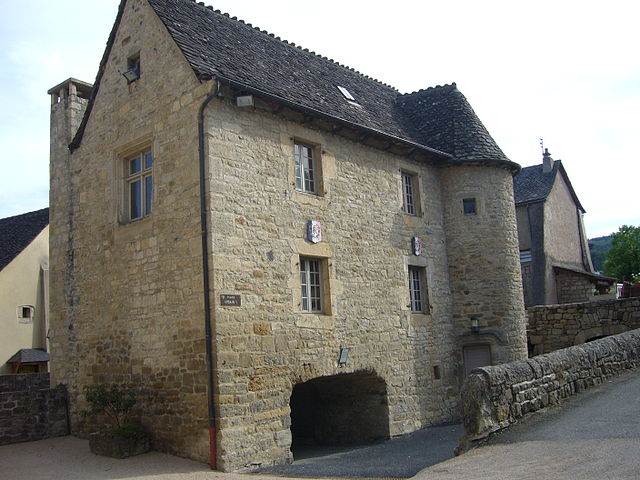
Lozère (Lozère)


- French department
- Country:

- Capital: Mende
- Coordinates: 44° 20' 0" N, 3° 36' 0" E


- GPS tracks (wikiloc): [Link]
- Area: 5166.9 sq km
- Population: 76309
- Web site: http://www.lozere.pref.gouv.fr/
- Wikipedia en: wiki(en)
- Wikipedia: wiki(fr)
- Wikidata storage: Wikidata: Q12580
- Wikipedia Commons Gallery: [Link]
- Wikipedia Commons Category: [Link]
- Wikipedia Commons Maps Category: [Link]
- Freebase ID: [/m/0gs7d]
- GeoNames ID: Alt: [2997288]
- BnF ID: [11985238z]
- VIAF ID: Alt: [153641592]
- OSM relation ID: [7421]
- GND ID: Alt: [4111398-6]
- archINFORM location ID: [2039]
- Library of Congress authority ID: Alt: [n83052245]
- MusicBrainz area ID: [02596d72-66f6-46d9-89bf-742cfba209eb]
- SUDOC authorities ID: [027912116]
- Encyclopædia Britannica Online ID: [place/Lozere]
- Gran Enciclopèdia Catalana ID: [0038559]
- Historical Gazetteer (GOV) ID: [object_390503]
- NUTS code: [FR814]
- INSEE department code: [48]
- ISO 3166-2 code: FR-48
Includes regions:


Saint-Frézal-de-Ventalon
- former commune in Lozère, France
- Country:
- Postal Code: 48240
- Coordinates: 44° 17' 7" N, 3° 51' 19" E
- GPS tracks (wikiloc): [Link]
- Area: 16.89 sq km
- Population: 146

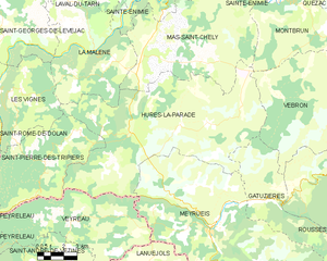
Hures-la-Parade
- commune in Lozère, France
- Country:
- Postal Code: 48150
- Coordinates: 44° 14' 41" N, 3° 21' 9" E
- GPS tracks (wikiloc): [Link]
- AboveSeaLevel: 1000 м m
- Area: 88.59 sq km
- Population: 274
Saint-Julien-des-Points
- commune in Lozère, France
- Country:
- Postal Code: 48160
- Coordinates: 44° 15' 20" N, 3° 57' 55" E
- GPS tracks (wikiloc): [Link]
- Area: 3.83 sq km
- Population: 113


Saint-Germain-de-Calberte
- commune in Lozère, France
- Country:
- Postal Code: 48370
- Coordinates: 44° 13' 4" N, 3° 48' 34" E
- GPS tracks (wikiloc): [Link]
- Area: 38.6 sq km
- Population: 440

Molezon
- commune in Lozère, France
- Country:
- Postal Code: 48110
- Coordinates: 44° 12' 30" N, 3° 40' 53" E
- GPS tracks (wikiloc): [Link]
- Area: 14.76 sq km
- Population: 93


Cassagnas
- commune in Lozère, France
- Country:
- Postal Code: 48400
- Coordinates: 44° 16' 15" N, 3° 44' 47" E
- GPS tracks (wikiloc): [Link]
- Area: 35.19 sq km
- Population: 117


Gatuzières
- commune in Lozère, France
- Country:
- Postal Code: 48150
- Coordinates: 44° 11' 55" N, 3° 29' 23" E
- GPS tracks (wikiloc): [Link]
- Area: 29.4 sq km
- Population: 61


Moissac-Vallée-Française
- commune in Lozère, France
- Country:
- Postal Code: 48110
- Coordinates: 44° 9' 47" N, 3° 47' 4" E
- GPS tracks (wikiloc): [Link]
- AboveSeaLevel: 300 м m
- Area: 27.05 sq km
- Population: 223
- Web site: [Link]

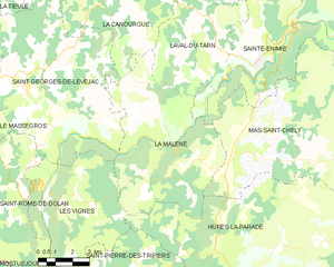
La Malène
- commune in Lozère, France
- Country:
- Postal Code: 48210
- Coordinates: 44° 18' 9" N, 3° 19' 13" E
- GPS tracks (wikiloc): [Link]
- Area: 40.68 sq km
- Population: 148
- Web site: [Link]


Mende
- commune in Lozère, France
- Country:
- Postal Code: 48000
- Coordinates: 44° 31' 6" N, 3° 30' 2" E
- GPS tracks (wikiloc): [Link]
- AboveSeaLevel: 732 м m
- Area: 36.56 sq km
- Population: 11641
- Web site: [Link]
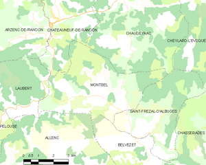
Montbel
- commune in Lozère, France
- Country:
- Postal Code: 48170
- Coordinates: 44° 35' 31" N, 3° 42' 56" E
- GPS tracks (wikiloc): [Link]
- Area: 22.87 sq km
- Population: 118


Le Pompidou
- commune in Lozère, France
- Country:
- Postal Code: 48110
- Coordinates: 44° 11' 43" N, 3° 39' 16" E
- GPS tracks (wikiloc): [Link]
- Area: 22.8 sq km
- Population: 166


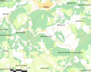
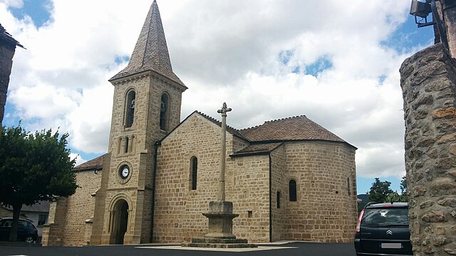
Balsièges
- commune in Lozère, France
- Country:
- Postal Code: 48000
- Coordinates: 44° 28' 50" N, 3° 27' 28" E
- GPS tracks (wikiloc): [Link]
- Area: 32.88 sq km
- Population: 538
- Web site: [Link]

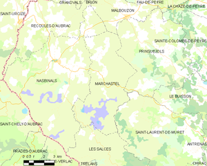
Marchastel
- commune in Lozère, France
- Country:
- Postal Code: 48260
- Coordinates: 44° 39' 4" N, 3° 6' 25" E
- GPS tracks (wikiloc): [Link]
- Area: 34.87 sq km
- Population: 56
La Fage-Montivernoux
- commune in Lozère, France
- Country:
- Postal Code: 48310
- Coordinates: 44° 45' 29" N, 3° 9' 9" E
- GPS tracks (wikiloc): [Link]
- Area: 37.77 sq km
- Population: 159


Saint-Laurent-de-Muret
- commune in Lozère, France
- Country:
- Postal Code: 48100
- Coordinates: 44° 36' 10" N, 3° 12' 25" E
- GPS tracks (wikiloc): [Link]
- Area: 46.04 sq km
- Population: 189


Saint-Étienne-du-Valdonnez
- commune in Lozère, France
- Country:
- Postal Code: 48000
- Coordinates: 44° 27' 20" N, 3° 33' 46" E
- GPS tracks (wikiloc): [Link]
- Area: 56.09 sq km
- Population: 648


Le Pont-de-Montvert
- former commune in Lozère, France
- Country:
- Postal Code: 48220
- Coordinates: 44° 21' 48" N, 3° 44' 37" E
- GPS tracks (wikiloc): [Link]
- Area: 90.25 sq km
- Population: 291


Malbouzon
- former commune in Lozère, France
- Country:
- Postal Code: 48270
- Coordinates: 44° 42' 4" N, 3° 8' 6" E
- GPS tracks (wikiloc): [Link]
- Area: 14.26 sq km
- Population: 131
Pierrefiche
- commune in Lozère, France
- Country:
- Postal Code: 48300
- Coordinates: 44° 41' 26" N, 3° 44' 0" E
- GPS tracks (wikiloc): [Link]
- Area: 16.82 sq km
- Population: 165
Cubiérettes
- commune in Lozère, France
- Country:
- Postal Code: 48190
- Coordinates: 44° 27' 33" N, 3° 47' 14" E
- GPS tracks (wikiloc): [Link]
- Area: 11.34 sq km
- Population: 54

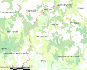
Chauchailles
- commune in Lozère, France
- Country:
- Postal Code: 48310
- Coordinates: 44° 47' 43" N, 3° 5' 0" E
- GPS tracks (wikiloc): [Link]
- Area: 17.4 sq km
- Population: 95

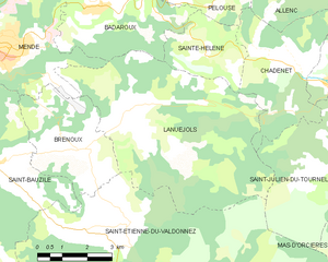
Lanuéjols
- commune in Lozère, France
- Country:
- Postal Code: 48000
- Coordinates: 44° 30' 3" N, 3° 34' 20" E
- GPS tracks (wikiloc): [Link]
- Area: 32.67 sq km
- Population: 312

Le Monastier-Pin-Moriès
- former commune in Lozère, France
- Country:
- Postal Code: 48100
- Coordinates: 44° 30' 53" N, 3° 15' 16" E
- GPS tracks (wikiloc): [Link]
- AboveSeaLevel: 610 м m
- Area: 19.3 sq km
- Population: 976
- Web site: [Link]


Recoules-d'Aubrac
- commune in Lozère, France
- Country:
- Postal Code: 48260
- Coordinates: 44° 41' 31" N, 3° 1' 26" E
- GPS tracks (wikiloc): [Link]
- Area: 26.55 sq km
- Population: 196


Saint-Flour-de-Mercoire
- commune in Lozère, France
- Country:
- Postal Code: 48300
- Coordinates: 44° 41' 44" N, 3° 49' 32" E
- GPS tracks (wikiloc): [Link]
- Area: 12.17 sq km
- Population: 192


Chambon-le-Château
- commune in Lozère, France
- Country:
- Postal Code: 48600
- Coordinates: 44° 51' 11" N, 3° 39' 34" E
- GPS tracks (wikiloc): [Link]
- Area: 8.12 sq km
- Population: 288


Grandvals
- commune in Lozère, France
- Country:
- Postal Code: 48260
- Coordinates: 44° 44' 23" N, 3° 2' 13" E
- GPS tracks (wikiloc): [Link]
- Area: 12.84 sq km
- Population: 77

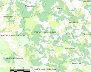
Saint-Jean-la-Fouillouse
- commune in Lozère, France
- Country:
- Postal Code: 48170
- Coordinates: 44° 42' 3" N, 3° 41' 29" E
- GPS tracks (wikiloc): [Link]
- Area: 29.27 sq km
- Population: 159


Sainte-Hélène
- commune in Lozère, France
- Country:
- Postal Code: 48190
- Coordinates: 44° 31' 9" N, 3° 36' 10" E
- GPS tracks (wikiloc): [Link]
- AboveSeaLevel: 900 м m
- Area: 6.73 sq km
- Population: 89


Sainte-Enimie
- former commune in Lozère, France
- Country:
- Postal Code: 48210
- Coordinates: 44° 21' 59" N, 3° 24' 41" E
- GPS tracks (wikiloc): [Link]
- Area: 87.34 sq km
- Population: 533
- Web site: [Link]


Saint-Amans
- commune in Lozère, France
- Country:
- Postal Code: 48700
- Coordinates: 44° 39' 47" N, 3° 27' 0" E
- GPS tracks (wikiloc): [Link]
- Area: 9.98 sq km
- Population: 154


Lajo
- commune in Lozère, France
- Country:
- Postal Code: 48120
- Coordinates: 44° 50' 15" N, 3° 25' 36" E
- GPS tracks (wikiloc): [Link]
- Area: 18.58 sq km
- Population: 103
Chastel-Nouvel
- commune in Lozère, France
- Country:
- Postal Code: 48000
- Coordinates: 44° 33' 33" N, 3° 30' 6" E
- GPS tracks (wikiloc): [Link]
- Area: 31.5 sq km
- Population: 834


Les Salces
- commune in Lozère, France
- Country:
- Postal Code: 48100
- Coordinates: 44° 32' 2" N, 3° 9' 43" E
- GPS tracks (wikiloc): [Link]
- Area: 45.78 sq km
- Population: 101


Fraissinet-de-Fourques
- commune in Lozère, France
- Country:
- Postal Code: 48400
- Coordinates: 44° 12' 55" N, 3° 32' 20" E
- GPS tracks (wikiloc): [Link]
- Area: 24.3 sq km
- Population: 70


Pied-de-Borne
- commune in Lozère, France
- Country:
- Postal Code: 48800
- Coordinates: 44° 28' 32" N, 3° 59' 5" E
- GPS tracks (wikiloc): [Link]
- AboveSeaLevel: 450 м m
- Area: 27.89 sq km
- Population: 201


Le Buisson
- commune in Lozère, France
- Country:
- Postal Code: 48100
- Coordinates: 44° 37' 39" N, 3° 14' 6" E
- GPS tracks (wikiloc): [Link]
- Area: 24.45 sq km
- Population: 236
Sainte-Colombe-de-Peyre
- former commune in Lozère, France
- Country:
- Postal Code: 48130
- Coordinates: 44° 41' 25" N, 3° 14' 21" E
- GPS tracks (wikiloc): [Link]
- Area: 21.9 sq km
- Population: 189


Saint-Privat-de-Vallongue
- commune in Lozère, France
- Country:
- Postal Code: 48240
- Coordinates: 44° 16' 40" N, 3° 50' 10" E
- GPS tracks (wikiloc): [Link]
- Area: 23.87 sq km
- Population: 242


Saint-Bonnet-de-Chirac
- commune in Lozère, France
- Country:
- Postal Code: 48100
- Coordinates: 44° 30' 30" N, 3° 16' 44" E
- GPS tracks (wikiloc): [Link]
- Area: 7.68 sq km
- Population: 74
Saint-Pierre-de-Nogaret
- commune in Lozère, France
- Country:
- Postal Code: 48340
- Coordinates: 44° 27' 41" N, 3° 8' 23" E
- GPS tracks (wikiloc): [Link]
- Area: 16.44 sq km
- Population: 179

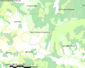
Saint-Frézal-d'Albuges
- commune in Lozère, France
- Country:
- Postal Code: 48170
- Coordinates: 44° 34' 8" N, 3° 45' 21" E
- GPS tracks (wikiloc): [Link]
- Area: 17.2 sq km
- Population: 69
Le Recoux
- former commune in Lozère, France
- Country:
- Postal Code: 48500
- Coordinates: 44° 20' 16" N, 3° 8' 50" E
- GPS tracks (wikiloc): [Link]
- Area: 23.69 sq km
- Population: 129


Bagnols-les-Bains
- former commune in Lozère, France
- Country:
- Postal Code: 48190
- Coordinates: 44° 30' 21" N, 3° 39' 55" E
- GPS tracks (wikiloc): [Link]
- Area: 2.4 sq km
- Population: 211
- Web site: [Link]


Chirac
- former commune in Lozère, France
- Country:
- Postal Code: 48100
- Coordinates: 44° 31' 26" N, 3° 15' 55" E
- GPS tracks (wikiloc): [Link]
- Area: 33.79 sq km
- Population: 1178
- Web site: [Link]


Langogne
- commune in Lozère, France
- Country:
- Postal Code: 48300
- Coordinates: 44° 43' 36" N, 3° 51' 18" E
- GPS tracks (wikiloc): [Link]
- Area: 31.37 sq km
- Population: 2894
- Web site: [Link]


Les Hermaux
- commune in Lozère, France
- Country:
- Postal Code: 48340
- Coordinates: 44° 30' 58" N, 3° 7' 54" E
- GPS tracks (wikiloc): [Link]
- Area: 17.59 sq km
- Population: 104


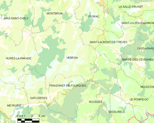
Florac
- former commune in Lozère, France
- Country:
- Postal Code: 48400
- Coordinates: 44° 19' 34" N, 3° 35' 35" E
- GPS tracks (wikiloc): [Link]
- Area: 29.89 sq km
- Population: 1909
- Web site: [Link]


Nasbinals
- commune in Lozère, France
- Country:
- Postal Code: 48260
- Coordinates: 44° 39' 44" N, 3° 2' 47" E
- GPS tracks (wikiloc): [Link]
- Area: 63.34 sq km
- Population: 512
- Web site: [Link]


La Villedieu
- commune in Lozère, France
- Country:
- Postal Code: 48700
- Coordinates: 44° 42' 52" N, 3° 31' 15" E
- GPS tracks (wikiloc): [Link]
- AboveSeaLevel: 1220 м m
- Area: 22.79 sq km
- Population: 30

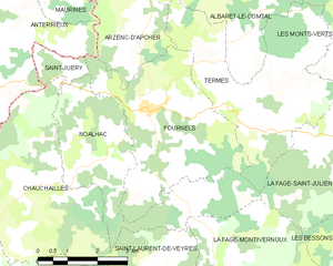
Fournels
- commune in Lozère, France
- Country:
- Postal Code: 48310
- Coordinates: 44° 48' 59" N, 3° 7' 15" E
- GPS tracks (wikiloc): [Link]
- Area: 15.76 sq km
- Population: 366


Saint-Juéry
- commune in Lozère, France
- Country:
- Postal Code: 48310
- Coordinates: 44° 49' 39" N, 3° 5' 9" E
- GPS tracks (wikiloc): [Link]
- Area: 1.65 sq km
- Population: 65


Luc
- commune in Lozère, France
- Country:
- Postal Code: 48250
- Coordinates: 44° 39' 1" N, 3° 53' 27" E
- GPS tracks (wikiloc): [Link]
- Area: 46.1 sq km
- Population: 223


Fau-de-Peyre
- former commune in Lozère, France
- Country:
- Postal Code: 48130
- Coordinates: 44° 44' 54" N, 3° 13' 23" E
- GPS tracks (wikiloc): [Link]
- Area: 26.72 sq km
- Population: 186
- Web site: [Link]


Saint-Bonnet-de-Montauroux
- former commune in Lozère, France
- Country:
- Postal Code: 48600
- Coordinates: 44° 48' 56" N, 3° 43' 12" E
- GPS tracks (wikiloc): [Link]
- Area: 21.33 sq km
- Population: 100


Arzenc-d'Apcher
- commune in Lozère, France
- Country:
- Postal Code: 48310
- Coordinates: 44° 51' 5" N, 3° 7' 7" E
- GPS tracks (wikiloc): [Link]
- Area: 7.88 sq km
- Population: 50

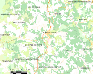
Aumont-Aubrac
- former commune in Lozère, France
- Country:
- Postal Code: 48130
- Coordinates: 44° 43' 22" N, 3° 17' 2" E
- GPS tracks (wikiloc): [Link]
- Area: 26.53 sq km
- Population: 1063
Laval-Atger
- former commune in Lozère, France
- Country:
- Postal Code: 48600
- Coordinates: 44° 48' 28" N, 3° 41' 43" E
- GPS tracks (wikiloc): [Link]
- Area: 10.67 sq km
- Population: 163


Esclanèdes
- commune in Lozère, France
- Country:
- Postal Code: 48230
- Coordinates: 44° 28' 54" N, 3° 21' 41" E
- GPS tracks (wikiloc): [Link]
- Area: 12.51 sq km
- Population: 376

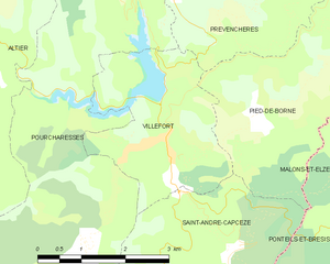
Villefort
- commune in Lozère, France
- Country:
- Postal Code: 48800
- Coordinates: 44° 26' 22" N, 3° 55' 55" E
- GPS tracks (wikiloc): [Link]
- Area: 7.35 sq km
- Population: 568
- Web site: [Link]


Naussac
- former commune in Lozère, France
- Country:
- Postal Code: 48300
- Coordinates: 44° 43' 38" N, 3° 50' 19" E
- GPS tracks (wikiloc): [Link]
- Area: 13.52 sq km
- Population: 204


Sainte-Croix-Vallée-Française
- commune in Lozère, France
- Country:
- Postal Code: 48110
- Coordinates: 44° 10' 47" N, 3° 44' 32" E
- GPS tracks (wikiloc): [Link]
- AboveSeaLevel: 350 м m
- Area: 18.57 sq km
- Population: 296
- Web site: [Link]
Saint-André-Capcèze
- commune in Lozère, France
- Country:
- Postal Code: 48800
- Coordinates: 44° 25' 1" N, 3° 56' 55" E
- GPS tracks (wikiloc): [Link]
- Area: 9.85 sq km
- Population: 176

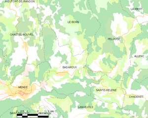
Badaroux
- commune in Lozère, France
- Country:
- Postal Code: 48000
- Coordinates: 44° 32' 12" N, 3° 33' 0" E
- GPS tracks (wikiloc): [Link]
- Area: 20.72 sq km
- Population: 958
- Web site: [Link]


Pourcharesses
- commune in Lozère, France
- Country:
- Postal Code: 48800
- Coordinates: 44° 26' 19" N, 3° 55' 58" E
- GPS tracks (wikiloc): [Link]
- AboveSeaLevel: 600 м m
- Area: 31.79 sq km
- Population: 116


Barjac
- commune in Lozère, France
- Country:
- Postal Code: 48000
- Coordinates: 44° 30' 16" N, 3° 24' 38" E
- GPS tracks (wikiloc): [Link]
- Area: 29.92 sq km
- Population: 750


Banassac
- former commune in Lozère, France
- Country:
- Postal Code: 48500
- Coordinates: 44° 26' 10" N, 3° 12' 0" E
- GPS tracks (wikiloc): [Link]
- Area: 17.41 sq km
- Population: 872
- Web site: [Link]


Saint-Georges-de-Lévéjac
- former commune in Lozère, France
- Country:
- Postal Code: 48500
- Coordinates: 44° 19' 9" N, 3° 13' 51" E
- GPS tracks (wikiloc): [Link]
- Area: 56.26 sq km
- Population: 250
- Web site: [Link]


La Bastide-Puylaurent
- commune in Lozère, France
- Country:
- Postal Code: 48250
- Coordinates: 44° 35' 33" N, 3° 54' 19" E
- GPS tracks (wikiloc): [Link]
- Area: 24.19 sq km
- Population: 164


Prévenchères
- commune in Lozère, France
- Country:
- Postal Code: 48800
- Coordinates: 44° 31' 17" N, 3° 54' 35" E
- GPS tracks (wikiloc): [Link]
- Area: 62.75 sq km
- Population: 257
- Web site: [Link]

Barre-des-Cévennes
- commune in Lozère, France
- Country:
- Postal Code: 48400
- Coordinates: 44° 14' 41" N, 3° 39' 12" E
- GPS tracks (wikiloc): [Link]
- Area: 34.29 sq km
- Population: 199


Le Bleymard
- former commune in Lozère, France
- Country:
- Postal Code: 48190
- Coordinates: 44° 29' 11" N, 3° 44' 6" E
- GPS tracks (wikiloc): [Link]
- Area: 16.36 sq km
- Population: 379


Arzenc-de-Randon
- commune in Lozère, France
- Country:
- Postal Code: 48170
- Coordinates: 44° 39' 43" N, 3° 37' 55" E
- GPS tracks (wikiloc): [Link]
- Area: 69.2 sq km
- Population: 213


Cocurès
- former commune in Lozère, France
- Country:
- Postal Code: 48400
- Coordinates: 44° 20' 54" N, 3° 37' 13" E
- GPS tracks (wikiloc): [Link]
- Area: 3.55 sq km
- Population: 210
- Web site: [Link]


Altier
- commune in Lozère, France
- Country:
- Postal Code: 48800
- Coordinates: 44° 28' 27" N, 3° 51' 41" E
- GPS tracks (wikiloc): [Link]
- Area: 54.45 sq km
- Population: 208


Saint-Sauveur-de-Peyre
- former commune in Lozère, France
- Country:
- Postal Code: 48130
- Coordinates: 44° 39' 31" N, 3° 17' 14" E
- GPS tracks (wikiloc): [Link]
- Area: 27.61 sq km
- Population: 271
- Web site: [Link]


Saint-Julien-du-Tournel
- former commune in Lozère, France
- Country:
- Postal Code: 48190
- Coordinates: 44° 30' 3" N, 3° 41' 3" E
- GPS tracks (wikiloc): [Link]
- Area: 36.57 sq km
- Population: 125

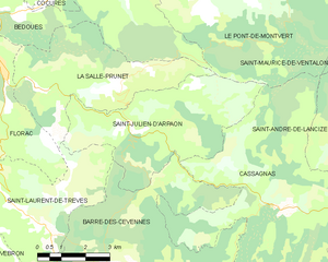
Saint-Julien-d'Arpaon
- former commune in Lozère, France
- Country:
- Postal Code: 48400
- Coordinates: 44° 17' 58" N, 3° 39' 57" E
- GPS tracks (wikiloc): [Link]
- Area: 20.72 sq km
- Population: 96


Cheylard-l'Évêque
- commune in Lozère, France
- Country:
- Postal Code: 48300
- Coordinates: 44° 38' 52" N, 3° 48' 10" E
- GPS tracks (wikiloc): [Link]
- Area: 29.64 sq km
- Population: 65


Saint-Alban-sur-Limagnole
- commune in Lozère, France
- Country:
- Postal Code: 48120
- Coordinates: 44° 46' 51" N, 3° 23' 18" E
- GPS tracks (wikiloc): [Link]
- Area: 51.23 sq km
- Population: 1341


Canilhac
- former commune in Lozère, France
- Country:
- Postal Code: 48500
- Coordinates: 44° 25' 25" N, 3° 9' 1" E
- GPS tracks (wikiloc): [Link]
- Area: 7.27 sq km
- Population: 164


Chasseradès
- former commune in Lozère, France
- Country:
- Postal Code: 48250
- Coordinates: 44° 33' 4" N, 3° 49' 33" E
- GPS tracks (wikiloc): [Link]
- Area: 61.93 sq km
- Population: 143

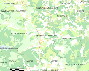
Châteauneuf-de-Randon
- commune in Lozère, France
- Country:
- Postal Code: 48170
- Coordinates: 44° 38' 26" N, 3° 40' 31" E
- GPS tracks (wikiloc): [Link]
- Area: 24.49 sq km
- Population: 565
- Web site: [Link]


Marvejols
- commune in Lozère, France
- Country:
- Postal Code: 48100
- Coordinates: 44° 33' 12" N, 3° 17' 24" E
- GPS tracks (wikiloc): [Link]
- Area: 12.45 sq km
- Population: 4841
- Web site: [Link]

Saint-Pierre-des-Tripiers
- commune in Lozère, France
- Country:
- Postal Code: 48150
- Coordinates: 44° 11' 58" N, 3° 15' 28" E
- GPS tracks (wikiloc): [Link]
- Area: 34.74 sq km
- Population: 80


Fontanes
- former commune in Lozère, France
- Country:
- Postal Code: 48300
- Coordinates: 44° 46' 12" N, 3° 47' 7" E
- GPS tracks (wikiloc): [Link]
- Area: 11.28 sq km
- Population: 148


Saint-Martin-de-Lansuscle
- commune in Lozère, France
- Country:
- Postal Code: 48110
- Coordinates: 44° 12' 58" N, 3° 45' 11" E
- GPS tracks (wikiloc): [Link]
- Area: 18.05 sq km
- Population: 189


Le Rozier
- commune in Lozère, France
- Country:
- Postal Code: 48150
- Coordinates: 44° 11' 26" N, 3° 12' 36" E
- GPS tracks (wikiloc): [Link]
- Area: 2.03 sq km
- Population: 141


La Canourgue
- commune in Lozère, France
- Country:
- Postal Code: 48500
- Coordinates: 44° 25' 58" N, 3° 12' 53" E
- GPS tracks (wikiloc): [Link]
- Area: 104.29 sq km
- Population: 2090
- Web site: [Link]

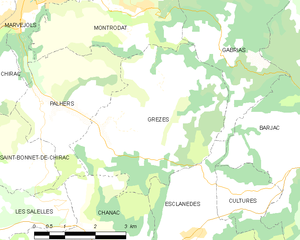
Grèzes
- commune in Lozère, France
- Country:
- Postal Code: 48100
- Coordinates: 44° 30' 47" N, 3° 20' 19" E
- GPS tracks (wikiloc): [Link]
- Area: 16.21 sq km
- Population: 204


Chanac
- commune in Lozère, France
- Country:
- Postal Code: 48230
- Coordinates: 44° 27' 59" N, 3° 20' 35" E
- GPS tracks (wikiloc): [Link]
- Area: 71.14 sq km
- Population: 1460
- Web site: [Link]


Saint-Maurice-de-Ventalon
- former commune in Lozère, France
- Country:
- Postal Code: 48220
- Coordinates: 44° 19' 22" N, 3° 49' 45" E
- GPS tracks (wikiloc): [Link]
- Area: 38.51 sq km
- Population: 68

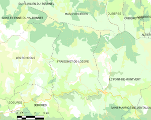
Fraissinet-de-Lozère
- former commune in Lozère, France
- Country:
- Postal Code: 48220
- Coordinates: 44° 22' 28" N, 3° 42' 2" E
- GPS tracks (wikiloc): [Link]
- Area: 38.58 sq km
- Population: 228


Bédouès
- former commune in Lozère, France
- Country:
- Postal Code: 48400
- Coordinates: 44° 20' 28" N, 3° 36' 17" E
- GPS tracks (wikiloc): [Link]
- Area: 26.8 sq km
- Population: 274
- Web site: [Link]


Mas-d'Orcières
- former commune in Lozère, France
- Country:
- Postal Code: 48190
- Coordinates: 44° 28' 47" N, 3° 42' 28" E
- GPS tracks (wikiloc): [Link]
- Area: 36.56 sq km
- Population: 101


Saint-Laurent-de-Trèves
- former commune in Lozère, France
- Country:
- Postal Code: 48400
- Coordinates: 44° 16' 16" N, 3° 36' 10" E
- GPS tracks (wikiloc): [Link]
- Area: 23.09 sq km
- Population: 184


Les Bondons
- commune in Lozère, France
- Country:
- Postal Code: 48400
- Coordinates: 44° 23' 10" N, 3° 37' 9" E
- GPS tracks (wikiloc): [Link]
- Area: 45.54 sq km
- Population: 144


Javols
- former commune in Lozère, France
- Country:
- Postal Code: 48130
- Coordinates: 44° 41' 36" N, 3° 20' 32" E
- GPS tracks (wikiloc): [Link]
- Area: 31.21 sq km
- Population: 331
- Web site: [Link]


Meyrueis
- commune in Lozère, France
- Country:
- Postal Code: 48150
- Coordinates: 44° 10' 42" N, 3° 25' 46" E
- GPS tracks (wikiloc): [Link]
- Area: 104.68 sq km
- Population: 838
- Web site: [Link]

Cubières
- commune in Lozère, France
- Country:
- Postal Code: 48190
- Coordinates: 44° 28' 23" N, 3° 46' 21" E
- GPS tracks (wikiloc): [Link]
- Area: 48.88 sq km
- Population: 162


Auroux
- commune in Lozère, France
- Country:
- Postal Code: 48600
- Coordinates: 44° 45' 10" N, 3° 43' 38" E
- GPS tracks (wikiloc): [Link]
- Area: 35.09 sq km
- Population: 395


Trélans
- commune in Lozère, France
- Country:
- Postal Code: 48340
- Coordinates: 44° 29' 59" N, 3° 5' 31" E
- GPS tracks (wikiloc): [Link]
- Area: 23.35 sq km
- Population: 95

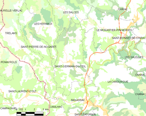
Saint-Germain-du-Teil
- commune in Lozère, France
- Country:
- Postal Code: 48340
- Coordinates: 44° 28' 41" N, 3° 10' 20" E
- GPS tracks (wikiloc): [Link]
- Area: 22.58 sq km
- Population: 863

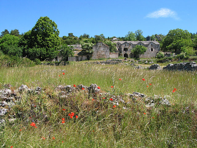
arrondissement of Florac
- arrondissement of France
- Country:
- Capital: Florac
- Coordinates: 44° 20' 0" N, 3° 30' 0" E
- GPS tracks (wikiloc): [Link]
- Area: 1687 sq km
- Population: 13303


Saint-Pierre-le-Vieux
- commune in Lozère, France
- Country:
- Postal Code: 48200
- Coordinates: 44° 50' 50" N, 3° 18' 31" E
- GPS tracks (wikiloc): [Link]
- AboveSeaLevel: 950 м m
- Area: 15.55 sq km
- Population: 312
Saint-Michel-de-Dèze
- commune in Lozère, France
- Country:
- Postal Code: 48160
- Coordinates: 44° 15' 0" N, 3° 53' 47" E
- GPS tracks (wikiloc): [Link]
- Area: 14.19 sq km
- Population: 246
Gabrias
- commune in Lozère, France
- Country:
- Postal Code: 48100
- Coordinates: 44° 32' 15" N, 3° 22' 10" E
- GPS tracks (wikiloc): [Link]
- Area: 20.65 sq km
- Population: 145
- Web site: [Link]


Estables
- commune in Lozère, France
- Country:
- Postal Code: 48700
- Coordinates: 44° 40' 7" N, 3° 29' 13" E
- GPS tracks (wikiloc): [Link]
- Area: 32.89 sq km
- Population: 165

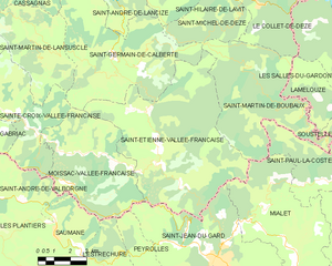
Saint-Étienne-Vallée-Française
- commune in Lozère, France
- Country:
- Postal Code: 48330
- Coordinates: 44° 9' 59" N, 3° 50' 32" E
- GPS tracks (wikiloc): [Link]
- AboveSeaLevel: 245 м m
- Area: 50.99 sq km
- Population: 515
- Web site: [Link]

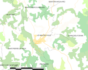
Le Malzieu-Ville
- commune in Lozère, France
- Country:
- Postal Code: 48140
- Coordinates: 44° 51' 22" N, 3° 19' 51" E
- GPS tracks (wikiloc): [Link]
- Area: 7.8 sq km
- Population: 740
- Web site: [Link]

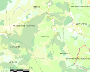
Rousses
- commune in Lozère, France
- Country:
- Postal Code: 48400
- Coordinates: 44° 12' 21" N, 3° 35' 14" E
- GPS tracks (wikiloc): [Link]
- Area: 22.38 sq km
- Population: 107

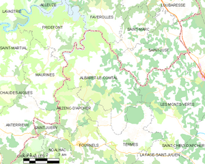
Albaret-le-Comtal
- commune in Lozère, France
- Country:
- Postal Code: 48310
- Coordinates: 44° 52' 30" N, 3° 7' 38" E
- GPS tracks (wikiloc): [Link]
- Area: 29.56 sq km
- Population: 176


Saint-Hilaire-de-Lavit
- commune in Lozère, France
- Country:
- Postal Code: 48160
- Coordinates: 44° 15' 12" N, 3° 51' 50" E
- GPS tracks (wikiloc): [Link]
- Area: 10.31 sq km
- Population: 117


Laubert
- commune in Lozère, France
- Country:
- Postal Code: 48170
- Coordinates: 44° 35' 8" N, 3° 38' 25" E
- GPS tracks (wikiloc): [Link]
- Area: 14.28 sq km
- Population: 102
Saint-Sauveur-de-Ginestoux
- commune in Lozère, France
- Country:
- Postal Code: 48170
- Coordinates: 44° 42' 17" N, 3° 36' 21" E
- GPS tracks (wikiloc): [Link]
- Area: 22.14 sq km
- Population: 56
Julianges
- commune in Lozère, France
- Country:
- Postal Code: 48140
- Coordinates: 44° 55' 48" N, 3° 18' 32" E
- GPS tracks (wikiloc): [Link]
- Area: 9.42 sq km
- Population: 58


Saint-Symphorien
- commune in Lozère, France
- Country:
- Postal Code: 48600
- Coordinates: 44° 50' 23" N, 3° 37' 28" E
- GPS tracks (wikiloc): [Link]
- Area: 33.28 sq km
- Population: 230

Vialas
- commune in Lozère, France
- Country:
- Postal Code: 48220
- Coordinates: 44° 20' 1" N, 3° 53' 45" E
- GPS tracks (wikiloc): [Link]
- Area: 49.77 sq km
- Population: 439


Chaudeyrac
- commune in Lozère, France
- Country:
- Postal Code: 48170
- Coordinates: 44° 39' 34" N, 3° 45' 23" E
- GPS tracks (wikiloc): [Link]
- Area: 44.1 sq km
- Population: 310

Saint-Rome-de-Dolan
- former commune in Lozère, France
- Country:
- Postal Code: 48500
- Coordinates: 44° 16' 25" N, 3° 12' 57" E
- GPS tracks (wikiloc): [Link]
- Area: 32.63 sq km
- Population: 64

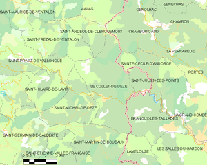
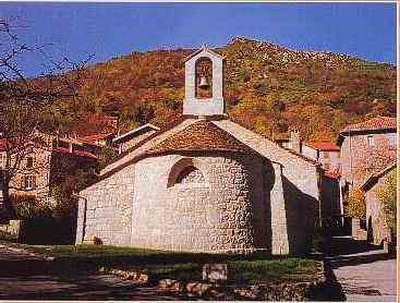
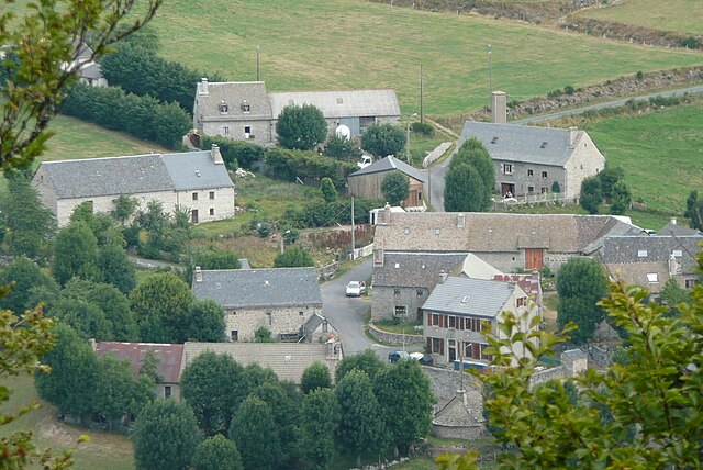
Le Collet-de-Dèze
- commune in Lozère, France
- Country:
- Postal Code: 48160
- Coordinates: 44° 14' 44" N, 3° 55' 24" E
- GPS tracks (wikiloc): [Link]
- Area: 26.47 sq km
- Population: 765


Rieutort-de-Randon
- commune in Lozère, France
- Country:
- Postal Code: 48700
- Coordinates: 44° 38' 4" N, 3° 28' 42" E
- GPS tracks (wikiloc): [Link]
- Area: 62.34 sq km
- Population: 774


Montbrun
- former commune in Lozère, France
- Country:
- Postal Code: 48210
- Coordinates: 44° 20' 14" N, 3° 30' 13" E
- GPS tracks (wikiloc): [Link]
- Area: 29.97 sq km
- Population: 112
Sainte-Eulalie
- commune in Lozère, France
- Country:
- Postal Code: 48120
- Coordinates: 44° 47' 27" N, 3° 28' 1" E
- GPS tracks (wikiloc): [Link]
- AboveSeaLevel: 1250 м m
- Area: 21.31 sq km
- Population: 38


Ispagnac
- commune in Lozère, France
- Country:
- Postal Code: 48320
- Coordinates: 44° 22' 14" N, 3° 32' 9" E
- GPS tracks (wikiloc): [Link]
- Area: 53.71 sq km
- Population: 889
- Web site: [Link]
Saint-Paul-le-Froid
- commune in Lozère, France
- Country:
- Postal Code: 48600
- Coordinates: 44° 48' 59" N, 3° 33' 38" E
- GPS tracks (wikiloc): [Link]
- Area: 44.17 sq km
- Population: 143
Saint-Martin-de-Boubaux
- commune in Lozère, France
- Country:
- Postal Code: 48160
- Coordinates: 44° 12' 0" N, 3° 55' 20" E
- GPS tracks (wikiloc): [Link]
- Area: 31.41 sq km
- Population: 177

Saint-Laurent-de-Veyrès
- commune in Lozère, France
- Country:
- Postal Code: 48310
- Coordinates: 44° 46' 15" N, 3° 7' 43" E
- GPS tracks (wikiloc): [Link]
- Area: 9.11 sq km
- Population: 38


Allenc
- commune in Lozère, France
- Country:
- Postal Code: 48190
- Coordinates: 44° 32' 28" N, 3° 39' 40" E
- GPS tracks (wikiloc): [Link]
- Area: 38.58 sq km
- Population: 227

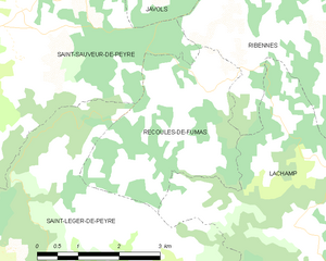
Recoules-de-Fumas
- commune in Lozère, France
- Country:
- Postal Code: 48100
- Coordinates: 44° 38' 28" N, 3° 20' 45" E
- GPS tracks (wikiloc): [Link]
- Area: 9.77 sq km
- Population: 100
Brion
- commune in Lozère, France
- Country:
- Postal Code: 48310
- Coordinates: 44° 45' 16" N, 3° 4' 15" E
- GPS tracks (wikiloc): [Link]
- Area: 22.11 sq km
- Population: 84
- Web site: [Link]
Ribennes
- commune in Lozère, France
- Country:
- Postal Code: 48700
- Coordinates: 44° 38' 21" N, 3° 23' 52" E
- GPS tracks (wikiloc): [Link]
- Area: 24.97 sq km
- Population: 165

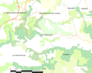
Les Salelles
- commune in Lozère, France
- Country:
- Postal Code: 48230
- Coordinates: 44° 28' 53" N, 3° 16' 46" E
- GPS tracks (wikiloc): [Link]
- Area: 10.62 sq km
- Population: 167


Serverette
- commune in Lozère, France
- Country:
- Postal Code: 48700
- Coordinates: 44° 42' 15" N, 3° 23' 10" E
- GPS tracks (wikiloc): [Link]
- Area: 17.35 sq km
- Population: 263
Les Bessons
- commune in Lozère, France
- Country:
- Postal Code: 48200
- Coordinates: 44° 46' 21" N, 3° 15' 12" E
- GPS tracks (wikiloc): [Link]
- Area: 23.49 sq km
- Population: 445
Saint-Privat-du-Fau
- commune in Lozère, France
- Country:
- Postal Code: 48140
- Coordinates: 44° 55' 1" N, 3° 20' 24" E
- GPS tracks (wikiloc): [Link]
- Area: 22.16 sq km
- Population: 136


Saint-Léger-de-Peyre
- commune in Lozère, France
- Country:
- Postal Code: 48100
- Coordinates: 44° 35' 40" N, 3° 18' 5" E
- GPS tracks (wikiloc): [Link]
- Area: 27.35 sq km
- Population: 182


Gabriac
- commune in Lozère, France
- Country:
- Postal Code: 48110
- Coordinates: 44° 32' 45" N, 3° 22' 25" E
- GPS tracks (wikiloc): [Link]
- Area: 8.44 sq km
- Population: 99


Les Vignes
- former commune in Lozère, France
- Country:
- Postal Code: 48210
- Coordinates: 44° 16' 40" N, 3° 13' 38" E
- GPS tracks (wikiloc): [Link]
- Area: 28.84 sq km
- Population: 101


Quézac
- former commune in Lozère, France
- Country:
- Postal Code: 48320
- Coordinates: 44° 22' 12" N, 3° 31' 30" E
- GPS tracks (wikiloc): [Link]
- Area: 26.91 sq km
- Population: 336
La Tieule
- commune in Lozère, France
- Country:
- Postal Code: 48500
- Coordinates: 44° 23' 2" N, 3° 9' 23" E
- GPS tracks (wikiloc): [Link]
- Area: 24 sq km
- Population: 88


arrondissement of Mende
- arrondissement of France
- Country:
- Capital: Mende
- Coordinates: 44° 40' 0" N, 3° 30' 0" E
- GPS tracks (wikiloc): [Link]
- Area: 3479 sq km
- Population: 63006

Fontans
- commune in Lozère, France
- Country:
- Postal Code: 48700
- Coordinates: 44° 44' 20" N, 3° 23' 12" E
- GPS tracks (wikiloc): [Link]
- Area: 33.9 sq km
- Population: 212


Brenoux
- commune in Lozère, France
- Country:
- Postal Code: 48000
- Coordinates: 44° 29' 0" N, 3° 31' 59" E
- GPS tracks (wikiloc): [Link]
- Area: 11.25 sq km
- Population: 378

Prinsuéjols
- former commune in Lozère, France
- Country:
- Postal Code: 48100
- Coordinates: 44° 40' 28" N, 3° 10' 7" E
- GPS tracks (wikiloc): [Link]
- Area: 42.96 sq km
- Population: 154


Saint-Saturnin
- commune in Lozère, France
- Country:
- Postal Code: 48500
- Coordinates: 44° 24' 41" N, 3° 11' 18" E
- GPS tracks (wikiloc): [Link]
- Area: 9.14 sq km
- Population: 63


Belvezet
- former commune in Lozère, France
- Country:
- Postal Code: 48170
- Coordinates: 44° 33' 49" N, 3° 44' 43" E
- GPS tracks (wikiloc): [Link]
- Area: 12.39 sq km
- Population: 84

Saint-Bauzile
- commune in Lozère, France
- Country:
- Postal Code: 48000
- Coordinates: 44° 28' 54" N, 3° 30' 10" E
- GPS tracks (wikiloc): [Link]
- AboveSeaLevel: 720 м m
- Area: 29.33 sq km
- Population: 638
- Web site: [Link]
Saint-Gal
- commune in Lozère, France
- Country:
- Postal Code: 48700
- Coordinates: 44° 40' 8" N, 3° 25' 30" E
- GPS tracks (wikiloc): [Link]
- Area: 9.88 sq km
- Population: 94
Rocles
- commune in Lozère, France
- Country:
- Postal Code: 48300
- Coordinates: 44° 42' 49" N, 3° 46' 58" E
- GPS tracks (wikiloc): [Link]
- AboveSeaLevel: 1100 м m
- Area: 19.84 sq km
- Population: 234
- Web site: [Link]


La Chaze-de-Peyre
- former commune in Lozère, France
- Country:
- Postal Code: 48130
- Coordinates: 44° 42' 10" N, 3° 15' 11" E
- GPS tracks (wikiloc): [Link]
- Area: 19.33 sq km
- Population: 308
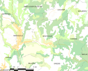
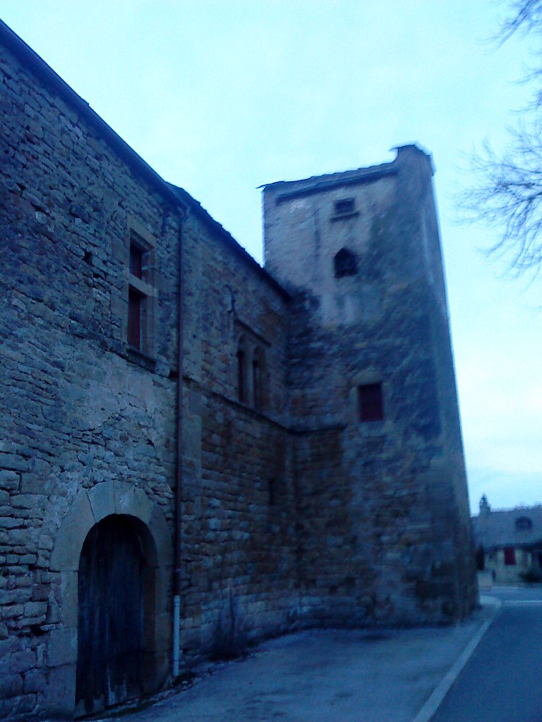
Montrodat
- commune in Lozère, France
- Country:
- Postal Code: 48100
- Coordinates: 44° 33' 6" N, 3° 19' 44" E
- GPS tracks (wikiloc): [Link]
- Area: 20.65 sq km
- Population: 1225
- Web site: [Link]

Palhers
- commune in Lozère, France
- Country:
- Postal Code: 48100
- Coordinates: 44° 31' 13" N, 3° 17' 54" E
- GPS tracks (wikiloc): [Link]
- Area: 8.59 sq km
- Population: 195
- Web site: [Link]
Cultures
- commune in Lozère, France
- Country:
- Postal Code: 48230
- Coordinates: 44° 29' 35" N, 3° 22' 40" E
- GPS tracks (wikiloc): [Link]
- Area: 3.96 sq km
- Population: 160

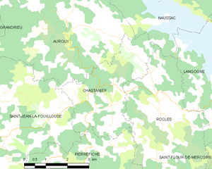
Chastanier
- commune in Lozère, France
- Country:
- Postal Code: 48300
- Coordinates: 44° 43' 31" N, 3° 45' 17" E
- GPS tracks (wikiloc): [Link]
- Area: 10.41 sq km
- Population: 81

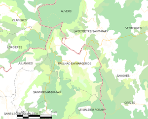
Paulhac-en-Margeride
- commune in Lozère, France
- Country:
- Postal Code: 48140
- Coordinates: 44° 56' 49" N, 3° 22' 50" E
- GPS tracks (wikiloc): [Link]
- Area: 15.79 sq km
- Population: 100

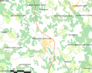
Saint-Chély-d'Apcher
- commune in Lozère, France
- Country:
- Postal Code: 48200
- Coordinates: 44° 48' 11" N, 3° 16' 33" E
- GPS tracks (wikiloc): [Link]
- Area: 28.26 sq km
- Population: 4156
- Web site: [Link]
Saint-Denis-en-Margeride
- commune in Lozère, France
- Country:
- Postal Code: 48700
- Coordinates: 44° 44' 8" N, 3° 28' 18" E
- GPS tracks (wikiloc): [Link]
- Area: 38.67 sq km
- Population: 174

Chaulhac
- commune in Lozère, France
- Country:
- Postal Code: 48140
- Coordinates: 44° 55' 20" N, 3° 15' 24" E
- GPS tracks (wikiloc): [Link]
- Area: 9.47 sq km
- Population: 74


Blavignac
- commune in Lozère, France
- Country:
- Postal Code: 48200
- Coordinates: 44° 53' 8" N, 3° 17' 12" E
- GPS tracks (wikiloc): [Link]
- Area: 13.83 sq km
- Population: 288


Prunières
- commune in Lozère, France
- Country:
- Postal Code: 48200
- Coordinates: 44° 49' 35" N, 3° 20' 32" E
- GPS tracks (wikiloc): [Link]
- Area: 13.09 sq km
- Population: 261
Noalhac
- commune in Lozère, France
- Country:
- Postal Code: 48310
- Coordinates: 44° 48' 41" N, 3° 6' 24" E
- GPS tracks (wikiloc): [Link]
- Area: 13.51 sq km
- Population: 94
Antrenas
- commune in Lozère, France
- Country:
- Postal Code: 48100
- Coordinates: 44° 34' 54" N, 3° 15' 54" E
- GPS tracks (wikiloc): [Link]
- Area: 17.55 sq km
- Population: 333


Le Massegros
- former commune in Lozère, France
- Country:
- Postal Code: 48500
- Coordinates: 44° 18' 32" N, 3° 10' 28" E
- GPS tracks (wikiloc): [Link]
- Area: 17.94 sq km
- Population: 405

Saint-Léger-du-Malzieu
- commune in Lozère, France
- Country:
- Postal Code: 48140
- Coordinates: 44° 53' 17" N, 3° 18' 35" E
- GPS tracks (wikiloc): [Link]
- Area: 18.92 sq km
- Population: 212


Servières
- commune in Lozère, France
- Country:
- Postal Code: 48000
- Coordinates: 44° 34' 30" N, 3° 24' 17" E
- GPS tracks (wikiloc): [Link]
- Area: 19.38 sq km
- Population: 184
Le Malzieu-Forain
- commune in Lozère, France
- Country:
- Postal Code: 48140
- Coordinates: 44° 51' 16" N, 3° 19' 42" E
- GPS tracks (wikiloc): [Link]
- AboveSeaLevel: 1200 м m
- Area: 48.65 sq km
- Population: 460


Grandrieu
- commune in Lozère, France
- Country:
- Postal Code: 48600
- Coordinates: 44° 47' 4" N, 3° 37' 59" E
- GPS tracks (wikiloc): [Link]
- Area: 65.37 sq km
- Population: 738
Les Laubies
- commune in Lozère, France
- Country:
- Postal Code: 48700
- Coordinates: 44° 41' 9" N, 3° 25' 46" E
- GPS tracks (wikiloc): [Link]
- Area: 22.8 sq km
- Population: 172
- Web site: [Link]
La Panouse
- commune in Lozère, France
- Country:
- Postal Code: 48600
- Coordinates: 44° 43' 47" N, 3° 35' 21" E
- GPS tracks (wikiloc): [Link]
- Area: 37.83 sq km
- Population: 81


Laval-du-Tarn
- commune in Lozère, France
- Country:
- Postal Code: 48500
- Coordinates: 44° 21' 15" N, 3° 21' 12" E
- GPS tracks (wikiloc): [Link]
- Area: 36.85 sq km
- Population: 102

Rimeize
- commune in Lozère, France
- Country:
- Postal Code: 48200
- Coordinates: 44° 45' 54" N, 3° 19' 26" E
- GPS tracks (wikiloc): [Link]
- Area: 32.3 sq km
- Population: 577
La Fage-Saint-Julien
- commune in Lozère, France
- Country:
- Postal Code: 48200
- Coordinates: 44° 48' 11" N, 3° 11' 28" E
- GPS tracks (wikiloc): [Link]
- Area: 18.06 sq km
- Population: 293

Pelouse
- commune in Lozère, France
- Country:
- Postal Code: 48000
- Coordinates: 44° 34' 7" N, 3° 37' 0" E
- GPS tracks (wikiloc): [Link]
- AboveSeaLevel: 1115 м m
- Area: 32.98 sq km
- Population: 229


Chadenet
- commune in Lozère, France
- Country:
- Postal Code: 48190
- Coordinates: 44° 31' 11" N, 3° 38' 3" E
- GPS tracks (wikiloc): [Link]
- Area: 12.96 sq km
- Population: 90

Termes
- commune in Lozère, France
- Country:
- Postal Code: 48310
- Coordinates: 44° 48' 47" N, 3° 10' 0" E
- GPS tracks (wikiloc): [Link]
- AboveSeaLevel: 1122 м m
- Area: 17.65 sq km
- Population: 204

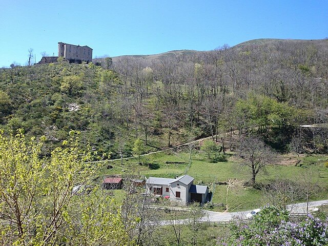
Vebron
- commune in Lozère, France
- Country:
- Postal Code: 48400
- Coordinates: 44° 14' 21" N, 3° 34' 40" E
- GPS tracks (wikiloc): [Link]
- Area: 69.66 sq km
- Population: 197
- Web site: [Link]
Lachamp
- commune in Lozère, France
- Country:
- Postal Code: 48100
- Coordinates: 44° 36' 41" N, 3° 22' 14" E
- GPS tracks (wikiloc): [Link]
- Area: 25.89 sq km
- Population: 173
Le Born
- commune in Lozère, France
- Country:
- Postal Code: 48000
- Coordinates: 44° 33' 35" N, 3° 33' 39" E
- GPS tracks (wikiloc): [Link]
- Area: 30.21 sq km
- Population: 148


Saint-André-de-Lancize
- commune in Lozère, France
- Country:
- Postal Code: 48240
- Coordinates: 44° 15' 29" N, 3° 48' 37" E
- GPS tracks (wikiloc): [Link]
- Area: 22.78 sq km
- Population: 128

Bassurels
- commune in Lozère, France
- Country:
- Postal Code: 48400
- Coordinates: 44° 10' 45" N, 3° 37' 30" E
- GPS tracks (wikiloc): [Link]
- Area: 46.34 sq km
- Population: 62
La Salle-Prunet
- former commune in Lozère, France
- Country:
- Postal Code: 48400
- Coordinates: 44° 18' 59" N, 3° 36' 48" E
- GPS tracks (wikiloc): [Link]
- AboveSeaLevel: 590 м m
- Area: 18.5 sq km
- Population: 179

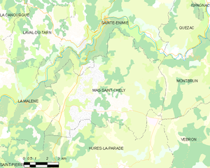
Mas-Saint-Chély
- commune in Lozère, France
- Country:
- Postal Code: 48210
- Coordinates: 44° 18' 32" N, 3° 23' 46" E
- GPS tracks (wikiloc): [Link]
- Area: 56.81 sq km
- Population: 119
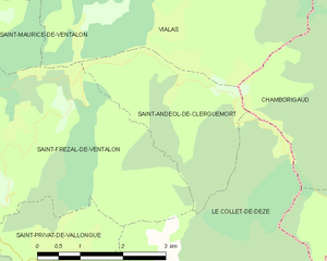
Saint-Andéol-de-Clerguemort
- former commune in Lozère, France
- Country:
- Postal Code: 48160
- Coordinates: 44° 17' 31" N, 3° 54' 26" E
- GPS tracks (wikiloc): [Link]
- Area: 6.86 sq km
- Population: 83
Shares border with regions:


Gard
- department located in southern France in the Occitanie region
- Country:
- Capital: Nîmes
- Coordinates: 44° 7' 41" N, 4° 4' 54" E
- GPS tracks (wikiloc): [Link]
- Area: 5853 sq km
- Population: 738189
- Web site: [Link]


Haute-Loire
- French department
- Country:
- Capital: Le Puy-en-Velay
- Coordinates: 45° 0' 0" N, 4° 0' 0" E
- GPS tracks (wikiloc): [Link]
- Area: 4977 sq km
- Population: 227034
- Web site: [Link]


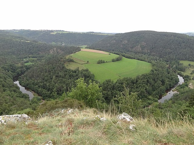
Ardèche
- French department
 Hiking in Ardèche
Hiking in the Ardèche region of France offers a remarkable experience for outdoor enthusiasts, with diverse landscapes ranging from dramatic gorges to tranquil forests. Here are some key aspects to consider when hiking in Ardèche:...
- Country:
- Capital: Privas
- Coordinates: 44° 40' 0" N, 4° 25' 0" E
- GPS tracks (wikiloc): [Link]
- Area: 5529 sq km
- Population: 324209
- Web site: [Link]


Aveyron
- French department
- Country:
- Capital: Rodez
- Coordinates: 44° 15' 0" N, 2° 42' 0" E
- GPS tracks (wikiloc): [Link]
- Area: 8735 sq km
- Population: 279169
- Web site: [Link]


Cantal
- French department
- Country:
- Capital: Aurillac
- Coordinates: 45° 2' 0" N, 3° 6' 0" E
- GPS tracks (wikiloc): [Link]
- Area: 5726 sq km
- Population: 146219
- Web site: [Link]