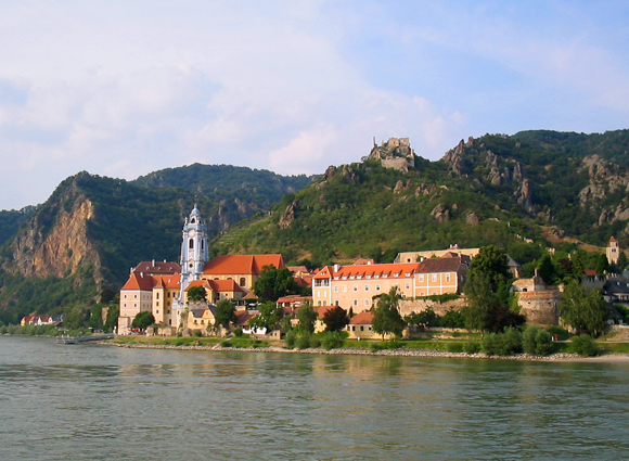
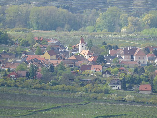
Mautern an der Donau (Mautern an der Donau)
- municipality in Austria
 Hiking in Mautern an der Donau
Mautern an der Donau, located in Austria in the region of Lower Austria, is a charming village that offers various hiking opportunities with stunning views of the Danube River and the surrounding landscape. Here are some highlights about hiking in this area:
Scenery and Trails
-
Danube Trail (Donausteig): This long-distance hiking trail runs along the banks of the Danube River and includes sections that pass through Mautern. You'll enjoy breathtaking views of the river, vineyards, and the picturesque landscape of the Wachau Valley, which is a UNESCO World Heritage Site.
-
Local Hiking Paths: Mautern has a network of local hiking paths that are well-marked. These trails vary in difficulty and length, making them suitable for different levels of hikers. You can explore the countryside, meander through vineyards, and discover charming spots along the way.
-
Castle Ruins: Some trails lead to historical sites, including the ruins of the Mautern Castle, where you can enjoy panoramic views of the area.
Flora and Fauna
The region is rich in biodiversity, offering a chance to spot various wildlife and beautiful plant life along the trails. The seasonal changes also provide a different experience with each hike, from lush green in spring and summer to vibrant foliage in autumn.
Hiking Tips
-
Preparation: Always check the weather and trail conditions before heading out. Make sure you bring adequate water, snacks, and a map or GPS device.
-
Footwear: Wear appropriate hiking boots for traction and comfort, especially if you're exploring uneven terrain.
-
Respect Nature: Follow local guidelines to preserve the natural beauty of the area. Stick to marked trails and carry out any trash you bring with you.
Best Time to Hike
The best time for hiking in Mautern an der Donau is during the spring and early autumn months when the weather is mild, and the landscape is at its most beautiful. Summer can also be great, but be prepared for warmer temperatures.
Overall, Mautern an der Donau provides a delightful hiking experience that combines natural beauty with cultural heritage. Whether you're a seasoned hiker or just looking for a leisurely walk, you'll find something to enjoy in this scenic region.
- Country:

- Postal Code: 3512
- Local Dialing Code: 02732
- Licence Plate Code: KR
- Coordinates: 48° 23' 37" N, 15° 34' 39" E


- GPS tracks (wikiloc): [Link]
- AboveSeaLevel: 201 м m
- Area: 9.14 sq km
- Population: 3567
- Web site: http://www.mautern.at
- Wikipedia en: wiki(en)
- Wikipedia: wiki(de)
- Wikidata storage: Wikidata: Q669995
- Wikipedia Commons Category: [Link]
- Freebase ID: [/m/02qxd86]
- GeoNames ID: Alt: [7872920]
- VIAF ID: Alt: [132682139]
- GND ID: Alt: [4100692-6]
- archINFORM location ID: [9966]
- Library of Congress authority ID: Alt: [n94069148]
- Austrian municipality key: [31327]
Shares border with regions:

Krems an der Donau
- city in Austria
Krems an der Donau is a picturesque town in Lower Austria, situated at the confluence of the Danube River and the Krems River. It is surrounded by beautiful landscapes, vineyards, and the scenic rolling hills of the Wachau Valley, making it a great destination for hiking enthusiasts. Here are some highlights and tips for hiking in and around Krems an der Donau:...
- Country:

- Postal Code: 3500
- Licence Plate Code: KS
- Coordinates: 48° 25' 0" N, 15° 37' 0" E


- GPS tracks (wikiloc): [Link]
- AboveSeaLevel: 203 м m
- Area: 51.61 sq km
- Population: 24610
- Web site: [Link]

Furth bei Göttweig
- municipality in Austria
Furth bei Göttweig is a picturesque village located in the Lower Austria region, known for its beautiful landscapes, vineyards, and historic sites. Hiking in this area provides a wonderful opportunity to explore the natural beauty and cultural heritage of Austria....
- Country:

- Postal Code: 3511
- Local Dialing Code: 02732
- Licence Plate Code: KR
- Coordinates: 48° 22' 0" N, 15° 36' 0" E


- GPS tracks (wikiloc): [Link]
- AboveSeaLevel: 214 м m
- Area: 12.37 sq km
- Population: 2956
- Web site: [Link]

Paudorf
- municipality in Austria
Paudorf, a small municipality located in Lower Austria, offers a scenic backdrop for hiking enthusiasts. The region is characterized by its rolling hills, vineyards, and beautiful landscapes, making it an appealing destination for both casual walkers and more serious hikers....
- Country:

- Postal Code: 3508
- Local Dialing Code: 02736
- Licence Plate Code: KR
- Coordinates: 48° 21' 0" N, 15° 37' 0" E


- GPS tracks (wikiloc): [Link]
- AboveSeaLevel: 257 м m
- Area: 30.09 sq km
- Population: 2598
- Web site: [Link]


Dürnstein
- municipality in Austria
Dürnstein is a charming village located in the Wachau Valley of Austria, known for its picturesque landscapes, vineyards, and historical sites. Hiking in and around Dürnstein offers stunning views of the Danube River, lush hillsides, and beautiful terraced vineyards....
- Country:

- Postal Code: 3601
- Local Dialing Code: 02711
- Licence Plate Code: KR
- Coordinates: 48° 23' 44" N, 15° 31' 13" E


- GPS tracks (wikiloc): [Link]
- AboveSeaLevel: 209 м m
- Area: 16.81 sq km
- Population: 864
- Web site: [Link]

Bergern im Dunkelsteinerwald
- municipality in Austria
 Hiking in Bergern im Dunkelsteinerwald
Bergern im Dunkelsteinerwald is a charming destination for hiking enthusiasts, located in Austria's Lower Austria region. The Dunkelsteinerwald itself is a picturesque forested area characterized by a mix of deciduous and coniferous trees, hills, and valleys, providing a beautiful backdrop for various outdoor activities. Here are some highlights to consider when planning your hiking adventure in this area:...
- Country:

- Postal Code: 3512
- Local Dialing Code: 02714
- Licence Plate Code: KR
- Coordinates: 48° 22' 0" N, 15° 33' 0" E


- GPS tracks (wikiloc): [Link]
- AboveSeaLevel: 305 м m
- Area: 36.53 sq km
- Population: 1253
- Web site: [Link]

Rossatz-Arnsdorf
- municipality in Austria
Rossatz-Arnsdorf, located in the Wachau Valley of Austria, is a picturesque area known for its stunning landscapes, vineyards, and rich cultural heritage. Hiking in this region offers a variety of trails suitable for different skill levels, making it a great destination for nature enthusiasts and outdoor adventurers....
- Country:

- Local Dialing Code: 02714
- Licence Plate Code: KR
- Coordinates: 48° 23' 45" N, 15° 30' 15" E


- GPS tracks (wikiloc): [Link]
- AboveSeaLevel: 225 м m
- Area: 3904 sq km
- Population: 1065
- Web site: [Link]