Maxou (Maxou)

- commune in Lot, France
- Country:

- Postal Code: 46090
- Coordinates: 44° 32' 11" N, 1° 26' 35" E


- GPS tracks (wikiloc): [Link]
- Area: 12.59 sq km
- Population: 300
- Wikipedia en: wiki(en)
- Wikipedia: wiki(fr)
- Wikidata storage: Wikidata: Q1322034
- Wikipedia Commons Category: [Link]
- Freebase ID: [/m/03mgngp]
- GeoNames ID: Alt: [6618282]
- SIREN number: [214601882]
- BnF ID: [15260929n]
- INSEE municipality code: 46188
Shares border with regions:

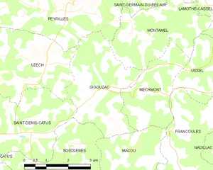
Gigouzac
- commune in Lot, France
- Country:
- Postal Code: 46150
- Coordinates: 44° 35' 0" N, 1° 26' 2" E
- GPS tracks (wikiloc): [Link]
- Area: 9.91 sq km
- Population: 254
Francoulès
- commune in Lot, France
- Country:
- Postal Code: 46090
- Coordinates: 44° 32' 37" N, 1° 29' 22" E
- GPS tracks (wikiloc): [Link]
- Area: 13.61 sq km
- Population: 226
Calamane
- commune in Lot, France
- Country:
- Postal Code: 46150
- Coordinates: 44° 31' 33" N, 1° 23' 27" E
- GPS tracks (wikiloc): [Link]
- Area: 7.6 sq km
- Population: 458
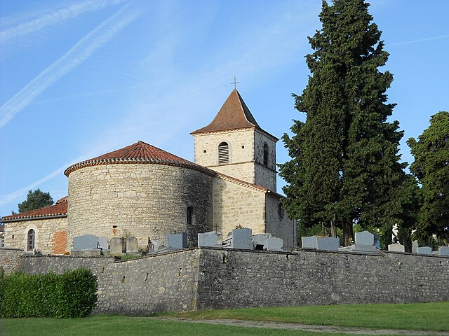
Mechmont
- commune in Lot, France
- Country:
- Postal Code: 46150
- Coordinates: 44° 34' 45" N, 1° 27' 0" E
- GPS tracks (wikiloc): [Link]
- Area: 6.71 sq km
- Population: 123
Boissières
- commune in Lot, France
- Country:
- Postal Code: 46150
- Coordinates: 44° 32' 36" N, 1° 24' 2" E
- GPS tracks (wikiloc): [Link]
- Area: 13.03 sq km
- Population: 392
- Web site: [Link]
Valroufié
- former commune in Lot, France
- Country:
- Postal Code: 46090
- Coordinates: 44° 31' 8" N, 1° 29' 16" E
- GPS tracks (wikiloc): [Link]
- Area: 13.48 sq km
- Population: 440

Saint-Pierre-Lafeuille
- commune in Lot, France
- Country:
- Postal Code: 46090
- Coordinates: 44° 31' 25" N, 1° 27' 14" E
- GPS tracks (wikiloc): [Link]
- Area: 8.52 sq km
- Population: 370