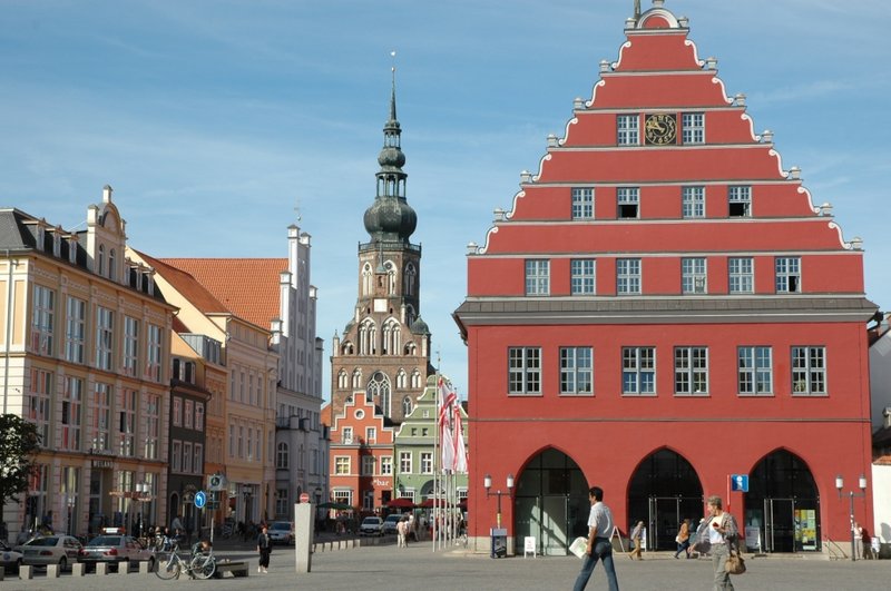
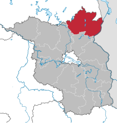
Mecklenburgische Seenplatte District (Landkreis Mecklenburgische Seenplatte)


- German district
 Hiking in Mecklenburgische Seenplatte District
Mecklenburgische Seenplatte, located in northeastern Germany, is a stunning region known for its many lakes, rivers, and expansive forests, making it an excellent destination for hiking enthusiasts. Here are some key highlights about hiking in this beautiful area:
Natural Beauty
-
Lakes and Wetlands: The region is home to the largest connected lake district in Germany, featuring numerous lakes such as Müritz, the largest in the country entirely within Germany. The picturesque landscapes offer varied terrains, from marshlands to dense forests.
-
National Parks: The Müritz National Park is a major highlight, covering 322 square kilometers and providing a range of hiking trails that allow you to explore its rich biodiversity, including a variety of bird species and unique flora.
Hiking Trails
-
Well-Marked Trails: The region has a well-developed network of hiking trails, varying in difficulty and length, catering to both casual walkers and more experienced hikers. Many trails are well-marked, making it easy to navigate.
-
Scenic Routes: Popular hiking routes include the Müritz Höhenweg, which offers stunning views of the Müritz lake and vast pine forests. Another great option is the “Mecklenburgische Seenplatte trail,” which showcases the area’s scenic lakes and charming villages.
-
Combination with Cycling: The region is also popular for cycling, so many hiking paths are shared with bike routes, giving you the option to explore both modes of transportation.
Best Time to Hike
- Spring and Early Fall: The best time to hike in Mecklenburgische Seenplatte is during the spring and early fall when the weather is mild, and the landscapes are vibrant. Summer can be warm and humid, while winter tends to bring cold temperatures and requires proper gear.
Practical Tips
-
Equipment: Wear sturdy hiking boots and dress in layers to accommodate changing weather conditions. Don’t forget a good backpack, plenty of water, snacks, and a map or GPS device.
-
Wildlife Awareness: Be mindful of the wildlife, especially birds and deer, and practice responsible hiking to protect the natural environment.
-
Local Culture: Take time to explore local villages along the trails to enjoy the regional cuisine and charm, which adds to the hiking experience.
-
Guided Tours: For those who prefer a guided experience, there are local organizations and tour operators offering guided hiking tours, which can provide valuable insights into the region’s natural history and ecosystems.
Overall, hiking in Mecklenburgische Seenplatte offers a blend of stunning landscapes, diverse ecosystems, and a peaceful atmosphere that is perfect for both nature lovers and avid hikers.
- Country:

- Capital: Neubrandenburg
- Licence Plate Code: WRN; RM; NZ; MÜR; MST; MSE; MC; DM; AT
- Coordinates: 53° 33' 0" N, 12° 58' 48" E


- GPS tracks (wikiloc): [Link]
- AboveSeaLevel: 57 м m
- Area: 5468.00 sq km
- Population: 261733
- Web site: http://www.lk-mecklenburgische-seenplatte.de
- Wikipedia en: wiki(en)
- Wikipedia: wiki(de)
- Wikidata storage: Wikidata: Q2902
- Wikipedia Commons Category: [Link]
- Wikipedia Commons Maps Category: [Link]
- Freebase ID: [/m/0h54qr8]
- GeoNames ID: Alt: [8648413]
- VIAF ID: Alt: [232489091]
- OSM relation ID: [1739376]
- GND ID: Alt: [16339539-1]
- archINFORM location ID: [5923]
- WOEID: [91981836]
- NUTS code: [DE80J]
- Instagram location ID: [131791586991305]
- German district key: 13071
Shares border with regions:


Rostock District
- district of Mecklenburg-Vorpommern, Germany
Hiking in Rostock District
Rostock, located in northern Germany along the Baltic Sea, is a beautiful region with a mix of coastal landscapes, forests, and charming countryside, making it a great destination for hiking enthusiasts. Here are some highlights for hiking in the Rostock district:...
- Country:
- Capital: Güstrow
- Licence Plate Code: TET; ROS; LRO; GÜ; DBR; BÜZ
- Coordinates: 53° 54' 0" N, 12° 15' 0" E
- GPS tracks (wikiloc): [Link]
- AboveSeaLevel: 39 м m
- Area: 3431 sq km
- Population: 211878
- Web site: [Link]


Ludwigslust-Parchim District
- German district
Hiking in Ludwigslust-Parchim District
Ludwigslust-Parchim is a district located in the state of Mecklenburg-Vorpommern in northern Germany. It's known for its diverse landscapes that include forests, lakes, and agricultural land, making it a great area for hiking enthusiasts. Here are some highlights and tips for hiking in the region:...
- Country:
- Licence Plate Code: STB; PCH; LWL; LUP; LBZ; HGN
- Coordinates: 53° 27' 0" N, 11° 33' 0" E
- GPS tracks (wikiloc): [Link]
- AboveSeaLevel: 41 м m
- Area: 4750.00 sq km
- Population: 212373
- Web site: [Link]


Vorpommern-Rügen District
- German district
Hiking in Vorpommern-Rügen District
Vorpommern-Rügen, located in northeastern Germany, is a fantastic destination for hiking enthusiasts, offering diverse landscapes, picturesque coastlines, and rich natural and cultural experiences. Here are some key aspects to consider when hiking in this region:...
- Country:
- Capital: Stralsund
- Licence Plate Code: VR; RÜG; RDG; NVP; GMN
- Coordinates: 54° 27' 18" N, 13° 23' 37" E
- GPS tracks (wikiloc): [Link]
- Area: 3188 sq km
- Web site: [Link]

Vorpommern-Greifswald District
- German district
Hiking in Vorpommern-Greifswald District
Vorpommern-Greifswald, located in northeastern Germany, is a fantastic destination for hikers due to its diverse landscapes, rich natural beauty, and well-maintained trails. Here’s an overview of what you can expect when hiking in this region:...
- Country:
- Capital: Greifswald
- Licence Plate Code: WLG; VG; UEM; SBG; PW; GW; ANK
- Coordinates: 53° 45' 36" N, 13° 53' 24" E
- GPS tracks (wikiloc): [Link]
- AboveSeaLevel: 1 м m
- Area: 3927 sq km
- Population: 237374

Uckermark District
- District in Brandenburg state, Germany
Hiking in Uckermark District
Hiking in the Uckermark district, located in the northeastern part of Germany, is a delight for nature enthusiasts. This picturesque region is characterized by its rolling landscapes, serene lakes, and lush forests, making it an ideal destination for outdoor exploration....
- Country:
- Capital: Prenzlau
- Licence Plate Code: ANG; PZ; SDT; TP; UM
- Coordinates: 53° 15' 0" N, 13° 52' 0" E
- GPS tracks (wikiloc): [Link]
- AboveSeaLevel: 20 м m
- Area: 3058.08 sq km
- Population: 121326
- Web site: [Link]
Ostprignitz-Ruppin District
- district in Brandenburg state, Germany
Hiking in Ostprignitz-Ruppin District
Ostprignitz-Ruppin, located in the northeastern part of Brandenburg, Germany, offers a unique and picturesque hiking experience. The region is characterized by its diverse landscapes, which include sprawling forests, rolling hills, glacial lakes, and historical sites. Here are some highlights and tips for hiking in this area:...
- Country:
- Licence Plate Code: WK; OPR; NP; KY
- Coordinates: 52° 58' 0" N, 12° 40' 0" E
- GPS tracks (wikiloc): [Link]
- AboveSeaLevel: 53 м m
- Area: 2509.22 sq km
- Population: 99125
- Web site: [Link]