Ostprignitz-Ruppin District (Landkreis Ostprignitz-Ruppin)

- district in Brandenburg state, Germany
 Hiking in Ostprignitz-Ruppin District
Ostprignitz-Ruppin, located in the northeastern part of Brandenburg, Germany, offers a unique and picturesque hiking experience. The region is characterized by its diverse landscapes, which include sprawling forests, rolling hills, glacial lakes, and historical sites. Here are some highlights and tips for hiking in this area:
Hiking Trails:
-
Ruppiner Seenland: This area features numerous lakes, providing a scenic backdrop for hiking. Trails around the lakes, such as the Ruppiner Seenweg, allow you to enjoy both nature and opportunities for wildlife observation.
-
Grumsin Forest: Known for its beech trees and part of the UNESCO World Heritage Site of Ancient and Primeval Beech Forests, this area offers tranquil hiking routes through ancient woodland.
-
Kyritz-Ruppiner Heide: A beautiful nature reserve that boasts heathland, forests, and wetlands. The area's trails provide a chance to experience the local flora and fauna.
-
Natural Park Stechlin-Ruppiner Land: This park offers a variety of marked hiking paths with varying lengths and difficulty levels, suitable for both casual hikers and more experienced trekkers.
Tips for Hiking in Ostprignitz-Ruppin:
- Plan Your Route: Trails are well-marked, but it's always a good idea to have a map or a GPS device for navigation.
- Check Local Conditions: Weather can change quickly, so be prepared for varying conditions, especially in the temperate seasons.
- Pack Essentials: Bring plenty of water, snacks, a first-aid kit, and sun protection.
- Wildlife Awareness: Keep an eye out for local wildlife, including deer, birds, and various small animals. Respect their habitats by staying on marked trails.
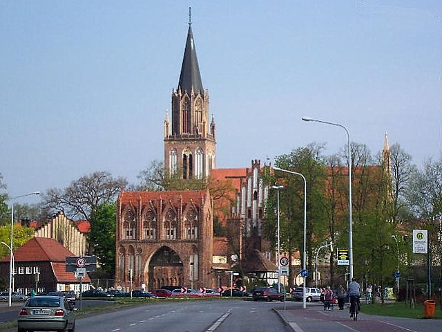
- Cultural Sites: Take time to explore historical buildings and landmarks, such as the town of Neuruppin, known for its connection to the German poet Theodor Fontane.
Hiking in Ostprignitz-Ruppin offers a mixture of natural beauty and cultural richness, making it an excellent destination for outdoor enthusiasts. Whether you're looking for a leisurely day hike or an immersive nature experience, this region has plenty to offer.
- Country:

- Licence Plate Code: WK; OPR; NP; KY
- Coordinates: 52° 58' 0" N, 12° 40' 0" E


- GPS tracks (wikiloc): [Link]
- AboveSeaLevel: 53 м m
- Area: 2509.22 sq km
- Population: 99125
- Web site: http://www.ostprignitz-ruppin.de/
- Wikipedia en: wiki(en)
- Wikipedia: wiki(de)
- Wikidata storage: Wikidata: Q6125
- Wikipedia Commons Gallery: [Link]
- Wikipedia Commons Category: [Link]
- Wikipedia Commons Maps Category: [Link]
- Freebase ID: [/m/0153fv]
- GeoNames ID: Alt: [3249087]
- VIAF ID: Alt: [244265802]
- OSM relation ID: [62574]
- GND ID: Alt: [4372157-6]
- archINFORM location ID: [3271]
- TGN ID: [7076937]
- NUTS code: [DE40D]
- German district key: 12068
Shares border with regions:

Mecklenburgische Seenplatte District
- German district
Hiking in Mecklenburgische Seenplatte District
Mecklenburgische Seenplatte, located in northeastern Germany, is a stunning region known for its many lakes, rivers, and expansive forests, making it an excellent destination for hiking enthusiasts. Here are some key highlights about hiking in this beautiful area:...
- Country:
- Capital: Neubrandenburg
- Licence Plate Code: WRN; RM; NZ; MÜR; MST; MSE; MC; DM; AT
- Coordinates: 53° 33' 0" N, 12° 58' 48" E
- GPS tracks (wikiloc): [Link]
- AboveSeaLevel: 57 м m
- Area: 5468.00 sq km
- Population: 261733
- Web site: [Link]
Stendal District
- German district in Saxony-Anhalt
Hiking in Stendal District
Stendal is a district located in the state of Saxony-Anhalt in Germany. While it may not be as well-known for hiking as some other regions, it does provide some opportunities for outdoor activities in a scenic, largely rural setting. Here are some highlights about hiking in the Stendal district:...
- Country:
- Licence Plate Code: SDL; OBG; HV
- Coordinates: 52° 41' 0" N, 11° 51' 0" E
- GPS tracks (wikiloc): [Link]
- AboveSeaLevel: 39 м m
- Area: 2423.04 sq km
- Population: 116666
- Web site: [Link]
Oberhavel District
- district in Brandenburg state, Germany
Hiking in Oberhavel District
Oberhavel is a beautiful district located in the state of Brandenburg, Germany, known for its picturesque landscapes, lush forests, and numerous lakes. It's a fantastic destination for hiking enthusiasts. Here are some key points to consider when hiking in Oberhavel:...
- Country:
- Licence Plate Code: OHV
- Coordinates: 52° 53' 0" N, 13° 15' 0" E
- GPS tracks (wikiloc): [Link]
- AboveSeaLevel: 67 м m
- Area: 1795.77 sq km
- Population: 202162
- Web site: [Link]
Prignitz District
- district in Brandenburg, Germany
Hiking in Prignitz District
Prignitz, located in the state of Brandenburg, Germany, offers a variety of hiking opportunities in a largely rural and picturesque landscape. Known for its diverse nature, including forests, meadows, and rivers, Prignitz provides a tranquil escape for outdoor enthusiasts. Here are some highlights for hiking in the region:...
- Country:
- Licence Plate Code: PR
- Coordinates: 53° 0' 0" N, 12° 0' 0" E
- GPS tracks (wikiloc): [Link]
- AboveSeaLevel: 41 м m
- Area: 2123.31 sq km
- Web site: [Link]
Havelland District
- District in Brandenburg state, Germany
Hiking in Havelland District
Havelland, located in the Brandenburg region of Germany, offers a rich tapestry of hiking opportunities for nature enthusiasts and outdoor adventurers. Here’s what you can expect when hiking in this picturesque district:...
- Country:
- Licence Plate Code: HVL
- Coordinates: 52° 38' 0" N, 12° 38' 0" E
- GPS tracks (wikiloc): [Link]
- AboveSeaLevel: 32 м m
- Area: 1717.00 sq km
- Population: 153294
- Web site: [Link]