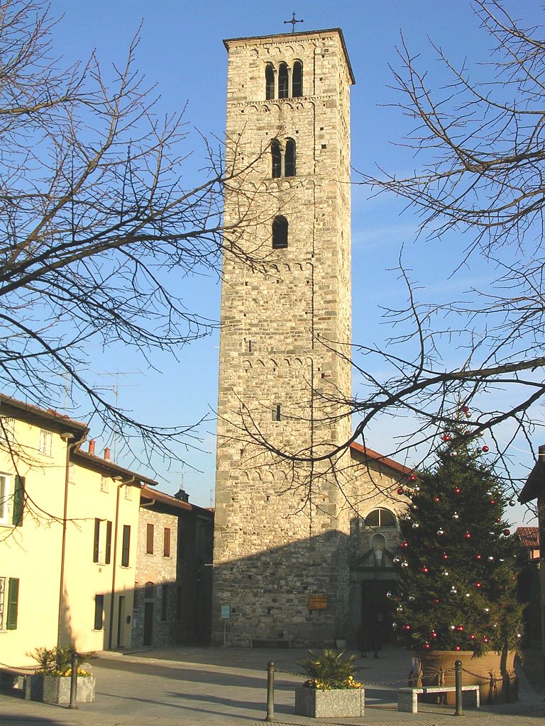
Merone (Merone)
.svg)
- Italian comune
 Hiking in Merone
Merone, located in the province of Como in Italy, is a charming town that offers access to beautiful hiking trails, particularly in the surrounding areas of the Triangolo Lariano, which is part of the larger Lombardy region. Although Merone itself is not widely known for extensive hiking routes, its proximity to natural parks and the scenic landscape of Lake Como makes it a great starting point for outdoor enthusiasts.
Hiking Trails and Areas Nearby
-
Triangolo Lariano: This mountainous area offers various hiking trails that provide stunning views of both Lake Como and the surrounding peaks. Trails range from easy walks suitable for families to more challenging hikes for those looking for an adventure.
-
Corni di Canzo: A popular hiking destination nearby, this area features numerous trails with various difficulty levels. The routes often lead to panoramic viewpoints that overlook the surrounding mountains and valleys.
-
Parco Regionale della Grigna: A bit further afield, the Grigna Regional Park offers excellent hiking opportunities with well-marked trails, varied terrain, and breathtaking landscapes. This park includes routes suitable for both experienced hikers and beginners.
-
The Sentiero del Viandante: This historic path, roughly following the eastern shore of Lake Como, is a must-do for hikers. It combines culture and nature, passing through quaint villages and offering fantastic views of the lake.
Tips for Hiking in Merone
-
Season: The best time for hiking in this region is typically from late spring to early autumn when the weather is mild and the trails are accessible.
-
Trail Maps: Make sure to acquire maps of the hiking trails. Local tourist offices or online resources can provide useful information and updates on trail conditions.
-
Gear: Wear appropriate footwear with good grip, and dress in layers to accommodate changes in weather. Don't forget essentials like water, snacks, sun protection, and a first-aid kit.
-
Respect Nature: Always follow Leave No Trace principles to protect the beautiful landscapes.
-
Local Guidance: Consider joining local hiking groups or guided tours to discover hidden gems and learn about the area's natural and cultural history.
Hiking around Merone can provide a unique experience, allowing you to enjoy the scenic beauty of Northern Italy while exploring its rich culture and history. Enjoy your hike!
- Country:

- Postal Code: 22046
- Local Dialing Code: 031
- Licence Plate Code: CO
- Coordinates: 45° 47' 0" N, 9° 15' 0" E


- GPS tracks (wikiloc): [Link]
- AboveSeaLevel: 280 м m
- Area: 3.28 sq km
- Population: 4101
- Web site: http://www.comune.merone.co.it
- Wikipedia en: wiki(en)
- Wikipedia: wiki(it)
- Wikidata storage: Wikidata: Q47617
- Wikipedia Commons Category: [Link]
- Freebase ID: [/m/0gj0x0]
- GeoNames ID: Alt: [6542493]
- VIAF ID: Alt: [168107792]
- OSM relation ID: [46072]
- archINFORM location ID: [1005]
- UN/LOCODE: [ITMER]
- ISTAT ID: 013147
- Italian cadastre code: F151
Shares border with regions:
Costa Masnaga
- Italian comune
Hiking in Costa Masnaga
Costa Masnaga, located in the province of Lecco in Northern Italy, offers scenic hiking opportunities that showcase the beauty of the Lombardy region. Although it may not be as widely recognized as some other hiking destinations in Italy, it provides a peaceful setting for nature lovers and hiking enthusiasts....
- Country:
- Postal Code: 23845
- Local Dialing Code: 031
- Licence Plate Code: LC
- Coordinates: 45° 46' 0" N, 9° 17' 0" E
- GPS tracks (wikiloc): [Link]
- AboveSeaLevel: 318 м m
- Area: 5.62 sq km
- Population: 4839
- Web site: [Link]
Rogeno
- Italian comune
Hiking in Rogeno
Rogeno, located in the Lombardy region of Italy near Lake Como, offers serene hiking experiences that showcase the region's natural beauty. The area is characterized by picturesque landscapes, rolling hills, and lush greenery, making it an excellent destination for outdoor enthusiasts....
- Country:
- Postal Code: 23849
- Local Dialing Code: 031
- Licence Plate Code: LC
- Coordinates: 45° 47' 0" N, 9° 16' 0" E
- GPS tracks (wikiloc): [Link]
- AboveSeaLevel: 292 м m
- Area: 4.82 sq km
- Population: 3142
- Web site: [Link]
Lurago d'Erba
- Italian comune
Hiking in Lurago d'Erba
Lurago d'Erba is a charming town located in the province of Como in Italy, nestled in the foothills of the Alps. This area offers a variety of hiking opportunities that are suitable for different skill levels. Here are some key points to consider if you're planning a hiking trip in and around Lurago d'Erba:...
- Country:
- Postal Code: 22040
- Local Dialing Code: 031
- Licence Plate Code: CO
- Coordinates: 45° 45' 0" N, 9° 13' 0" E
- GPS tracks (wikiloc): [Link]
- AboveSeaLevel: 351 м m
- Area: 4.7 sq km
- Population: 5383
- Web site: [Link]

Erba
- Italian comune
Hiking in Erba
Erba, located in the province of Como in Lombardy, is an excellent destination for hiking enthusiasts. Surrounded by the picturesque landscapes of the Pre-Alps, the area offers a variety of trails suitable for all skill levels, from leisurely walks to more challenging hikes....
- Country:
- Postal Code: 22036
- Local Dialing Code: 031
- Licence Plate Code: CO
- Coordinates: 45° 49' 0" N, 9° 13' 0" E
- GPS tracks (wikiloc): [Link]
- AboveSeaLevel: 320 м m
- Area: 17.80 sq km
- Population: 16346
- Web site: [Link]


Lambrugo
- Italian comune
Hiking in Lambrugo
Lambrugo, located in the northern part of Italy, near the beautiful region of Lombardy, offers a range of hiking opportunities for outdoor enthusiasts. While it's a smaller and less well-known area compared to some of Italy's major national parks, it does provide a charming landscape for those looking to explore nature....
- Country:
- Postal Code: 22045
- Local Dialing Code: 031
- Licence Plate Code: CO
- Coordinates: 45° 45' 0" N, 9° 14' 0" E
- GPS tracks (wikiloc): [Link]
- AboveSeaLevel: 290 м m
- Area: 1.84 sq km
- Population: 2529
- Web site: [Link]


Monguzzo
- Italian comune
Hiking in Monguzzo
Monguzzo, located in the Lombardy region of Italy, is a quaint town nestled in the Brianza area, which is known for its beautiful landscapes, rolling hills, and proximity to the larger city of Como and the stunning Lake Como. While Monguzzo itself is not a major hiking destination, it offers access to some lovely trails and natural scenery that are perfect for outdoor enthusiasts....
- Country:
- Postal Code: 22040
- Local Dialing Code: 031
- Licence Plate Code: CO
- Coordinates: 45° 47' 0" N, 9° 14' 0" E
- GPS tracks (wikiloc): [Link]
- AboveSeaLevel: 320 м m
- Area: 3.73 sq km
- Population: 2348
- Web site: [Link]


Eupilio
- Italian comune
Hiking in Eupilio
Eupilio is a charming town located in the province of Como in the Lombardy region of northern Italy. It is situated near Lake Pusiano, making it a beautiful area for hiking with scenic views and a variety of natural landscapes....
- Country:
- Postal Code: 22030
- Local Dialing Code: 031
- Licence Plate Code: CO
- Coordinates: 45° 49' 0" N, 9° 16' 0" E
- GPS tracks (wikiloc): [Link]
- AboveSeaLevel: 383 м m
- Area: 6.94 sq km
- Population: 2610
- Web site: [Link]