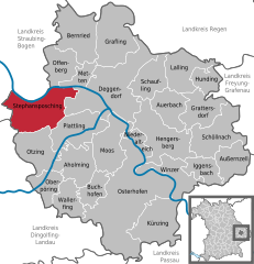
Metten (Metten)
- human settlement in Germany
Metten is a charming town in Bavaria, Germany, known for its beautiful landscapes and outdoor activities, including hiking. The town is surrounded by lush forests, rolling hills, and the Danube River, making it an ideal location for nature lovers and hikers of all skill levels.
Hiking Trails
Here are some popular hiking trails and areas around Metten:
-
Danube Cycling and Hiking Path: While primarily known for cycling, this path also offers great hiking opportunities alongside the Danube River. The scenic views of the river, combined with nearby forests and fields, make this a pleasant route for leisurely hikes.
-
Wanderwege (Hiking Trails): There are several marked trails in the surrounding area that range from easy to moderate difficulty. These trails often lead you through the local forest, where you can enjoy the flora and fauna native to Bavaria.
-
Floodplain Nature Reserve: The areas near the Danube include nature reserves that provide well-maintained paths. You may encounter diverse wildlife and plants, particularly in spring and summer.
Tips for Hiking in Metten
- Weather Preparedness: Bavarian weather can be unpredictable, so it's wise to check the forecast and dress in layers. Bring rain gear if necessary.
- Safety: Always stay on marked trails, and inform someone of your hiking plans.
- Footwear: Good hiking boots or shoes are essential, as many trails can be uneven or muddy, especially after rain.
- Hydration & Snacks: Carry enough water and snacks, especially for longer hikes. There might not be places to refill water on some trails.
Attractions & Amenities
After your hike, you can explore the town of Metten, which has a quaint atmosphere with local eateries and amenities for hikers. Some points of interest include:
- Metten Abbey: A historic Benedictine monastery worth visiting, known for its beautiful architecture and peaceful grounds.
- Local Cuisine: Enjoy traditional Bavarian dishes at local restaurants.
Hiking in Metten offers a wonderful opportunity to explore the natural beauty of Bavaria while enjoying a range of outdoor activities. Make sure to respect nature and leave no trace to help keep the area pristine for future hikers.
- Country:

- Postal Code: 94526
- Local Dialing Code: 0991
- Licence Plate Code: DEG
- Coordinates: 48° 52' 0" N, 12° 55' 0" E


- GPS tracks (wikiloc): [Link]
- AboveSeaLevel: 318 м m
- Area: 11.95 sq km
- Population: 4191
- Web site: http://www.markt-metten.de
- Wikipedia en: wiki(en)
- Wikipedia: wiki(de)
- Wikidata storage: Wikidata: Q505803
- Wikipedia Commons Category: [Link]
- Freebase ID: [/m/02q0_zf]
- GeoNames ID: Alt: [2871573]
- VIAF ID: Alt: [156046093]
- OSM relation ID: [959810]
- GND ID: Alt: [4039016-0]
- archINFORM location ID: [13548]
- Library of Congress authority ID: Alt: [n88155691]
- MusicBrainz area ID: [8ff14341-a4f2-461b-a9c6-2a785f8a810e]
- Bavarikon ID: [ODB_A00001445]
- German municipality key: 09271132
Shares border with regions:


Deggendorf
- town in Bavaria, Germany
Deggendorf, located in the picturesque Bavaria region of Germany, offers a variety of hiking opportunities that are appealing to both novice and experienced hikers. The area is known for its scenic landscapes, including rolling hills, lush forests, and stunning views of the Danube River and the surrounding Bavarian countryside....
- Country:

- Postal Code: 94469
- Local Dialing Code: 0991
- Licence Plate Code: DEG
- Coordinates: 48° 50' 41" N, 12° 57' 30" E


- GPS tracks (wikiloc): [Link]
- AboveSeaLevel: 323 м m
- Area: 77.21 sq km
- Population: 31757
- Web site: [Link]


Bernried
- municipality of Germany
Bernried, located in Bavaria, Germany, is an excellent destination for hiking enthusiasts. Nestled near the beautiful Starnberger See (Lake Starnberg), it offers a mix of picturesque landscapes, serene lakeshores, and forested hills. Here are some highlights to consider when hiking in Bernried:...
- Country:

- Postal Code: 94374; 94505
- Local Dialing Code: 09905
- Licence Plate Code: DEG
- Coordinates: 48° 55' 0" N, 12° 52' 0" E


- GPS tracks (wikiloc): [Link]
- AboveSeaLevel: 382 м m
- Area: 39.47 sq km
- Population: 4772
- Web site: [Link]


Stephansposching
- municipality of Germany
Stephansposching is a small village in Bavaria, Germany, located near the banks of the River Inn. While it may not be as well-known as some other hiking destinations in the region, its picturesque countryside, rolling hills, and proximity to nature trails make it a lovely spot for outdoor activities....
- Country:

- Postal Code: 94569
- Local Dialing Code: 09931; 09935
- Licence Plate Code: DEG
- Coordinates: 48° 49' 0" N, 12° 48' 0" E


- GPS tracks (wikiloc): [Link]
- AboveSeaLevel: 326 м m
- Area: 44.64 sq km
- Population: 3027
- Web site: [Link]


Offenberg
- municipality of Germany
Offenberg is a small town located in Bavaria, Germany, known for its beautiful landscapes and outdoor activities, including hiking. Here are some highlights about hiking in that area:...
- Country:

- Postal Code: 94560
- Local Dialing Code: 09906; 09962; 09905; 0991
- Licence Plate Code: DEG
- Coordinates: 48° 52' 0" N, 12° 52' 0" E


- GPS tracks (wikiloc): [Link]
- AboveSeaLevel: 346 м m
- Area: 23.76 sq km
- Population: 3258
- Web site: [Link]


Grafling
- municipality of Germany
Hiking in Grafling, located in Bavaria, Germany, offers a variety of scenic trails and beautiful landscapes, making it an excellent destination for outdoor enthusiasts. Here are some highlights and tips for hiking in the area:...
- Country:

- Postal Code: 94539
- Local Dialing Code: 0991
- Licence Plate Code: DEG
- Coordinates: 48° 53' 40" N, 12° 58' 30" E


- GPS tracks (wikiloc): [Link]
- AboveSeaLevel: 433 м m
- Area: 46.32 sq km
- Population: 2738
- Web site: [Link]

