Miagliano (Miagliano)
- Italian comune
 Hiking in Miagliano
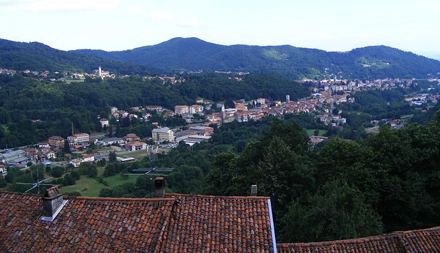
Miagliano is a charming village located in the Piedmont region of Italy, nestled in the lush hills of the Biella area. This region offers several beautiful hiking opportunities, characterized by picturesque landscapes, forested trails, and panoramic views of the surrounding mountains and valleys.
Hiking Trails and Routes
-
Monte Tovo: This is one of the most popular nearby peaks, offering panoramic views of the Biella region and distant Alps. The trail is moderately challenging and takes you through dense forests.
-
Sentiero dei Partigiani: This historical trail is dedicated to the Italian partisans from World War II. It provides an educational aspect to hiking, with various points of interest along the route. The trail typically offers moderate terrain suitable for most hikers.
-
Path of the River Elvo: This gentle trail follows the Elvo River and is ideal for families. It offers a more leisurely hike with beautiful natural scenery, great for experiencing the local flora and fauna.
-
Via dei Camosci: This is a circular route that offers hikers a chance to enjoy not only the rich biodiversity of the area but also the tranquility of the forests.
Tips for Hiking in Miagliano
-
Weather Considerations: The weather can vary, so check the forecast before heading out. It’s a good idea to hike during the warmer months (spring to early autumn) for the best experience.
-
Preparation: Ensure you’re wearing appropriate hiking footwear and carry enough water and snacks. A map or GPS device can be helpful, although many trails are well-marked.
-
Local Guidelines: Respect the local environment by staying on marked paths and following Leave No Trace principles. Be aware of local wildlife and the ecological significance of the area.
-
Safety: Always inform someone of your hiking plans, especially if you’re heading out alone. Familiarize yourself with the trail difficulties to choose one that matches your experience and fitness level.
Additional Activities
Aside from hiking, you can explore Miagliano's local culture, including small shops and eateries offering traditional cuisine. Be sure to indulge in local cheeses and wines, which are highlights of the region.
Whether you're an experienced hiker or a novice, Miagliano and its surroundings provide a splendid opportunity to experience the natural beauty of Italy!
- Country:

- Postal Code: 13816
- Local Dialing Code: 015
- Licence Plate Code: BI
- Coordinates: 45° 37' 7" N, 8° 2' 37" E


- GPS tracks (wikiloc): [Link]
- AboveSeaLevel: 520 м m
- Area: 0.67 sq km
- Population: 584
- Web site: http://www.comune.miagliano.bi.it
- Wikipedia en: wiki(en)
- Wikipedia: wiki(it)
- Wikidata storage: Wikidata: Q18085
- Wikipedia Commons Category: [Link]
- Freebase ID: [/m/0gr270]
- GeoNames ID: Alt: [3173476]
- VIAF ID: Alt: [245878553]
- OSM relation ID: [45507]
- TGN ID: [7056064]
- ISTAT ID: 096034
- Italian cadastre code: F189
Shares border with regions:

Andorno Micca
- Italian comune
Hiking in Andorno Micca
Andorno Micca is a charming town situated in the Piedmont region of Italy, specifically in the province of Biella. The area is known for its beautiful natural landscapes, which make it an excellent destination for hiking enthusiasts. Here are some highlights and tips for hiking in Andorno Micca:...
- Country:
- Postal Code: 13811
- Local Dialing Code: 015
- Licence Plate Code: BI
- Coordinates: 45° 36' 0" N, 8° 3' 0" E
- GPS tracks (wikiloc): [Link]
- AboveSeaLevel: 544 м m
- Area: 11.89 sq km
- Population: 3218
- Web site: [Link]
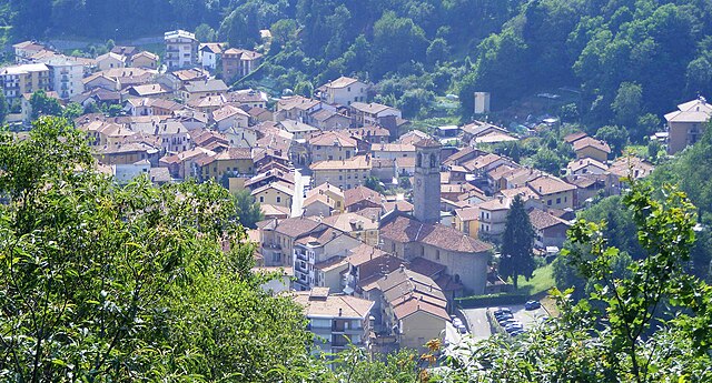
Sagliano Micca
- Italian comune
Hiking in Sagliano Micca
Sagliano Micca is a charming municipality located in the Biella region of Piedmont, Italy. It is nestled in the beautiful foothills of the Alps, making it an excellent destination for hiking enthusiasts. Here are some highlights and tips regarding hiking in and around Sagliano Micca:...
- Country:
- Postal Code: 13816
- Local Dialing Code: 015
- Licence Plate Code: BI
- Coordinates: 45° 37' 0" N, 8° 3' 0" E
- GPS tracks (wikiloc): [Link]
- AboveSeaLevel: 589 м m
- Area: 14.61 sq km
- Population: 1610
- Web site: [Link]
Tollegno
- Italian comune
Hiking in Tollegno
Tollegno is a charming village located in the Piedmont region of northern Italy, nestled in the foothills of the Biella Alps. Hiking in this area offers a fantastic opportunity to explore beautiful landscapes, rich biodiversity, and cultural heritage....
- Country:
- Postal Code: 13818
- Local Dialing Code: 015
- Licence Plate Code: BI
- Coordinates: 45° 35' 0" N, 8° 3' 0" E
- GPS tracks (wikiloc): [Link]
- AboveSeaLevel: 495 м m
- Area: 3.31 sq km
- Population: 2469
- Web site: [Link]