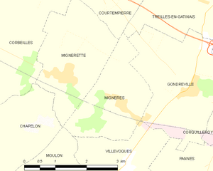
Mignerette (Mignerette)

- commune in Loiret, France
- Country:

- Postal Code: 45490
- Coordinates: 48° 3' 18" N, 2° 36' 2" E


- GPS tracks (wikiloc): [Link]
- Area: 6.21 sq km
- Population: 388
- Wikipedia en: wiki(en)
- Wikipedia: wiki(fr)
- Wikidata storage: Wikidata: Q1423700
- Wikipedia Commons Category: [Link]
- Freebase ID: [/m/03nwhps]
- GeoNames ID: Alt: [6434655]
- SIREN number: [214502072]
- BnF ID: [15260599q]
- INSEE municipality code: 45207
Shares border with regions:


Corbeilles
- commune in Loiret, France
- Country:
- Postal Code: 45490
- Coordinates: 48° 4' 20" N, 2° 32' 57" E
- GPS tracks (wikiloc): [Link]
- Area: 32.62 sq km
- Population: 1544
- Web site: [Link]

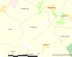
Chapelon
- commune in Loiret, France
- Country:
- Postal Code: 45270
- Coordinates: 48° 2' 13" N, 2° 34' 42" E
- GPS tracks (wikiloc): [Link]
- Area: 6.52 sq km
- Population: 268
Courtempierre
- commune in Loiret, France
- Country:
- Postal Code: 45490
- Coordinates: 48° 6' 11" N, 2° 36' 51" E
- GPS tracks (wikiloc): [Link]
- Area: 13.3 sq km
- Population: 236

Mignères
- commune in Loiret, France
- Country:
- Postal Code: 45490
- Coordinates: 48° 2' 47" N, 2° 37' 30" E
- GPS tracks (wikiloc): [Link]
- Area: 5.12 sq km
- Population: 314

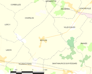
Moulon
- commune in Loiret, France
- Country:
- Postal Code: 45270
- Coordinates: 48° 1' 10" N, 2° 35' 28" E
- GPS tracks (wikiloc): [Link]
- Area: 9.4 sq km
- Population: 201