Milly (Milly)

- former commune in Manche, France
- Country:

- Postal Code: 50600
- Coordinates: 48° 36' 8" N, 1° 1' 12" E


- GPS tracks (wikiloc): [Link]
- Area: 9.65 sq km
- Population: 339
- Wikipedia en: wiki(en)
- Wikipedia: wiki(fr)
- Wikidata storage: Wikidata: Q1103514
- Wikipedia Commons Category: [Link]
- Freebase ID: [/m/03qcf8x]
- Freebase ID: [/m/03qcf8x]
- GeoNames ID: Alt: [6435482]
- GeoNames ID: Alt: [6435482]
- BnF ID: [152623044]
- BnF ID: [152623044]
- INSEE municipality code: 50329
- INSEE municipality code: 50329
Shares border with regions:

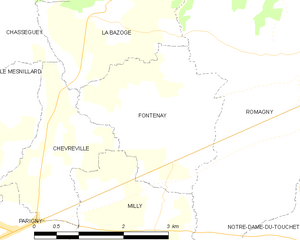
Fontenay
- former commune in Manche, France
- Country:
- Postal Code: 50140
- Coordinates: 48° 37' 42" N, 1° 1' 48" E
- GPS tracks (wikiloc): [Link]
- Area: 6.85 sq km
- Population: 314


Lapenty
- commune in Manche, France
- Country:
- Postal Code: 50600
- Coordinates: 48° 34' 45" N, 1° 0' 25" E
- GPS tracks (wikiloc): [Link]
- Area: 14.89 sq km
- Population: 387
- Web site: [Link]

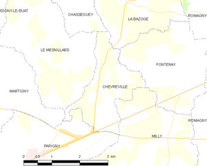
Chèvreville
- former commune in Manche, France
- Country:
- Postal Code: 50600
- Coordinates: 48° 36' 51" N, 1° 2' 50" E
- GPS tracks (wikiloc): [Link]
- Area: 4.45 sq km
- Population: 214

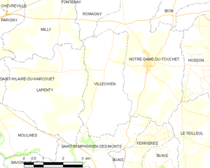
Villechien
- former commune in Manche, France
- Country:
- Postal Code: 50140
- Coordinates: 48° 34' 46" N, 0° 59' 11" E
- GPS tracks (wikiloc): [Link]
- Area: 10.83 sq km
- Population: 177