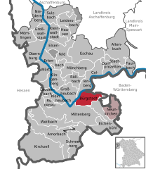
Miltenberg (Miltenberg)
- seat of Landkreis Miltenberg in Bavaria, Germany
Miltenberg is a picturesque town located in the Lower Franconia region of Bavaria, Germany. Surrounded by beautiful natural landscapes, it offers excellent hiking opportunities for outdoor enthusiasts of all levels. Here are some highlights and considerations for hiking in the Miltenberg area:
Scenic Trails
-
Main Hiking Trail (Mainwanderweg): This long-distance hiking trail follows the scenic Main River, providing stunning views and a chance to explore charming villages along the way. The trail is well-marked and includes varied terrains.
-
Odenwald Trails: The nearby Odenwald region offers numerous trails through forested areas, valleys, and hills. Popular routes include the Odenwald Panorama Trail, which offers beautiful vistas and a chance to see local flora and fauna.
-
Local Nature Trails: There are several shorter loops and nature trails around Miltenberg that allow for exploration of the area’s natural beauty without committing to a long hike. Trails like the “Miltenberger Rundweg” provide opportunities to experience the local countryside.
Key Points to Consider
-
Difficulty Levels: Trails range from easy walks suitable for families to more challenging hikes for experienced hikers. Always check the difficulty rating of the trails before heading out.
-
Seasonal Hiking: The best hiking seasons are spring through fall, when the weather is mild and the trails are accessible. However, winter can offer beautiful snowy landscapes if you enjoy winter hiking, albeit with the need for appropriate gear.
-
Local Attractions: While hiking, take the opportunity to explore Miltenberg itself, known for its medieval architecture, the historic Mildenburg castle, and charming timber-framed houses.
-
Preparation: Make sure to wear appropriate hiking shoes, bring enough water, and check the weather forecast. It’s also wise to have a map or GPS device handy for trail navigation.
Facilities
- Visitor Center: Consider stopping by the local tourist information center for maps and additional hiking resources.
- Restaurants and Cafés: After a day of hiking, you’ll find various restaurants and cafés in Miltenberg to relax and enjoy local Bavarian cuisine.
Conclusion
Hiking in Miltenberg allows you to immerse yourself in the stunning natural beauty of Bavaria while enjoying the rich cultural history of the area. Whether you’re a seasoned hiker or a casual walker, Miltenberg's trails offer something for everyone.
- Country:

- Postal Code: 63897
- Local Dialing Code: 09371
- Licence Plate Code: MIL
- Coordinates: 49° 42' 14" N, 9° 15' 52" E


- GPS tracks (wikiloc): [Link]
- AboveSeaLevel: 129 м m
- Area: 60.18 sq km
- Population: 9324
- Web site: http://www.stadt-miltenberg.de
- Wikipedia en: wiki(en)
- Wikipedia: wiki(de)
- Wikidata storage: Wikidata: Q502681
- Wikipedia Commons Category: [Link]
- Freebase ID: [/m/028dmw]
- GeoNames ID: Alt: [6558388]
- VIAF ID: Alt: [246483537]
- OSM relation ID: [393538]
- GND ID: Alt: [4039383-5]
- archINFORM location ID: [7476]
- Library of Congress authority ID: Alt: [n79055122]
- MusicBrainz area ID: [c7a00ccf-7937-4777-bf5a-07c565585976]
- WOEID: [675313]
- Bavarikon ID: [ODB_A00000408]
- German municipality key: 09676139
Shares border with regions:


Bürgstadt
- human settlement in Germany
Bürgstadt, located in the beautiful Bavarian region of Germany, offers a range of hiking opportunities amidst stunning landscapes. It's close to the Main River and surrounded by rolling hills, vineyards, and forests, making it a picturesque destination for outdoor enthusiasts....
- Country:

- Postal Code: 63927
- Local Dialing Code: 09371
- Licence Plate Code: MIL
- Coordinates: 49° 42' 49" N, 9° 16' 17" E


- GPS tracks (wikiloc): [Link]
- AboveSeaLevel: 150 м m
- Area: 17.38 sq km
- Population: 4284
- Web site: [Link]


Eichenbühl
- municipality of Germany
Eichenbühl is a quaint village located in the Bavaria region of Germany, surrounded by beautiful forests, meadows, and hills, making it a great destination for hiking enthusiasts. Here are some points of interest and considerations for hiking in Eichenbühl:...
- Country:

- Postal Code: 63928
- Local Dialing Code: 09371
- Licence Plate Code: MIL
- Coordinates: 49° 42' 20" N, 9° 19' 45" E


- GPS tracks (wikiloc): [Link]
- AboveSeaLevel: 158 м m
- Area: 31.24 sq km
- Population: 2545
- Web site: [Link]

