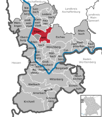
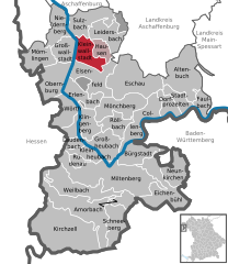
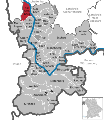
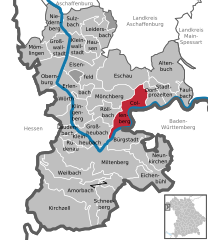
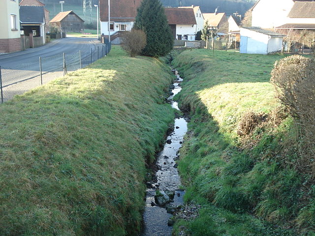
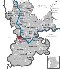
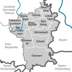
Miltenberg (Landkreis Miltenberg)

- district in Bavaria, Germany
 Hiking in Miltenberg
Miltenberg, located in the Bavaria region of Germany, is a charming town nestled along the Main River and surrounded by picturesque landscapes, making it an excellent destination for hiking enthusiasts. Here are some highlights about hiking in the Miltenberg district:
Trails and Routes
-
Main Loop Trail (Main-Radweg): This is a popular biking and hiking trail that runs along the Main River, offering scenic views and easy access to multiple points of interest in the region. It's a relatively flat trail, suitable for all skill levels.
-
The Odenwald Forest: Just to the east of Miltenberg, the Odenwald is a hiker's paradise with diverse trails that range from gentle walks to more challenging hikes. The area is rich in biodiversity, with lush forests, charming villages, and panoramic viewpoints.
-
Local Themed Trails: There are several themed hiking trails around Miltenberg, including educational trails that introduce hikers to the local flora and fauna, or historical trails that highlight the region’s cultural heritage, including charming vineyards and old towns.
Key Features
- Scenic Views: Many hiking routes offer spectacular views of the Main River, surrounding vineyards, and the rolling hills of the Odenwald.
- Cultural Sites: Along the trails, hikers can discover historical landmarks, such as medieval towns, rustic wine taverns, and ancient ruins.
- Wildlife: The region is home to diverse flora and fauna. As you hike, you may encounter a variety of birds and other wildlife native to the area.
Tips for Hiking in Miltenberg
- Preparation: While many trails are well-marked, having a local trail map or a smartphone with GPS can help navigate the area.
- Weather: Check the weather forecast before heading out, as conditions can change quickly, especially in forested areas.
- Timing: Spring and autumn are particularly beautiful seasons for hiking, showcasing vibrant foliage and pleasant temperatures.
- Local Cuisine: Consider stopping by local establishments to enjoy Bavarian cuisine and wines, especially the wines from the nearby Franconian wine region.
Conclusion
Whether you're a novice hiker or an experienced trekker, Miltenberg and its surroundings offer a fantastic range of hiking opportunities that combine natural beauty with cultural experiences. Enjoy your hiking adventure in this scenic part of Bavaria!
- Country:

- Capital: Miltenberg
- Licence Plate Code: MIL
- Coordinates: 49° 45' 0" N, 9° 15' 0" E


- GPS tracks (wikiloc): [Link]
- AboveSeaLevel: 224 м m
- Area: 716.00 sq km
- Population: 114255
- Web site: http://www.landkreis-miltenberg.de/
- Wikipedia en: wiki(en)
- Wikipedia: wiki(de)
- Wikidata storage: Wikidata: Q10472
- Wikipedia Commons Category: [Link]
- Freebase ID: [/m/02347j]
- GeoNames ID: Alt: [3220894]
- VIAF ID: Alt: [312806356]
- OSM relation ID: [62404]
- GND ID: Alt: [4039385-9]
- archINFORM location ID: [1339]
- Library of Congress authority ID: Alt: [n82095485]
- TGN ID: [7077077]
- Bavarikon ID: [ODB_A00000388]
- NUTS code: [DE269]
- German district key: 09676
Includes regions:

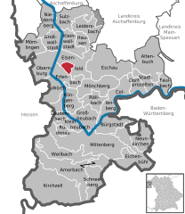
Forstwald
- unincorporated area in Germany
Hiking in Forstwald
Gemeindefreies Gebiet Forstwald is a nature area located in Germany, known for its beautiful landscapes and tranquil environment, making it an appealing spot for hiking enthusiasts. Here are some key details to consider for your hiking adventure there:...
- Country:
- Coordinates: 49° 49' 40" N, 9° 10' 45" E
- GPS tracks (wikiloc): [Link]

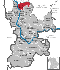
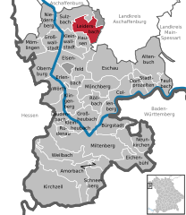
Sulzbach am Main
- human settlement in Germany
Hiking in Sulzbach am Main
Sulzbach am Main, located in Bavaria, Germany, offers a range of scenic hiking opportunities for outdoor enthusiasts. The region is characterized by diverse landscapes, including forests, hills, and river valleys, making it an ideal destination for nature lovers. Here are some features and trails you can explore in and around Sulzbach am Main:...
- Country:
- Postal Code: 63834
- Local Dialing Code: 06028
- Licence Plate Code: MIL
- Coordinates: 49° 54' 28" N, 9° 9' 24" E
- GPS tracks (wikiloc): [Link]
- AboveSeaLevel: 123 м m
- Area: 19.93 sq km
- Population: 7071
- Web site: [Link]

Hohe Wart
- unincorporated area in Germany
Hiking in Hohe Wart
Hohe Wart is a high point located in the rugged terrain of the Palatinate Forest in Germany. It's part of the larger Palatine region, which offers a wealth of hiking opportunities, scenic views, and diverse flora and fauna. Hiking in the area around Hohe Wart can be a fantastic experience for both seasoned hikers and beginners alike....
- Country:
- Coordinates: 49° 54' 0" N, 9° 15' 0" E
- GPS tracks (wikiloc): [Link]

Großwallstadt
- community in Bavaria, Germany
Hiking in Großwallstadt
Großwallstadt, a small town in Bavaria, Germany, is surrounded by beautiful landscapes and offers several hiking opportunities. The region is characterized by rolling hills, forests, and picturesque vineyards, making it an ideal spot for both casual walks and more challenging hikes....
- Country:
- Postal Code: 63868
- Local Dialing Code: 06022
- Licence Plate Code: MIL
- Coordinates: 49° 53' 0" N, 9° 10' 0" E
- GPS tracks (wikiloc): [Link]
- AboveSeaLevel: 121 м m
- Area: 14.03 sq km
- Population: 3345
- Web site: [Link]
Altenbuch
- municipality of Germany
Hiking in Altenbuch
Altenbuch is a charming village located in Bavaria, Germany, surrounded by beautiful landscapes that are ideal for hiking enthusiasts. The region features a mix of rolling hills, dense forests, and scenic countryside, providing a variety of trails for hikers of all skill levels....
- Country:
- Postal Code: 97901
- Local Dialing Code: 09392
- Licence Plate Code: MIL
- Coordinates: 49° 50' 0" N, 9° 25' 0" E
- GPS tracks (wikiloc): [Link]
- AboveSeaLevel: 240 м m
- Area: 37.64 sq km
- Population: 1242
- Web site: [Link]

Amorbach
- municipality of Germany
Hiking in Amorbach
Amorbach, located in the Odenwald region of Germany, is a charming town that offers several wonderful hiking opportunities. This area is characterized by its scenic landscapes, dense forests, and picturesque valleys, making it an attractive destination for hikers of all skill levels. Here are some highlights for hiking in Amorbach:...
- Country:
- Postal Code: 63916
- Local Dialing Code: 09373
- Licence Plate Code: MIL
- Coordinates: 49° 38' 0" N, 9° 13' 0" E
- GPS tracks (wikiloc): [Link]
- AboveSeaLevel: 165 м m
- Area: 50.92 sq km
- Population: 3984
- Web site: [Link]


Erlenbach am Main
- human settlement in Germany
Hiking in Erlenbach am Main
Erlenbach am Main is a charming small town in Bavaria, Germany, situated along the banks of the Main River. It's surrounded by picturesque landscapes, making it a lovely destination for hiking enthusiasts. Here are some highlights and tips for hiking in and around Erlenbach am Main:...
- Country:
- Postal Code: 63906
- Local Dialing Code: 09372
- Licence Plate Code: MIL
- Coordinates: 49° 48' 14" N, 9° 9' 50" E
- GPS tracks (wikiloc): [Link]
- AboveSeaLevel: 129 м m
- Area: 16.33 sq km
- Population: 9959
- Web site: [Link]

Bürgstadt
- human settlement in Germany
Hiking in Bürgstadt
Bürgstadt, located in the beautiful Bavarian region of Germany, offers a range of hiking opportunities amidst stunning landscapes. It's close to the Main River and surrounded by rolling hills, vineyards, and forests, making it a picturesque destination for outdoor enthusiasts....
- Country:
- Postal Code: 63927
- Local Dialing Code: 09371
- Licence Plate Code: MIL
- Coordinates: 49° 42' 49" N, 9° 16' 17" E
- GPS tracks (wikiloc): [Link]
- AboveSeaLevel: 150 м m
- Area: 17.38 sq km
- Population: 4284
- Web site: [Link]


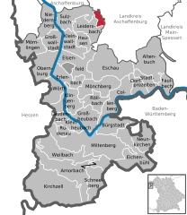
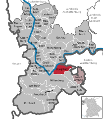
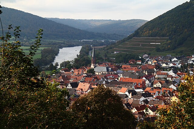
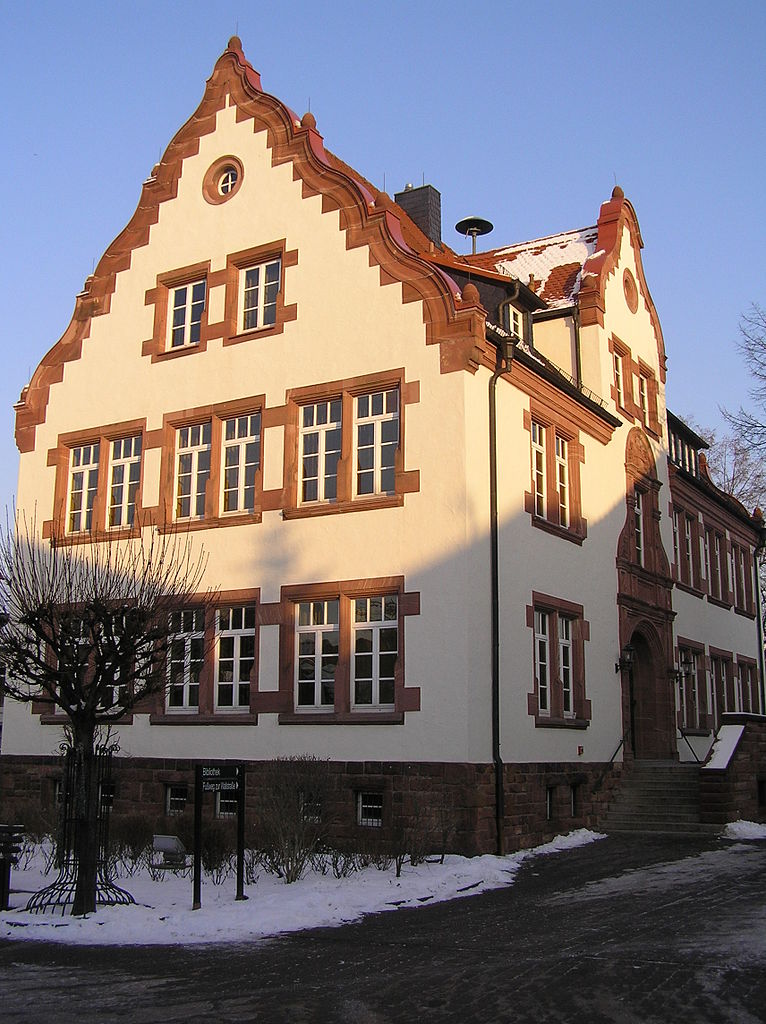
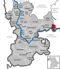
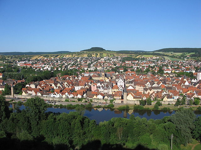
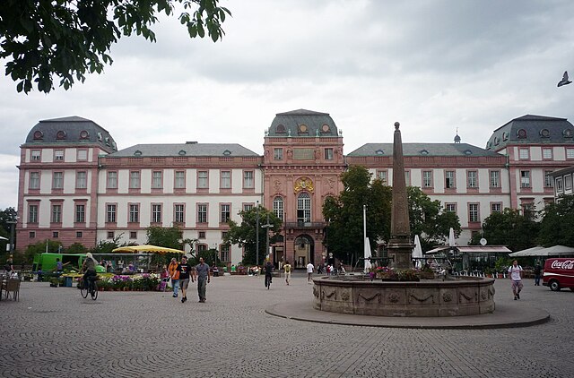
Miltenberg
- seat of Landkreis Miltenberg in Bavaria, Germany
Hiking in Miltenberg
Miltenberg is a picturesque town located in the Lower Franconia region of Bavaria, Germany. Surrounded by beautiful natural landscapes, it offers excellent hiking opportunities for outdoor enthusiasts of all levels. Here are some highlights and considerations for hiking in the Miltenberg area:...
- Country:
- Postal Code: 63897
- Local Dialing Code: 09371
- Licence Plate Code: MIL
- Coordinates: 49° 42' 14" N, 9° 15' 52" E
- GPS tracks (wikiloc): [Link]
- AboveSeaLevel: 129 м m
- Area: 60.18 sq km
- Population: 9324
- Web site: [Link]


Dorfprozelten
- municipality of Germany
Hiking in Dorfprozelten
Dorfprozelten is a charming village located in Bavaria, Germany, near the banks of the Main River. It's a lovely area for hiking, offering picturesque landscapes, tranquil paths, and a blend of natural beauty and cultural experiences. Here are some highlights of hiking in and around Dorfprozelten:...
- Country:
- Postal Code: 97904
- Local Dialing Code: 09392
- Licence Plate Code: MIL
- Coordinates: 49° 47' 0" N, 9° 23' 0" E
- GPS tracks (wikiloc): [Link]
- AboveSeaLevel: 141 м m
- Area: 10.39 sq km
- Population: 1741
- Web site: [Link]


Klingenberg am Main
- town in Bavaria, Germany
Hiking in Klingenberg am Main
Klingenberg am Main is a charming town located along the Main River in Bavaria, Germany, and offers beautiful hiking opportunities that cater to various skill levels. The landscape around Klingenberg is characterized by rolling hills, scenic vineyards, and picturesque views of the river. Here are some highlights for hikers in the area:...
- Country:
- Postal Code: 63911
- Local Dialing Code: 09372
- Licence Plate Code: MIL
- Coordinates: 49° 47' 0" N, 9° 11' 0" E
- GPS tracks (wikiloc): [Link]
- AboveSeaLevel: 128 м m
- Area: 21.12 sq km
- Population: 6112
- Web site: [Link]


Stadtprozelten
- human settlement in Germany
Hiking in Stadtprozelten
Stadtprozelten, a charming town located on the banks of the Main River in Bavaria, Germany, offers access to several scenic hiking trails that showcase the region's natural beauty. Here are some highlights of hiking in and around Stadtprozelten:...
- Country:
- Postal Code: 97909
- Local Dialing Code: 09392
- Licence Plate Code: MIL
- Coordinates: 49° 47' 7" N, 9° 24' 44" E
- GPS tracks (wikiloc): [Link]
- AboveSeaLevel: 134 м m
- Area: 10.84 sq km
- Population: 1504
- Web site: [Link]
Großheubach
- human settlement in Germany
Hiking in Großheubach
Großheubach is a charming village located in Bavaria, Germany, near the scenic Weinfranken region. It offers various hiking opportunities that showcase the beautiful landscapes of the region, including the hilly terrain, vineyards, and the majestic Main River....
- Country:
- Postal Code: 63920
- Local Dialing Code: 09371
- Licence Plate Code: MIL
- Coordinates: 49° 44' 0" N, 9° 14' 0" E
- GPS tracks (wikiloc): [Link]
- AboveSeaLevel: 132 м m
- Area: 19.00 sq km
- Population: 4596
- Web site: [Link]

Elsenfeld
- human settlement in Germany
Hiking in Elsenfeld
Elsenfeld is a charming town located in the Bavarian region of Germany, surrounded by picturesque landscapes, making it a great destination for hiking enthusiasts. Here are some highlights about hiking in and around Elsenfeld:...
- Country:
- Postal Code: 63820
- Local Dialing Code: 06022
- Licence Plate Code: MIL
- Coordinates: 49° 51' 0" N, 9° 10' 0" E
- GPS tracks (wikiloc): [Link]
- AboveSeaLevel: 123 м m
- Area: 24.37 sq km
- Population: 9015
- Web site: [Link]


Obernburg am Main
- human settlement in Germany
Hiking in Obernburg am Main
Obernburg, located in Bavaria, Germany, is a charming town that offers wonderful opportunities for hiking enthusiasts. Nestled near the banks of the Main River and surrounded by picturesque landscapes, Obernburg serves as a great starting point for various hiking trails. Here are some highlights for hikers:...
- Country:
- Postal Code: 63785
- Local Dialing Code: 06022
- Coordinates: 49° 50' 24" N, 9° 8' 29" E
- GPS tracks (wikiloc): [Link]
- AboveSeaLevel: 127 м m
- Area: 24.83 sq km
- Population: 8477
- Web site: [Link]


Eichenbühl
- municipality of Germany
Hiking in Eichenbühl
Eichenbühl is a quaint village located in the Bavaria region of Germany, surrounded by beautiful forests, meadows, and hills, making it a great destination for hiking enthusiasts. Here are some points of interest and considerations for hiking in Eichenbühl:...
- Country:
- Postal Code: 63928
- Local Dialing Code: 09371
- Licence Plate Code: MIL
- Coordinates: 49° 42' 20" N, 9° 19' 45" E
- GPS tracks (wikiloc): [Link]
- AboveSeaLevel: 158 м m
- Area: 31.24 sq km
- Population: 2545
- Web site: [Link]


Eschau
- human settlement in Germany
Hiking in Eschau
Eschau, located in the Alsace region of France, offers a variety of hiking opportunities that allow you to explore the beautiful landscapes, vineyards, and charming villages typical of the area. Here are some highlights and suggestions for hiking in and around Eschau:...
- Country:
- Postal Code: 63863
- Local Dialing Code: 09374
- Licence Plate Code: MIL
- Coordinates: 49° 49' 13" N, 9° 15' 26" E
- GPS tracks (wikiloc): [Link]
- AboveSeaLevel: 171 м m
- Area: 38.12 sq km
- Population: 3891
- Web site: [Link]
Kleinwallstadt
- human settlement in Germany
Hiking in Kleinwallstadt
Kleinwallstadt, located in Bavaria, Germany, is a charming small town that offers a variety of hiking opportunities amidst picturesque landscapes. The surrounding region is characterized by gentle hills, lush forests, and scenic trails that cater to hikers of all levels....
- Country:
- Postal Code: 63839
- Local Dialing Code: 06022
- Licence Plate Code: MIL
- Coordinates: 49° 52' 18" N, 9° 10' 4" E
- GPS tracks (wikiloc): [Link]
- AboveSeaLevel: 123 м m
- Area: 15.77 sq km
- Population: 4876
- Web site: [Link]


Rüdenau
- municipality of Germany
Hiking in Rüdenau
Rüdenau is a small municipality in Bavaria, Germany, that offers a variety of hiking opportunities in a beautiful natural setting. While the area may not be as widely known as some larger hiking destinations, it provides a tranquil environment for outdoor enthusiasts....
- Country:
- Postal Code: 63924
- Local Dialing Code: 09371
- Licence Plate Code: MIL
- Coordinates: 49° 43' 0" N, 9° 11' 0" E
- GPS tracks (wikiloc): [Link]
- AboveSeaLevel: 193 м m
- Area: 4.01 sq km
- Population: 793
- Web site: [Link]


Mömlingen
- municipality of Germany
Hiking in Mömlingen
Mömlingen is a charming village located in the Lower Franconia region of Bavaria, Germany. Its surrounding landscapes offer beautiful hiking opportunities, characterized by scenic woodlands, meadows, and the picturesque countryside typical of this region. Here are some key points to consider when planning a hike in Mömlingen:...
- Country:
- Postal Code: 63853
- Local Dialing Code: 06022
- Licence Plate Code: MIL
- Coordinates: 49° 51' 0" N, 9° 5' 0" E
- GPS tracks (wikiloc): [Link]
- AboveSeaLevel: 148 м m
- Area: 18.45 sq km
- Population: 4929
- Web site: [Link]

Niedernberg
- municipality of Germany
Hiking in Niedernberg
Niedernberg, located in Bavaria, Germany, is a small village that offers various outdoor activities, including hiking. Here are some key points to consider if you’re interested in hiking in and around Niedernberg:...
- Country:
- Postal Code: 63843
- Local Dialing Code: 06028
- Licence Plate Code: MIL
- Coordinates: 49° 55' 0" N, 9° 8' 0" E
- GPS tracks (wikiloc): [Link]
- AboveSeaLevel: 117 м m
- Area: 15.61 sq km
- Population: 4993
- Web site: [Link]


Mönchberg
- human settlement in Germany
Hiking in Mönchberg
Mönchberg, located in Bavaria, Germany, is a charming destination for hiking enthusiasts. The region offers a variety of trails that cater to different skill levels, making it suitable for both beginners and experienced hikers. Here are some highlights of hiking in Mönchberg:...
- Country:
- Postal Code: 63933
- Local Dialing Code: 09374
- Licence Plate Code: MIL
- Coordinates: 49° 46' 59" N, 9° 13' 59" E
- GPS tracks (wikiloc): [Link]
- AboveSeaLevel: 254 м m
- Area: 24.15 sq km
- Population: 2596
- Web site: [Link]

Collenberg
- town in Bavaria
Hiking in Collenberg
Collenberg is a charming village located in Bavaria, Germany, nestled along the banks of the Main River. It offers a variety of outdoor activities and serves as a great starting point for hiking enthusiasts looking to explore the surrounding natural beauty....
- Country:
- Postal Code: 97903
- Local Dialing Code: 09376
- Licence Plate Code: MIL
- Coordinates: 49° 46' 0" N, 9° 20' 0" E
- GPS tracks (wikiloc): [Link]
- AboveSeaLevel: 154 м m
- Area: 23.85 sq km
- Population: 2340
- Web site: [Link]


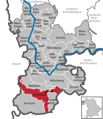
Kirchzell
- human settlement in Germany
Hiking in Kirchzell
Kirchzell is a charming village located in the Odenwald region of Germany, known for its beautiful landscapes and hiking opportunities. The area offers numerous trails that cater to both novice and experienced hikers. Here are some highlights for hiking in Kirchzell:...
- Country:
- Postal Code: 63931
- Local Dialing Code: 09373
- Licence Plate Code: MIL
- Coordinates: 49° 37' 0" N, 9° 11' 0" E
- GPS tracks (wikiloc): [Link]
- AboveSeaLevel: 192 м m
- Area: 63.86 sq km
- Population: 2382
- Web site: [Link]


Kleinheubach
- municipality in Landkreis Miltenberg, Bavaria, Germany
Hiking in Kleinheubach
Kleinheubach, a charming village located in Bavaria, Germany, offers a variety of hiking opportunities that cater to different skill levels and preferences. Nestled in the scenic landscape near the banks of the Main River and surrounded by lush forests and vineyards, Kleinheubach is an excellent starting point for hikers looking to explore the region....
- Country:
- Postal Code: 63924
- Local Dialing Code: 09371
- Licence Plate Code: MIL
- Coordinates: 49° 43' 22" N, 9° 12' 52" E
- GPS tracks (wikiloc): [Link]
- AboveSeaLevel: 128 м m
- Area: 9.49 sq km
- Population: 3657
- Web site: [Link]

Faulbach
- municipality of Germany
Hiking in Faulbach
Faulbach, located in Germany, offers a variety of hiking opportunities, especially for those who appreciate scenic landscapes and tranquil nature. While it may not be as widely known as some other hiking destinations, it has its own charm and appeal. Here are some points to consider when hiking in Faulbach:...
- Country:
- Postal Code: 97906
- Local Dialing Code: 09392
- Licence Plate Code: MIL
- Coordinates: 49° 47' 7" N, 9° 26' 39" E
- GPS tracks (wikiloc): [Link]
- AboveSeaLevel: 140 м m
- Area: 10.97 sq km
- Population: 2588
- Web site: [Link]
Schneeberg
- human settlement in Germany
Hiking in Schneeberg
Schneeberg, located in Bavaria, Germany, is a popular destination for hiking enthusiasts, offering a variety of trails that cater to different skill levels. Here are some key points to consider when exploring hiking in this region:...
- Country:
- Postal Code: 63936
- Local Dialing Code: 09373
- Licence Plate Code: MIL
- Coordinates: 49° 38' 22" N, 9° 14' 49" E
- GPS tracks (wikiloc): [Link]
- AboveSeaLevel: 168 м m
- Area: 16.60 sq km
- Population: 1785
- Web site: [Link]


Röllbach
- municipality of Germany
Hiking in Röllbach
Röllbach is a picturesque area located in Germany, known for its beautiful landscapes and hiking opportunities. While specific trails may vary, here are some general aspects to consider when hiking in Röllbach:...
- Country:
- Postal Code: 63934
- Local Dialing Code: 09372
- Licence Plate Code: MIL
- Coordinates: 49° 46' 23" N, 9° 14' 45" E
- GPS tracks (wikiloc): [Link]
- AboveSeaLevel: 219 м m
- Area: 12.42 sq km
- Population: 1279
- Web site: [Link]

Neunkirchen, Lower Franconia
- municipality of Germany
Hiking in Neunkirchen, Lower Franconia
Neunkirchen in Lower Franconia, Germany, offers a variety of hiking opportunities, showcasing the beautiful landscapes and natural features of the region. Here are some highlights:...
- Country:
- Postal Code: 63930
- Local Dialing Code: 09378
- Licence Plate Code: MIL
- Coordinates: 49° 42' 25" N, 9° 23' 58" E
- GPS tracks (wikiloc): [Link]
- AboveSeaLevel: 329 м m
- Area: 16.65 sq km
- Population: 1511
- Web site: [Link]

Leidersbach
- municipality of Germany
Hiking in Leidersbach
Leidersbach is a small town located in Bavaria, Germany, and it offers some great hiking opportunities in its scenic surroundings. While it may not be as widely known as larger hiking destinations, the area is characterized by beautiful landscapes, rolling hills, and forests that provide a peaceful environment for outdoor activities....
- Country:
- Postal Code: 63849
- Local Dialing Code: 06092; 06028
- Licence Plate Code: MIL
- Coordinates: 49° 54' 0" N, 9° 13' 0" E
- GPS tracks (wikiloc): [Link]
- AboveSeaLevel: 196 м m
- Area: 19.81 sq km
- Population: 4788
- Web site: [Link]


Weilbach
- municipality in Landkreis Miltenberg, Bavaria, Germany
Hiking in Weilbach
Weilbach, located in the state of Bavaria, Germany, is surrounded by picturesque landscapes and offers a variety of hiking opportunities. The region is characterized by its rolling hills, lush forests, and scenic trails, making it an attractive destination for both casual walkers and more experienced hikers....
- Country:
- Postal Code: 63937
- Local Dialing Code: 09373
- Licence Plate Code: MIL
- Coordinates: 49° 41' 0" N, 9° 12' 0" E
- GPS tracks (wikiloc): [Link]
- AboveSeaLevel: 152 м m
- Area: 27.28 sq km
- Population: 2200
- Web site: [Link]

Hausen
- place in Bavaria, Germany
Hiking in Hausen
Hausen, located in the Miltenberg district of Bavaria, Germany, offers a variety of hiking opportunities, particularly for those who enjoy scenic views, nature, and a bit of local culture. The surrounding landscapes are characterized by rolling hills, vineyards, and dense forests, making it ideal for both casual hikers and more experienced trekkers....
- Country:
- Postal Code: 63840
- Local Dialing Code: 06022
- Licence Plate Code: MIL
- Coordinates: 49° 52' 11" N, 9° 12' 37" E
- GPS tracks (wikiloc): [Link]
- AboveSeaLevel: 203 м m
- Area: 8.06 sq km
- Population: 1859
- Web site: [Link]

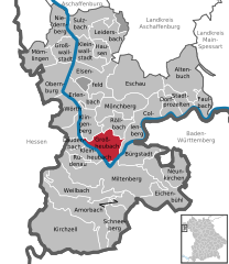
Laudenbach
- human settlement in Germany
Hiking in Laudenbach
Laudenbach, located in Bavaria, Germany, offers a picturesque setting for hiking enthusiasts. The area is characterized by its lush landscapes, rolling hills, and scenic views, making it an ideal destination for outdoor activities....
- Country:
- Postal Code: 63925
- Local Dialing Code: 09372
- Licence Plate Code: MIL
- Coordinates: 49° 44' 45" N, 9° 10' 34" E
- GPS tracks (wikiloc): [Link]
- AboveSeaLevel: 127 м m
- Area: 4.94 sq km
- Population: 1424
- Web site: [Link]

Wörth am Main
- municipality of Germany
Hiking in Wörth am Main
Wörth am Main is a charming town located in Bavaria, Germany, along the banks of the Main River. While it may not be a widely known hiking destination, it offers some scenic routes and nearby areas for outdoor enthusiasts. Here are some highlights and tips for hiking in and around Wörth am Main:...
- Country:
- Postal Code: 63939
- Local Dialing Code: 09372
- Licence Plate Code: MIL
- Coordinates: 49° 47' 47" N, 9° 9' 27" E
- GPS tracks (wikiloc): [Link]
- AboveSeaLevel: 126 м m
- Area: 15.89 sq km
- Population: 4699
- Web site: [Link]
Hohe Berg
- former unincorporated area in Germany
Hiking in Hohe Berg
Gemeindefreies Gebiet Hohe Berg is a beautiful area located in Germany, specifically within the state of Thuringia. It is part of the larger Thuringian Forest, known for its stunning landscapes, rich biodiversity, and excellent hiking trails. Here are some key points to consider when planning a hiking trip in this area:...
- Country:
- Coordinates: 49° 47' 20" N, 9° 11' 10" E
- GPS tracks (wikiloc): [Link]
Shares border with regions:
Main-Spessart
- district in Bavaria, Germany
Hiking in Main-Spessart
Main-Spessart is a beautiful region located in Bavaria, Germany, known for its scenic landscapes, charming villages, and rich cultural heritage. It's a fantastic destination for hiking enthusiasts, offering a variety of trails that cater to different skill levels. Here’s what you can expect when hiking in Main-Spessart:...
- Country:
- Capital: Karlstadt am Main
- Licence Plate Code: MSP
- Coordinates: 49° 55' 12" N, 9° 45' 0" E
- GPS tracks (wikiloc): [Link]
- AboveSeaLevel: 313 м m
- Area: 1321.4186 sq km
- Population: 125915
- Web site: [Link]


Aschaffenburg
- district in Bavaria, Germany
Hiking in Aschaffenburg
Aschaffenburg, located in Bavaria, Germany, is known for its beautiful landscapes and proximity to the Spessart mountain range, making it a great destination for hiking enthusiasts. The region offers a mix of nature, historic sites, and charming villages, providing a variety of hiking experiences....
- Country:
- Capital: Aschaffenburg
- Licence Plate Code: ALZ; AB
- Coordinates: 50° 4' 48" N, 9° 10' 12" E
- GPS tracks (wikiloc): [Link]
- AboveSeaLevel: 246 м m
- Area: 699.00 sq km
- Population: 152367
Aschaffenburg
- town in Bavaria, Germany
Hiking in Aschaffenburg
Aschaffenburg is a charming town located in Bavaria, Germany, and is surrounded by beautiful landscapes that offer great opportunities for hiking. The region is characterized by its mix of cultural heritage and natural beauty, making it an ideal destination for outdoor enthusiasts....
- Country:
- Postal Code: 63739–63743
- Local Dialing Code: 06021
- Licence Plate Code: AB
- Coordinates: 49° 58' 0" N, 9° 9' 0" E
- GPS tracks (wikiloc): [Link]
- AboveSeaLevel: 138 м m
- Area: 62.57 sq km
- Population: 68986
- Web site: [Link]

Darmstadt-Dieburg
- district in Hesse, Germany
Hiking in Darmstadt-Dieburg
Darmstadt-Dieburg is a lovely region in Hesse, Germany, known for its scenic landscapes, rich history, and a number of excellent hiking trails. Here are some highlights and tips for hiking in this area:...
- Country:
- Capital: Darmstadt
- Licence Plate Code: DI; DA
- Coordinates: 49° 53' 54" N, 8° 40' 32" E
- GPS tracks (wikiloc): [Link]
- AboveSeaLevel: 203 м m
- Area: 658.51 sq km
- Population: 284413
- Web site: [Link]

Odenwaldkreis
- district in Hesse, Germany
Hiking in Odenwaldkreis
Odenwaldkreis, located in the Odenwald mountain range in Germany, offers a variety of beautiful hiking opportunities. Known for its scenic landscapes, charming villages, and rich cultural heritage, it is a fantastic destination for nature enthusiasts and hikers....
- Country:
- Capital: Erbach
- Licence Plate Code: ERB
- Coordinates: 49° 39' 48" N, 8° 59' 38" E
- GPS tracks (wikiloc): [Link]
- AboveSeaLevel: 233 м m
- Area: 623.96 sq km
- Population: 96648
- Web site: [Link]


Neckar-Odenwald
- district of Baden-Württemberg, Germany
Hiking in Neckar-Odenwald
Neckar-Odenwald-Kreis, located in the state of Baden-Württemberg, Germany, is a fantastic destination for hiking enthusiasts. The region is characterized by its scenic landscapes, which include dense forests, rolling hills, and the beautiful Neckar River valley. Here are some key points to know about hiking in this area:...
- Country:
- Capital: Mosbach
- Licence Plate Code: MOS
- Coordinates: 49° 29' 0" N, 9° 17' 0" E
- GPS tracks (wikiloc): [Link]
- AboveSeaLevel: 416 м m
- Area: 1126.29 sq km
- Population: 141847
- Web site: [Link]


Main-Tauber
- district of Baden-Württemberg, Germany
Hiking in Main-Tauber
Main-Tauber-Kreis, located in the Baden-Württemberg state of Germany, is a beautiful region known for its stunning landscapes, historic towns, and rich cultural heritage, making it an excellent destination for hiking enthusiasts. Here are some key aspects of hiking in this picturesque area:...
- Country:
- Capital: Tauberbischofsheim
- Licence Plate Code: TBB
- Coordinates: 49° 34' 12" N, 9° 42' 36" E
- GPS tracks (wikiloc): [Link]
- AboveSeaLevel: 190 м m
- Area: 1304.41 sq km
- Population: 132181
- Web site: [Link]