Mionnay (Mionnay)
- commune in Ain, France
- Country:

- Postal Code: 01390
- Coordinates: 45° 53' 42" N, 4° 55' 47" E


- GPS tracks (wikiloc): [Link]
- Area: 19.62 sq km
- Population: 2138
- Web site: http://www.mionnay.fr
- Wikipedia en: wiki(en)
- Wikipedia: wiki(fr)
- Wikidata storage: Wikidata: Q274703
- Wikipedia Commons Category: [Link]
- Wikipedia Commons Maps Category: [Link]
- Freebase ID: [/m/0816nh]
- Freebase ID: [/m/0816nh]
- Freebase ID: [/m/0816nh]
- GeoNames ID: Alt: [6424593]
- GeoNames ID: Alt: [6424593]
- GeoNames ID: Alt: [6424593]
- SIREN number: [210102489]
- SIREN number: [210102489]
- SIREN number: [210102489]
- WOEID: [12666742]
- WOEID: [12666742]
- WOEID: [12666742]
- INSEE municipality code: 01248
- INSEE municipality code: 01248
- INSEE municipality code: 01248
Shares border with regions:


Cailloux-sur-Fontaines
- commune in the metropolis of Lyon, France
- Country:
- Postal Code: 69270
- Coordinates: 45° 51' 9" N, 4° 52' 29" E
- GPS tracks (wikiloc): [Link]
- Area: 8.69 sq km
- Population: 2598
- Web site: [Link]

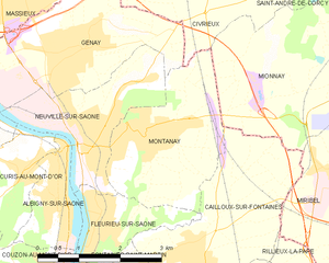
Montanay
- commune in the metropolis of Lyon, France
- Country:
- Postal Code: 69250
- Coordinates: 45° 52' 45" N, 4° 51' 47" E
- GPS tracks (wikiloc): [Link]
- Area: 7.16 sq km
- Population: 3089
- Web site: [Link]

Montluel
- commune in Ain, France
- Country:
- Postal Code: 01120
- Coordinates: 45° 51' 6" N, 5° 3' 23" E
- GPS tracks (wikiloc): [Link]
- Area: 40.11 sq km
- Population: 7032
- Web site: [Link]

Miribel
- commune in Ain, France
- Country:
- Postal Code: 01700
- Coordinates: 45° 49' 28" N, 4° 57' 11" E
- GPS tracks (wikiloc): [Link]
- AboveSeaLevel: 174 м m
- Area: 24.49 sq km
- Population: 9574
- Web site: [Link]

Civrieux
- commune in Ain, France
- Country:
- Postal Code: 01390
- Coordinates: 45° 55' 16" N, 4° 52' 51" E
- GPS tracks (wikiloc): [Link]
- Area: 19.76 sq km
- Population: 1546
- Web site: [Link]

Tramoyes
- commune in Ain, France
- Country:
- Postal Code: 01390
- Coordinates: 45° 52' 42" N, 4° 58' 5" E
- GPS tracks (wikiloc): [Link]
- Area: 12.93 sq km
- Population: 1674
- Web site: [Link]

Saint-André-de-Corcy
- commune in Ain, France
- Country:
- Postal Code: 01390
- Coordinates: 45° 55' 35" N, 4° 57' 8" E
- GPS tracks (wikiloc): [Link]
- Area: 20.73 sq km
- Population: 3129
- Web site: [Link]