Mirbel (Mirbel)

- commune in Haute-Marne, France
- Country:

- Postal Code: 52320
- Coordinates: 48° 17' 22" N, 5° 2' 37" E


- GPS tracks (wikiloc): [Link]
- Area: 6.08 sq km
- Population: 42
- Wikipedia en: wiki(en)
- Wikipedia: wiki(fr)
- Wikidata storage: Wikidata: Q614912
- Wikipedia Commons Category: [Link]
- Freebase ID: [/m/03ntvhh]
- Freebase ID: [/m/03ntvhh]
- GeoNames ID: Alt: [6436253]
- GeoNames ID: Alt: [6436253]
- SIREN number: [215202359]
- SIREN number: [215202359]
- BnF ID: [15263572d]
- BnF ID: [15263572d]
- INSEE municipality code: 52326
- INSEE municipality code: 52326
Shares border with regions:


Ambonville
- commune in Haute-Marne, France
- Country:
- Postal Code: 52110
- Coordinates: 48° 18' 43" N, 5° 0' 56" E
- GPS tracks (wikiloc): [Link]
- Area: 14.47 sq km
- Population: 76

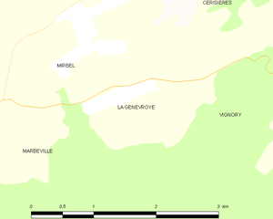
La Genevroye
- commune in Haute-Marne, France
- Country:
- Postal Code: 52320
- Coordinates: 48° 16' 43" N, 5° 3' 13" E
- GPS tracks (wikiloc): [Link]
- Area: 2.83 sq km
- Population: 30


Marbéville
- commune in Haute-Marne, France
- Country:
- Postal Code: 52320
- Coordinates: 48° 16' 35" N, 5° 1' 22" E
- GPS tracks (wikiloc): [Link]
- Area: 17.71 sq km
- Population: 99


Vignory
- commune in Haute-Marne, France
- Country:
- Postal Code: 52320
- Coordinates: 48° 16' 41" N, 5° 6' 11" E
- GPS tracks (wikiloc): [Link]
- Area: 19.46 sq km
- Population: 253
Cerisières
- commune in Haute-Marne, France
- Country:
- Postal Code: 52320
- Coordinates: 48° 18' 28" N, 5° 4' 49" E
- GPS tracks (wikiloc): [Link]
- AboveSeaLevel: 332 м m
- Area: 10.02 sq km
- Population: 81