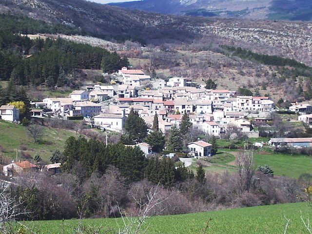
Mison (Mison)
- commune in Alpes-de-Haute-Provence, France
 Hiking in Mison
Mison, located in South Korea, is known for its beautiful landscapes and hiking opportunities, particularly in the vicinity of the Jiri Mountain range. While it may not be as widely recognized as some of the more famous hiking destinations in South Korea, it offers a unique experience for those looking to explore less crowded trails.
Popular Hiking Areas and Trails:
-
Jirisan National Park: This park is a significant highlight near Mison, with various trails catering to different skill levels. The trails vary from easy walks to challenging climbs, featuring diverse ecosystems, beautiful vistas, and historic temples along the way.
-
Mison Mountain (Misonbong): This is a relatively lesser-known peak that provides a great hiking experience and panoramic views of the surrounding areas. Trail conditions can vary, so it's best to check local resources for the latest information.
Tips for Hiking in Mison:
- Check Weather Conditions: The weather can change rapidly in mountainous areas, so it’s crucial to check forecasts and dress appropriately.
- Stay Hydrated: Always carry enough water, especially if you are planning on doing longer hikes.
- Trail Etiquette: Be mindful of trail rules and respect nature. Stay on marked paths to protect the environment.
- Prepare for Wildlife: While hiking, it's possible to encounter wildlife. Keep a safe distance, and be aware of your surroundings.
- Local Resources: Consider reaching out to local hiking clubs or guides for information and companionship during hikes.
Best Time to Hike:
The best months for hiking in Mison typically range from late spring to early autumn (May to October), when the weather is mild and the flora is in full bloom or showcasing beautiful autumn colors.
Exploring Mison's trails can be an enriching experience, combining the thrill of adventure with the beauty of nature. Always remember to practice safety while enjoying your hikes!
- Country:

- Postal Code: 04200
- Coordinates: 44° 16' 3" N, 5° 51' 33" E


- GPS tracks (wikiloc): [Link]
- Area: 31.72 sq km
- Population: 1106
- Web site: http://www.mairiedemison.fr
- Wikipedia en: wiki(en)
- Wikipedia: wiki(fr)
- Wikidata storage: Wikidata: Q936984
- Wikipedia Commons Category: [Link]
- Freebase ID: [/m/03m7wxp]
- Freebase ID: [/m/03m7wxp]
- GeoNames ID: Alt: [2993697]
- GeoNames ID: Alt: [2993697]
- SIREN number: [210401238]
- SIREN number: [210401238]
- INSEE municipality code: 04123
- INSEE municipality code: 04123
Shares border with regions:

Châteauneuf-de-Chabre
- former commune in Hautes-Alpes, France
Hiking in Châteauneuf-de-Chabre
Châteauneuf-de-Chabre, located in the Hautes-Alpes region of France, is a hidden gem for outdoor enthusiasts and hikers. The area boasts stunning natural landscapes, including rugged mountains, lush valleys, and picturesque villages, making it an excellent location for both casual walkers and experienced hikers....
- Country:
- Postal Code: 05300
- Coordinates: 44° 16' 58" N, 5° 49' 10" E
- GPS tracks (wikiloc): [Link]
- Area: 23.9 sq km
- Population: 368
Antonaves
- former commune in Hautes-Alpes, France
Hiking in Antonaves
Antonaves is a small commune located in southeastern France, in the region of Auvergne-Rhône-Alpes. While it may not be as well-known as some larger hiking destinations, it offers access to beautiful natural landscapes typical of the French countryside....
- Country:
- Postal Code: 05300
- Coordinates: 44° 15' 59" N, 5° 48' 17" E
- GPS tracks (wikiloc): [Link]
- Area: 8.03 sq km
- Population: 170

Laragne-Montéglin
- commune in Hautes-Alpes, France
Hiking in Laragne-Montéglin
Laragne-Montéglin is a charming commune located in the Hautes-Alpes department of southeastern France. It's surrounded by stunning natural landscapes, making it a great destination for hiking enthusiasts. Here are some highlights and tips for hiking in this area:...
- Country:
- Postal Code: 05300
- Coordinates: 44° 18' 54" N, 5° 49' 18" E
- GPS tracks (wikiloc): [Link]
- Area: 23.51 sq km
- Population: 3455
- Web site: [Link]

Upaix
- commune in Hautes-Alpes, France
Hiking in Upaix
It seems there might be a typo or misunderstanding surrounding the location "Upaix." If you're referring to hiking in a specific area or region with a similar name, please clarify....
- Country:
- Postal Code: 05300
- Coordinates: 44° 18' 50" N, 5° 53' 26" E
- GPS tracks (wikiloc): [Link]
- Area: 23.26 sq km
- Population: 456
Le Poët
- commune in Hautes-Alpes, France
Hiking in Le Poët
Le Poët is a charming commune in the Drôme department of southeastern France, nestled in the foothills of the Vercors Mountains. It offers a variety of hiking opportunities that showcase its beautiful landscapes, historical sites, and the rich natural environment....
- Country:
- Postal Code: 05300
- Coordinates: 44° 17' 35" N, 5° 53' 49" E
- GPS tracks (wikiloc): [Link]
- Area: 15.51 sq km
- Population: 771
- Web site: [Link]

Ribiers
- former commune in Hautes-Alpes, France
Hiking in Ribiers
Ribiers is a charming village located in the Hautes-Alpes department of southeastern France. It is situated near the beautiful mountains of the French Alps, making it an appealing destination for hikers of all levels. Here are some key points to consider if you're planning a hiking trip in and around Ribiers:...
- Country:
- Postal Code: 05300
- Coordinates: 44° 13' 52" N, 5° 51' 23" E
- GPS tracks (wikiloc): [Link]
- AboveSeaLevel: 972 м m
- Area: 36.55 sq km
- Population: 817
- Web site: [Link]

Sisteron
- commune in Alpes-de-Haute-Provence, France
Hiking in Sisteron
Sisteron, located in southeastern France, is a beautiful destination for hiking enthusiasts, offering a mix of majestic landscapes, historical sites, and diverse trails suitable for various skill levels. Nestled between the Alps and the Provençal landscape, the region is characterized by its stunning cliffs, gorges, and the renowned Durance River....
- Country:
- Postal Code: 04200
- Coordinates: 44° 11' 24" N, 5° 56' 47" E
- GPS tracks (wikiloc): [Link]
- AboveSeaLevel: 485 м m
- Area: 50.25 sq km
- Population: 7213
- Web site: [Link]