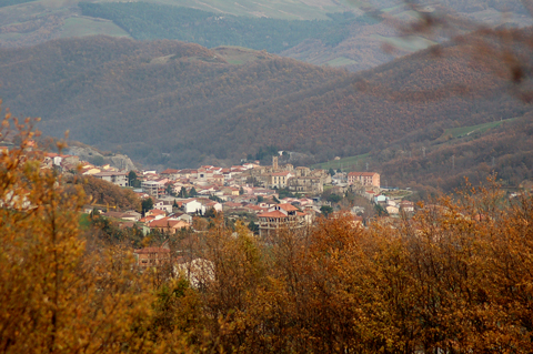
Molinara (Molinara)
.svg)
- Italian comune
 Hiking in Molinara
Molinara, a small town in the province of Benevento in the Campania region of Italy, offers beautiful hiking opportunities surrounded by picturesque landscapes, rolling hills, and scenic views. Here are some aspects to consider when hiking in and around Molinara:
Trails and Routes:
-
Local Trails: Explore various trails that lead through fields, vineyards, and olive groves. Many trails are well-marked and suitable for different skill levels, making it a great destination for both beginners and experienced hikers.
-
Monte Taburno: Just a short drive from Molinara, Monte Taburno is part of the Taburno-Camposauro Regional Park. It offers more challenging hiking options with rewarding panoramic views and diverse flora and fauna.
-
Cultural Routes: Some trails in the region may also lead to historical sites, ancient churches, and ruins, allowing hikers to enjoy both nature and cultural heritage.
Tips for Hiking in Molinara:
-
Seasonal Considerations: The best times to hike are during the spring and fall when temperatures are mild. Summers can be hot, and winters may bring rain, so check the weather before heading out.
-
Proper Gear: Wear sturdy hiking shoes and dress appropriately for the weather. A hat and sunscreen are also advisable during sunny days.
-
Stay Hydrated: Carry enough water, especially during warmer months, as some trails may not have easy access to water sources.
-
Maps and Guides: While some trails may be marked, bringing a map or a GPS device is a good idea to help navigate and explore more remote areas.
-
Local Regulations and Safety: Be aware of local regulations regarding camping, fires, and trail access. Always respect nature and pack out what you pack in.
Flora and Fauna:
The region around Molinara is home to a variety of plant and animal species, making it an excellent place for nature enthusiasts. Keep an eye out for local wildlife as you hike.
Local Culture and Cuisine:
After a day of hiking, consider exploring Molinara’s local cuisine. Enjoy traditional dishes made from fresh, local ingredients in the town’s restaurants or prepare a picnic with local produce.
Overall, hiking in Molinara can be a wonderful experience combining nature, culture, and stunning Italian scenery. Always plan ahead, and happy hiking!
- Country:

- Postal Code: 82020
- Local Dialing Code: 0824
- Licence Plate Code: BN
- Coordinates: 41° 18' 0" N, 14° 55' 0" E


- GPS tracks (wikiloc): [Link]
- AboveSeaLevel: 582 м m
- Area: 24.16 sq km
- Population: 1593
- Web site: http://www.comune.molinara.bn.it/
- Wikipedia en: wiki(en)
- Wikipedia: wiki(it)
- Wikidata storage: Wikidata: Q55921
- Wikipedia Commons Category: [Link]
- Freebase ID: [/m/0gn1vl]
- GeoNames ID: Alt: [6538746]
- VIAF ID: Alt: [246839782]
- OSM relation ID: [41228]
- GND ID: Alt: [7737842-8]
- ISTAT ID: 062041
- Italian cadastre code: F287
Shares border with regions:

Foiano di Val Fortore
- Italian comune
Hiking in Foiano di Val Fortore
Foiano di Val Fortore is a charming village located in the province of Benevento in the Campania region of Italy. Surrounded by the beautiful mountainous landscapes of the Apennine range, it offers various hiking opportunities for outdoor enthusiasts....
- Country:
- Postal Code: 82020
- Local Dialing Code: 0824
- Licence Plate Code: BN
- Coordinates: 41° 21' 0" N, 14° 59' 0" E
- GPS tracks (wikiloc): [Link]
- AboveSeaLevel: 520 м m
- Area: 41.31 sq km
- Population: 1403
- Web site: [Link]


San Giorgio La Molara
- Italian comune
Hiking in San Giorgio La Molara
San Giorgio La Molara is a charming town located in the province of Benevento, in the Campania region of southern Italy. It is surrounded by beautiful landscapes and offers several hiking opportunities. Here are some key points to consider when hiking in and around San Giorgio La Molara:...
- Country:
- Postal Code: 82020
- Local Dialing Code: 0824
- Licence Plate Code: BN
- Coordinates: 41° 16' 0" N, 14° 55' 0" E
- GPS tracks (wikiloc): [Link]
- AboveSeaLevel: 667 м m
- Area: 65.77 sq km
- Population: 2952
- Web site: [Link]


San Marco dei Cavoti
- Italian comune
Hiking in San Marco dei Cavoti
San Marco dei Cavoti is a charming town located in the Campania region of Italy, known for its picturesque landscapes and rich history. The surrounding area offers a variety of hiking opportunities for both casual walkers and seasoned hikers....
- Country:
- Postal Code: 82029
- Local Dialing Code: 0824
- Licence Plate Code: BN
- Coordinates: 41° 18' 39" N, 14° 52' 50" E
- GPS tracks (wikiloc): [Link]
- AboveSeaLevel: 695 м m
- Area: 49.19 sq km
- Population: 3295
- Web site: [Link]