Moncla (Moncla)

- commune in Pyrénées-Atlantiques, France
- Country:

- Postal Code: 64330
- Coordinates: 43° 34' 54" N, 0° 13' 59" E


- GPS tracks (wikiloc): [Link]
- Area: 5.83 sq km
- Population: 106
- Wikipedia en: wiki(en)
- Wikipedia: wiki(fr)
- Wikidata storage: Wikidata: Q857004
- Wikipedia Commons Category: [Link]
- Freebase ID: [/m/03qlycf]
- Freebase ID: [/m/03qlycf]
- GeoNames ID: Alt: [2993388]
- GeoNames ID: Alt: [2993388]
- SIREN number: [216403923]
- SIREN number: [216403923]
- BnF ID: [15270214w]
- BnF ID: [15270214w]
- INSEE municipality code: 64392
- INSEE municipality code: 64392
Shares border with regions:

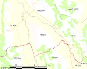
Verlus
- commune in Gers, France
- Country:
- Postal Code: 32400
- Coordinates: 43° 36' 8" N, 0° 11' 48" E
- GPS tracks (wikiloc): [Link]
- Area: 6.19 sq km
- Population: 93

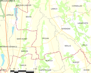
Projan
- commune in Gers, France
- Country:
- Postal Code: 32400
- Coordinates: 43° 35' 58" N, 0° 14' 14" E
- GPS tracks (wikiloc): [Link]
- Area: 11.78 sq km
- Population: 177
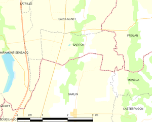
Sarron
- commune in Landes, France
- Country:
- Postal Code: 40800
- Coordinates: 43° 35' 31" N, 0° 16' 30" E
- GPS tracks (wikiloc): [Link]
- Area: 3.9 sq km
- Population: 113


Castetpugon
- commune in Pyrénées-Atlantiques, France
- Country:
- Postal Code: 64330
- Coordinates: 43° 33' 40" N, 0° 13' 48" E
- GPS tracks (wikiloc): [Link]
- Area: 7.49 sq km
- Population: 205
Portet
- commune in Pyrénées-Atlantiques, France
- Country:
- Postal Code: 64330
- Coordinates: 43° 34' 45" N, 0° 11' 13" E
- GPS tracks (wikiloc): [Link]
- Area: 7.89 sq km
- Population: 171


Garlin
- commune in Pyrénées-Atlantiques, France
- Country:
- Postal Code: 64330
- Coordinates: 43° 33' 33" N, 0° 16' 24" E
- GPS tracks (wikiloc): [Link]
- AboveSeaLevel: 200 м m
- Area: 18.3 sq km
- Population: 1405