Montailleur (Montailleur)
- commune in Savoie, France
Montailleur is a charming commune located in the Savoie department in the Auvergne-Rhône-Alpes region of southeastern France. It's situated in the foothills of the French Alps and offers a variety of hiking opportunities for outdoor enthusiasts.
Hiking Opportunities in Montailleur
-
Scenic Trails: The area around Montailleur features picturesque trails that provide stunning views of the surrounding mountains and valleys. You can expect diverse landscapes, including lush forests, alpine meadows, and panoramic vistas.
-
Difficulty Levels: There are routes suitable for all skill levels, from easy walks suitable for families to more challenging hikes for experienced trekkers. Always check trail conditions and difficulty ratings before starting a hike.
-
Local Flora and Fauna: As you hike, keep an eye out for the diverse flora and fauna of the region, including various plant species and wildlife that inhabit the area.
-
Access to Larger Trails: Montailleur serves as a great base for accessing larger hiking networks in the Savoie region, including trails leading into the Chartreuse or Vanoise National Parks.
-
Cultural and Historical Sites: Some trails may pass by local cultural and historical landmarks, giving hikers a chance to learn about the region's heritage while enjoying nature.
Tips for Hiking in Montailleur
- Map and Compass: Always carry a map or a GPS device, as trails can sometimes be unmarked or poorly signposted.
- Weather Preparedness: Check the weather forecast before heading out, and dress in layers to prepare for changing conditions typical in mountainous areas.
- Water and Snacks: Bring plenty of water and snacks, as facilities may be limited on some hiking trails.
- Leave No Trace: Follow Leave No Trace principles to protect the natural environment for future hikers.
Local Resources
- Tourist Information Center: The local tourist office can provide maps, hiking tips, and information on guided walks or group hikes.
- Hiking Groups: Joining a local hiking group can enhance your experience and provide opportunities to meet fellow enthusiasts.
Whether you are seeking tranquility or adventure, the hiking trails around Montailleur offer a wonderful way to explore the beauty of the French Alps. Enjoy your hike!
- Country:

- Postal Code: 73460
- Coordinates: 45° 37' 3" N, 6° 16' 45" E


- GPS tracks (wikiloc): [Link]
- Area: 15.3 sq km
- Population: 681
- Wikipedia en: wiki(en)
- Wikipedia: wiki(fr)
- Wikidata storage: Wikidata: Q661158
- Wikipedia Commons Category: [Link]
- Freebase ID: [/m/03npgsr]
- GeoNames ID: Alt: [6442825]
- SIREN number: [217301621]
- BnF ID: [152740954]
- Trismegistos Geo ID: [21616]
- INSEE municipality code: 73162
Shares border with regions:


Cléry
- commune in Savoie, France
Cléry, located in Savoie, is a beautiful area that offers a variety of hiking opportunities amidst stunning alpine scenery. The region is characterized by its picturesque landscapes, charming villages, and a rich tapestry of nature, making it an ideal destination for both novice and experienced hikers....
- Country:

- Postal Code: 73460
- Coordinates: 45° 38' 39" N, 6° 17' 35" E


- GPS tracks (wikiloc): [Link]
- Area: 10.9 sq km
- Population: 431
- Web site: [Link]


Grésy-sur-Isère
- commune in Savoie, France
Grésy-sur-Isère is a charming town located in the Savoie department of the Auvergne-Rhône-Alpes region in southeastern France. Surrounded by the stunning landscapes of the French Alps, it offers several hiking opportunities that cater to different skill levels and preferences....
- Country:

- Postal Code: 73460
- Coordinates: 45° 36' 4" N, 6° 15' 13" E


- GPS tracks (wikiloc): [Link]
- Area: 9.02 sq km
- Population: 1242
Saint-Vital
- commune in Savoie, France
Saint-Vital is a beautiful area located in the province of Manitoba, Canada, particularly known for its picturesque trails and natural beauty. While it may not be as widely recognized as some of the larger national parks, it offers various opportunities for hiking enthusiasts....
- Country:

- Postal Code: 73460
- Coordinates: 45° 37' 37" N, 6° 17' 53" E


- GPS tracks (wikiloc): [Link]
- Area: 3.6 sq km
- Population: 679
- Web site: [Link]


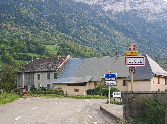
École, Savoie
- commune in Savoie, France
École in Savoie, located in the Auvergne-Rhône-Alpes region of France, offers a picturesque setting for hiking enthusiasts. Nestled in the heart of the French Alps, this area is known for its stunning natural landscapes, including mountains, valleys, and beautiful lakes. Here are some key points to consider if you're planning to hike around École:...
- Country:

- Postal Code: 73630
- Coordinates: 45° 39' 2" N, 6° 10' 3" E


- GPS tracks (wikiloc): [Link]
- Area: 29.65 sq km
- Population: 271


Aiton, Savoie
- commune in Savoie, France
Aiton, located in the Savoie department of the Auvergne-Rhône-Alpes region in southeastern France, offers a variety of hiking opportunities in a beautiful natural setting. Here’s an overview of what you can expect:...
- Country:

- Postal Code: 73220
- Coordinates: 45° 33' 40" N, 6° 15' 31" E


- GPS tracks (wikiloc): [Link]
- Area: 16.29 sq km
- Population: 1706


Sainte-Hélène-sur-Isère
- commune in Savoie, France
 Hiking in Sainte-Hélène-sur-Isère
Sainte-Hélène-sur-Isère is a charming commune located in the Auvergne-Rhône-Alpes region of France, nestled in the Isère department. Its picturesque surroundings make it an excellent destination for hiking enthusiasts. Here’s what you can expect when hiking in and around this lovely area:...
- Country:

- Postal Code: 73460
- Coordinates: 45° 36' 50" N, 6° 19' 15" E


- GPS tracks (wikiloc): [Link]
- Area: 14.43 sq km
- Population: 1185
- Web site: [Link]
