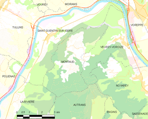
Montaud (Montaud)
- commune in Isère, France
Montaud, located in the Isère department in the Auvergne-Rhône-Alpes region of France, is a lesser-known gem for hiking enthusiasts. Nestled in the beautiful French Alps, it offers a combination of stunning landscapes, varied terrains, and a rich variety of flora and fauna.
Hiking Highlights in Montaud:
-
Scenic Trails: The area around Montaud features several hiking trails that cater to different difficulty levels, from easy walks suitable for families to more challenging routes for experienced hikers. The trails often weave through forests, meadows, and alongside streams, offering beautiful views of the surrounding mountains.
-
Natural Beauty: The region's natural beauty is remarkable, with views of the Vercors Massif and the Chartreuse mountains. In spring and summer, wildflowers paint the meadows in vibrant colors, while autumn offers a stunning display of foliage.
-
Wildlife Watching: Montaud's diverse habitats are home to a variety of wildlife. Keep an eye out for deer, chamois, and numerous bird species while hiking. Birdwatching can be particularly rewarding in the early morning or late afternoon.
-
Cultural Heritage: Along the hikes, you may encounter local farms, traditional alpine chalets, and historical monuments. This adds a cultural dimension to your outdoor experience.
-
Access and Information: Montaud can be accessed by road, and it's advisable to check local maps and trail guides or use reliable hiking apps for navigation. The local tourist office can provide up-to-date information on trail conditions and recommendations.
-
Best Time to Hike: The best time for hiking in Montaud is from late spring to early autumn (May to October). However, if you’re equipped for winter hiking, the area can also be beautiful in the snowy months, offering opportunities for snowshoeing.
-
Local Regulations: As with any natural area, it’s essential to follow Leave No Trace principles, respect wildlife, and stay on marked trails to help preserve the environment.
Overall, hiking in Montaud offers a serene and picturesque experience for outdoor enthusiasts looking to explore the stunning landscapes of the Isère region. Always remember to check weather conditions before heading out and prepare accordingly!
- Country:

- Postal Code: 38210
- Coordinates: 45° 15' 46" N, 5° 33' 40" E


- GPS tracks (wikiloc): [Link]
- Area: 14.59 sq km
- Population: 537
- Web site: http://www.montaud.fr
- Wikipedia en: wiki(en)
- Wikipedia: wiki(fr)
- Wikidata storage: Wikidata: Q1068807
- Wikipedia Commons Category: [Link]
- Freebase ID: [/m/03nvk8x]
- GeoNames ID: Alt: [6433250]
- SIREN number: [213802481]
- BnF ID: [152580601]
- PACTOLS thesaurus ID: [pcrtlh5T9YOTsK]
- INSEE municipality code: 38248
Shares border with regions:


Saint-Quentin-sur-Isère
- commune in Isère, France
 Hiking in Saint-Quentin-sur-Isère
Saint-Quentin-sur-Isère, located in the Isère department of France, is surrounded by beautiful landscapes that are perfect for hiking enthusiasts. The region features a mix of rolling hills, forests, and views of the nearby Alps, making it a great destination for hiking....
- Country:

- Postal Code: 38210
- Coordinates: 45° 16' 45" N, 5° 32' 32" E


- GPS tracks (wikiloc): [Link]
- Area: 19.45 sq km
- Population: 1396
- Web site: [Link]


La Rivière
- commune in Isère, France
La Rivière is a beautiful commune located in the Isère department of the Auvergne-Rhône-Alpes region in southeastern France. The area is characterized by stunning natural landscapes, mountains, and rivers, making it an excellent destination for hiking enthusiasts....
- Country:

- Postal Code: 38210
- Coordinates: 45° 14' 13" N, 5° 30' 29" E


- GPS tracks (wikiloc): [Link]
- Area: 18.45 sq km
- Population: 770


Veurey-Voroize
- commune in Isère, France
Veurey-Voroize is a charming commune located near Grenoble in the Auvergne-Rhône-Alpes region of France. It is surrounded by scenic landscapes and mountains, making it an attractive destination for hiking enthusiasts....
- Country:

- Postal Code: 38113
- Coordinates: 45° 16' 20" N, 5° 36' 52" E


- GPS tracks (wikiloc): [Link]
- Area: 12.21 sq km
- Population: 1444
- Web site: [Link]


Autrans
- former commune in Isère, France
Autrans is a picturesque village located in the Vercors Regional Natural Park in France, renowned for its stunning landscapes and extensive network of hiking trails. The area is perfect for both casual walkers and seasoned hikers, offering a variety of routes catering to different skill levels and preferences....
- Country:

- Postal Code: 38880
- Coordinates: 45° 10' 30" N, 5° 32' 32" E


- GPS tracks (wikiloc): [Link]
- Area: 44.02 sq km
- Population: 1589
- Web site: [Link]
