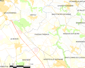
Montbert (Montbert)

- commune in Loire-Atlantique, France
- Country:

- Postal Code: 44140
- Coordinates: 47° 3' 28" N, 1° 29' 20" E


- GPS tracks (wikiloc): [Link]
- Area: 28.24 sq km
- Population: 3076
- Web site: http://www.mairie-de-montbert.fr
- Wikipedia en: wiki(en)
- Wikipedia: wiki(fr)
- Wikidata storage: Wikidata: Q1065262
- Wikipedia Commons Category: [Link]
- Freebase ID: [/m/03nwckr]
- Freebase ID: [/m/03nwckr]
- GeoNames ID: Alt: [2992925]
- GeoNames ID: Alt: [2992925]
- SIREN number: [214401028]
- SIREN number: [214401028]
- BnF ID: [15260271h]
- BnF ID: [15260271h]
- VIAF ID: Alt: [300108595]
- VIAF ID: Alt: [300108595]
- INSEE municipality code: 44102
- INSEE municipality code: 44102
Shares border with regions:

Château-Thébaud
- commune in Loire-Atlantique, France
- Country:
- Postal Code: 44690
- Coordinates: 47° 7' 30" N, 1° 25' 11" E
- GPS tracks (wikiloc): [Link]
- AboveSeaLevel: 60 м m
- Area: 17.64 sq km
- Population: 2983
- Web site: [Link]


Le Bignon
- commune in Loire-Atlantique, France
- Country:
- Postal Code: 44140
- Coordinates: 47° 5' 54" N, 1° 29' 26" E
- GPS tracks (wikiloc): [Link]
- AboveSeaLevel: 23 м m
- Area: 27.54 sq km
- Population: 3667

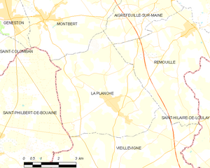
La Planche
- commune in Loire-Atlantique, France
- Country:
- Postal Code: 44140
- Coordinates: 47° 0' 59" N, 1° 26' 7" E
- GPS tracks (wikiloc): [Link]
- Area: 24.42 sq km
- Population: 2576
- Web site: [Link]
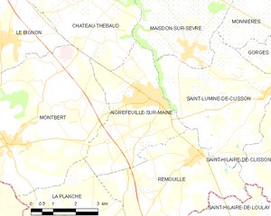
Aigrefeuille-sur-Maine
- commune in Loire-Atlantique, France
- Country:
- Postal Code: 44140
- Coordinates: 47° 4' 36" N, 1° 24' 2" E
- GPS tracks (wikiloc): [Link]
- Area: 14.58 sq km
- Population: 3700
- Web site: [Link]

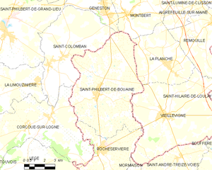
Saint-Philbert-de-Bouaine
- commune in Vendée, France
- Country:
- Postal Code: 85660
- Coordinates: 46° 59' 7" N, 1° 31' 15" E
- GPS tracks (wikiloc): [Link]
- Area: 50.16 sq km
- Population: 3326
- Web site: [Link]


Geneston
- commune in Loire-Atlantique, France
- Country:
- Postal Code: 44140
- Coordinates: 47° 3' 20" N, 1° 30' 46" E
- GPS tracks (wikiloc): [Link]
- AboveSeaLevel: 19 м m
- Area: 8.04 sq km
- Population: 3636
- Web site: [Link]