Montboucher (Montboucher)

- commune in Creuse, France
- Country:

- Postal Code: 23400
- Coordinates: 45° 57' 12" N, 1° 40' 51" E


- GPS tracks (wikiloc): [Link]
- Area: 27.68 sq km
- Population: 352
- Wikipedia en: wiki(en)
- Wikipedia: wiki(fr)
- Wikidata storage: Wikidata: Q179557
- Wikipedia Commons Category: [Link]
- Freebase ID: [/m/03mfjwm]
- Freebase ID: [/m/03mfjwm]
- GeoNames ID: Alt: [6429228]
- GeoNames ID: Alt: [6429228]
- SIREN number: [212313308]
- SIREN number: [212313308]
- BnF ID: [15251521t]
- BnF ID: [15251521t]
- INSEE municipality code: 23133
- INSEE municipality code: 23133
Shares border with regions:
Masbaraud-Mérignat
- commune in Creuse, France
- Country:
- Postal Code: 23400
- Coordinates: 45° 58' 33" N, 1° 44' 44" E
- GPS tracks (wikiloc): [Link]
- Area: 20.39 sq km
- Population: 342
Saint-Junien-la-Bregère
- commune in Creuse, France
- Country:
- Postal Code: 23400
- Coordinates: 45° 53' 2" N, 1° 45' 20" E
- GPS tracks (wikiloc): [Link]
- Area: 25.66 sq km
- Population: 137
Saint-Amand-Jartoudeix
- commune in Creuse, France
- Country:
- Postal Code: 23400
- Coordinates: 45° 54' 51" N, 1° 39' 31" E
- GPS tracks (wikiloc): [Link]
- Area: 18.74 sq km
- Population: 172

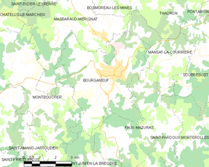
Bourganeuf
- commune in Creuse, France
- Country:
- Postal Code: 23400
- Coordinates: 45° 57' 13" N, 1° 45' 20" E
- GPS tracks (wikiloc): [Link]
- Area: 22.54 sq km
- Population: 2732


Châtelus-le-Marcheix
- commune in Creuse, France
- Country:
- Postal Code: 23430
- Coordinates: 45° 59' 58" N, 1° 36' 28" E
- GPS tracks (wikiloc): [Link]
- Area: 43.2 sq km
- Population: 342
Saint-Pierre-Chérignat
- commune in Creuse, France
- Country:
- Postal Code: 23430
- Coordinates: 45° 58' 22" N, 1° 36' 51" E
- GPS tracks (wikiloc): [Link]
- AboveSeaLevel: 421 м m
- Area: 23.72 sq km
- Population: 173