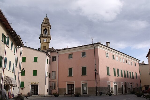
Montecatini Val di Cecina (Montecatini Val di Cecina)
.svg)
- Italian comune
 Hiking in Montecatini Val di Cecina
Montecatini Val di Cecina is a charming village located in the province of Pisa, Tuscany, Italy. It's a fantastic destination for hiking enthusiasts due to its stunning landscapes and rich natural and cultural heritage. Here are some highlights and tips for hiking in the area:
Scenic Trails
-
Hiking Trails: The region offers a variety of marked trails that cater to different levels of hiking experience. Trails often lead through olive groves, vineyards, hills, and offer breathtaking views of the surrounding countryside.
-
Volterra and the Surrounding Hills: Many trails connect to the ancient Etruscan town of Volterra. The route offers a mix of historical exploration and natural beauty, making it a perfect day hike.
-
Local Flora and Fauna: Hikers can enjoy diverse ecosystems, which include Mediterranean vegetation and opportunities to spot various wildlife such as deer, foxes, and a variety of bird species.
Cultural Attractions
-
Historical Sites: Along the hiking paths, you'll encounter historical ruins, old churches, and charming Tuscan farms, enriching your hiking experience with a taste of local history and culture.
-
Local Villages: Exploring nearby villages and towns like Saline di Volterra can enhance your hiking experience, offering chances for rest, local cuisine, and cultural immersion.
Practical Tips
-
Best Time to Hike: The ideal time for hiking in this region is during the spring and fall when the weather is mild and the landscapes are particularly beautiful.
-
Gear: Wear sturdy hiking boots and appropriate clothing for the weather. A good map or GPS device can help navigate the trails.
-
Water and Snacks: Ensure you carry enough water and some snacks, especially for longer hikes, as some trails may not have facilities nearby.
-
Guided Tours: If you’re unfamiliar with the area, consider joining a guided hiking tour for insights into the local ecology and history.
-
Respect Nature: Always follow local guidelines for trail use, stay on marked paths, and take your trash with you to preserve the beauty of the region.
Exploring the hiking trails around Montecatini Val di Cecina offers not only physical activity but also a unique opportunity to experience the serene beauty and cultural richness of Tuscany. Enjoy your hiking adventure!
- Country:

- Postal Code: 56040
- Local Dialing Code: 0588
- Licence Plate Code: PI
- Coordinates: 43° 23' 37" N, 10° 44' 59" E


- GPS tracks (wikiloc): [Link]
- AboveSeaLevel: 416 м m
- Area: 154.86 sq km
- Population: 1676
- Web site: http://www.comune.montecatini.pi.it
- Wikipedia en: wiki(en)
- Wikipedia: wiki(it)
- Wikidata storage: Wikidata: Q103127
- Wikipedia Commons Category: [Link]
- Freebase ID: [/m/09mdd6]
- GeoNames ID: Alt: [6542214]
- VIAF ID: Alt: [160056270]
- OSM relation ID: [42393]
- GND ID: Alt: [4756170-1]
- WOEID: [12677190]
- UN/LOCODE: [ITIMQ]
- NKCR AUT ID: [ge991403]
- ISTAT ID: 050019
- Italian cadastre code: F458
Shares border with regions:

Guardistallo
- Italian comune
Hiking in Guardistallo
Guardistallo is a charming hilltop village located in the Tuscany region of Italy. Nestled in the scenic countryside, it offers a range of hiking opportunities that showcase the beautiful landscapes and rich history of the area....
- Country:
- Postal Code: 56040
- Local Dialing Code: 0586
- Licence Plate Code: PI
- Coordinates: 43° 18' 49" N, 10° 38' 0" E
- GPS tracks (wikiloc): [Link]
- AboveSeaLevel: 278 м m
- Area: 23.61 sq km
- Population: 1226
- Web site: [Link]

Lajatico
- Italian comune
Hiking in Lajatico
Lajatico is a picturesque village located in the Tuscany region of Italy, known for its stunning landscapes, rolling hills, and rich cultural heritage. Hiking in and around Lajatico offers a wonderful opportunity to experience the natural beauty of the Tuscan countryside along with its historical sites....
- Country:
- Postal Code: 56030
- Local Dialing Code: 0587
- Licence Plate Code: PI
- Coordinates: 43° 28' 20" N, 10° 43' 46" E
- GPS tracks (wikiloc): [Link]
- AboveSeaLevel: 205 м m
- Area: 72.66 sq km
- Population: 1301
- Web site: [Link]

Montescudaio
- Italian comune
Hiking in Montescudaio
Montescudaio is a charming village located in the Tuscan region of Italy, surrounded by picturesque landscapes, vineyards, and rolling hills, making it an excellent destination for hiking enthusiasts. Here’s what you can expect when hiking in and around Montescudaio:...
- Country:
- Postal Code: 56040
- Local Dialing Code: 0586
- Licence Plate Code: PI
- Coordinates: 43° 20' 0" N, 10° 38' 0" E
- GPS tracks (wikiloc): [Link]
- AboveSeaLevel: 242 м m
- Area: 20.24 sq km
- Population: 2198
- Web site: [Link]

Monteverdi Marittimo
- Italian comune
Hiking in Monteverdi Marittimo
Monteverdi Marittimo is a picturesque village located in the heart of the Tuscan countryside, in Italy. It is surrounded by stunning landscapes, making it a great destination for hiking enthusiasts. Here are some highlights and tips for hiking in and around Monteverdi Marittimo:...
- Country:
- Postal Code: 56040
- Local Dialing Code: 0565
- Licence Plate Code: PI
- Coordinates: 43° 11' 0" N, 10° 43' 0" E
- GPS tracks (wikiloc): [Link]
- AboveSeaLevel: 364 м m
- Area: 98.09 sq km
- Population: 742
- Web site: [Link]
Pomarance
- Italian comune
Hiking in Pomarance
Pomarance, located in the Tuscany region of Italy, is an excellent destination for hiking enthusiasts due to its beautiful landscapes, rolling hills, and rich historical sites. Here are some key aspects of hiking in Pomarance:...
- Country:
- Postal Code: 56045
- Local Dialing Code: 0588
- Licence Plate Code: PI
- Coordinates: 43° 17' 59" N, 10° 52' 25" E
- GPS tracks (wikiloc): [Link]
- AboveSeaLevel: 370 м m
- Area: 227.71 sq km
- Population: 5708
- Web site: [Link]

Riparbella
- Italian comune
Hiking in Riparbella
Riparbella is a charming town in Tuscany, Italy, surrounded by beautiful landscapes that make it an excellent spot for hiking enthusiasts. Here are some highlights for hiking in and around Riparbella:...
- Country:
- Postal Code: 56046
- Local Dialing Code: 0586
- Licence Plate Code: PI
- Coordinates: 43° 22' 0" N, 10° 36' 0" E
- GPS tracks (wikiloc): [Link]
- AboveSeaLevel: 216 м m
- Area: 58.84 sq km
- Population: 1630
- Web site: [Link]

Volterra
- Italian comune
Hiking in Volterra
Volterra, located in the heart of Tuscany, Italy, is not only known for its rich history and medieval architecture but also offers some stunning hiking opportunities. Here are some highlights for hiking in and around Volterra:...
- Country:
- Postal Code: 56048
- Local Dialing Code: 0588
- Licence Plate Code: PI
- Coordinates: 43° 24' 0" N, 10° 52' 0" E
- GPS tracks (wikiloc): [Link]
- AboveSeaLevel: 531 м m
- Area: 252.85 sq km
- Population: 10290
- Web site: [Link]


Bibbona
- Italian comune
Hiking in Bibbona
Bibbona, located in the Tuscany region of Italy, is a charming destination for hiking enthusiasts. Here are some highlights and tips for hiking in and around Bibbona:...
- Country:
- Postal Code: 57020
- Local Dialing Code: 0586
- Licence Plate Code: LI
- Coordinates: 43° 16' 10" N, 10° 35' 40" E
- GPS tracks (wikiloc): [Link]
- AboveSeaLevel: 80 м m
- Area: 65.68 sq km
- Population: 3224
- Web site: [Link]