Montelupo Fiorentino (Montelupo Fiorentino)
.svg)
- Italian comune
 Hiking in Montelupo Fiorentino
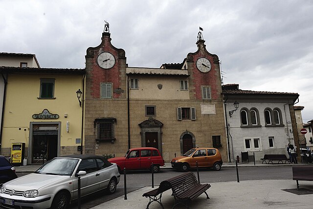
Montelupo Fiorentino, located in the Tuscany region of Italy, is a gem for outdoor enthusiasts and hikers. Nestled between Florence and Pisa, this town is well-known for its scenic landscapes, rich history, and local ceramics.
Hiking Opportunities:
-
Surrounding Landscapes:
- The area around Montelupo Fiorentino features rolling hills, vineyards, and olive groves, making it a picturesque setting for hiking. Trails often offer stunning views of Tuscany's iconic countryside.
-
Trail Networks:
- There are several well-marked trails that cater to different skill levels. You can find easy walks suitable for families, as well as more challenging routes for experienced hikers. Popular trails might take you through nearby natural reserves or along the banks of the Arno River.
-
Cultural and Historical Sites:
- While hiking, you can also explore historical landmarks such as the ruins of ancient castles, churches, and traditional Tuscan villas. Incorporating these sites into your hike can provide a richer cultural experience.
-
Nature Reserves:
- Look for trails that lead into nature reserves, where you can enjoy local flora and fauna. Birdwatching is a popular activity, and you might spot various species native to the region.
-
Guided Tours:
- If you're not familiar with the area, consider joining a guided hiking tour. Local guides can provide insights into the region's history, culture, and environment while ensuring you stay on the best paths.
Practical Tips:
- Best Time to Hike: Spring and autumn offer mild temperatures and beautiful scenery, making them ideal seasons for hiking. Summers can be hot, so if you choose to hike during this time, plan for early morning or later in the day.
- What to Bring: Always carry plenty of water, snacks, a good map or GPS device, sun protection, and comfortable hiking shoes.
- Local Cuisine: After your hike, treat yourself to local Tuscan dishes in Montelupo Fiorentino. Don’t miss the opportunity to taste some local wines or visit a nearby winery.
In summary, Montelupo Fiorentino provides a wonderful setting for hikers of all experience levels, offering a mix of natural beauty and cultural exploration.
- Country:

- Postal Code: 50056
- Local Dialing Code: 0571
- Licence Plate Code: FI
- Coordinates: 43° 44' 0" N, 11° 1' 0" E


- GPS tracks (wikiloc): [Link]
- AboveSeaLevel: 35 м m
- Area: 24.67 sq km
- Population: 14247
- Web site: http://www.comune.montelupo-fiorentino.fi.it/
- Wikipedia en: wiki(en)
- Wikipedia: wiki(it)
- Wikidata storage: Wikidata: Q82766
- Wikipedia Commons Gallery: [Link]
- Wikipedia Commons Category: [Link]
- Freebase ID: [/m/0glcnh]
- GeoNames ID: Alt: [6538563]
- VIAF ID: Alt: [153593736]
- OSM relation ID: [42586]
- archINFORM location ID: [45188]
- WOEID: [718885]
- TGN ID: [7006164]
- UN/LOCODE: [ITMPO]
- Digital Atlas of the Roman Empire ID: [42272]
- ISTAT ID: 048028
- Italian cadastre code: F551
Shares border with regions:


Carmignano
- Italian comune
Hiking in Carmignano
Carmignano is a charming town located in Tuscany, Italy, known for its stunning landscapes, rich history, and excellent wines, particularly Carmignano wine. Hiking in this area offers a unique combination of natural beauty and cultural heritage, making it an attractive destination for outdoor enthusiasts....
- Country:
- Postal Code: 59015
- Local Dialing Code: 055
- Licence Plate Code: PO
- Coordinates: 43° 48' 37" N, 11° 0' 54" E
- GPS tracks (wikiloc): [Link]
- AboveSeaLevel: 189 м m
- Area: 38.43 sq km
- Population: 14663
- Web site: [Link]

Empoli
- Italian comune
Hiking in Empoli
Empoli, located in the Tuscany region of Italy, is not only known for its rich history and culture but also offers a variety of hiking opportunities thanks to its beautiful landscapes, rolling hills, and proximity to the Arno River. Here are some details that can guide you if you're looking to hike in and around Empoli:...
- Country:
- Postal Code: 50053
- Local Dialing Code: 0571
- Licence Plate Code: FI
- Coordinates: 43° 43' 0" N, 10° 57' 0" E
- GPS tracks (wikiloc): [Link]
- AboveSeaLevel: 28 м m
- Area: 62.21 sq km
- Population: 48626
- Web site: [Link]

Capraia e Limite
- Italian comune
Hiking in Capraia e Limite
Capraia e Limite is a charming municipality located in the Tuscany region of Italy, nestled near the scenic banks of the Arno River, just a short distance from Florence and Prato. This area is rich in natural beauty and offers a variety of hiking opportunities that allow you to experience the stunning landscapes, historical sites, and local flora and fauna....
- Country:
- Postal Code: 50050
- Local Dialing Code: 0571
- Licence Plate Code: FI
- Coordinates: 43° 45' 0" N, 10° 59' 0" E
- GPS tracks (wikiloc): [Link]
- AboveSeaLevel: 28 м m
- Area: 24.92 sq km
- Population: 7782
- Web site: [Link]

Lastra a Signa
- Italian comune
Hiking in Lastra a Signa
Lastra a Signa, located in Tuscany, Italy, is surrounded by beautiful landscapes that make it a charming destination for hiking enthusiasts. The area features rolling hills, vineyards, olive groves, and the Arno River, offering picturesque views and a variety of trails for hikers of all levels. Here are some highlights and tips for hiking in and around Lastra a Signa:...
- Country:
- Postal Code: 50055
- Local Dialing Code: 055
- Licence Plate Code: FI
- Coordinates: 43° 46' 0" N, 11° 6' 0" E
- GPS tracks (wikiloc): [Link]
- AboveSeaLevel: 36 м m
- Area: 43.06 sq km
- Population: 20308
- Web site: [Link]
Montespertoli
- Italian comune
Hiking in Montespertoli
Montespertoli is a charming town located in the Tuscany region of Italy, known for its beautiful landscapes, vineyards, and rich cultural heritage. It's a fantastic destination for hiking enthusiasts, offering a variety of trails that cater to different skill levels....
- Country:
- Postal Code: 50025
- Local Dialing Code: 0571
- Licence Plate Code: FI
- Coordinates: 43° 39' 0" N, 11° 5' 0" E
- GPS tracks (wikiloc): [Link]
- AboveSeaLevel: 257 м m
- Area: 124.97 sq km
- Population: 13497
- Web site: [Link]