Monteprandone (Monteprandone)
.svg)
- Italian comune
 Hiking in Monteprandone
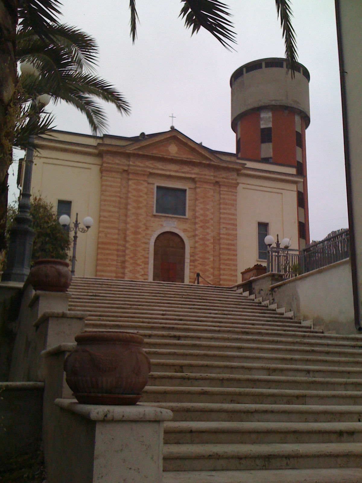
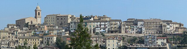
Monteprandone, located in the Marche region of Italy, is a charming hilltop town that offers some great opportunities for hiking enthusiasts. The area is characterized by its rolling hills, beautiful landscapes, and rich cultural heritage. Here are some key points to consider if you’re planning a hiking trip there:
Trails and Routes
-
Scenic Views: The hikes around Monteprandone often provide stunning views of the Adriatic Sea and the surrounding countryside. Some popular routes can take you through vineyards and olive groves.
-
Natural Parks: Consider exploring nearby natural parks, such as the Sibillini Mountains National Park to the west, which has more challenging trails with diverse wildlife and breathtaking vistas.
-
Local Trails: The area has various local trails ranging from easy walks to more challenging hikes. Look for routes that lead through the quaint villages and historical sites.
-
Cultural Routes: Some trails integrate visits to historical landmarks, churches, and quaint towns, giving you a sense of the region’s culture and history.
Best Times to Hike
- Spring (April to June): The weather is mild, and the flora is in bloom, making it an ideal time for hiking.
- Fall (September to October): Similar to spring, fall offers pleasant temperatures and beautiful autumn foliage.
Preparing for Your Hike
- Footwear: Ensure you have comfortable, sturdy hiking boots, especially if you plan on tackling uneven terrain.
- Weather: Check the weather forecast before heading out and dress in layers, as temperatures can fluctuate.
- Water and Snacks: Carry enough water and snacks, especially if you're planning a longer hike.
Local Tips
- Maps and Guidance: Consider getting a map of local hiking trails or hiring a local guide for the best experience.
- Respect Nature: Stay on marked trails to protect the local environment and be mindful of wildlife.
Overall, Monteprandone provides a wonderful setting for hiking that combines natural beauty with cultural exploration. Whether you are a seasoned hiker or a casual walker, there are options to suit every level.
- Country:

- Postal Code: 63076
- Local Dialing Code: 0735
- Licence Plate Code: AP
- Coordinates: 42° 55' 13" N, 13° 50' 8" E


- GPS tracks (wikiloc): [Link]
- AboveSeaLevel: 280 м m
- Area: 26.38 sq km
- Population: 12678
- Web site: http://www.comune.monteprandone.ap.it/
- Wikipedia en: wiki(en)
- Wikipedia: wiki(it)
- Wikidata storage: Wikidata: Q56083
- Wikipedia Commons Gallery: [Link]
- Wikipedia Commons Category: [Link]
- Freebase ID: [/m/0gl8d_]
- GeoNames ID: Alt: [6538540]
- VIAF ID: Alt: [141177422]
- OSM relation ID: [42217]
- UN/LOCODE: [ITMPE]
- Google Maps Customer ID: [10650562388279052821]
- ISTAT ID: 044045
- Italian cadastre code: F591
Shares border with regions:

San Benedetto del Tronto
- Italian comune
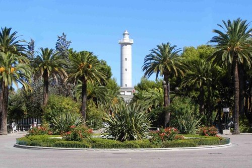
Hiking in San Benedetto del Tronto
San Benedetto del Tronto, located on the Adriatic coast in the Marche region of Italy, is well-known for its beautiful beaches, but it also offers some fantastic hiking opportunities in the surrounding areas. Here are some highlights and tips for hiking around this charming seaside town:...
- Country:
- Postal Code: 63074
- Local Dialing Code: 0735
- Licence Plate Code: AP
- Coordinates: 42° 56' 38" N, 13° 53' 0" E
- GPS tracks (wikiloc): [Link]
- AboveSeaLevel: 4 м m
- Area: 25.41 sq km
- Population: 47351
- Web site: [Link]

Colonnella
- Italian comune
Hiking in Colonnella
Colonnella is a charming small town located in the Abruzzo region of Italy, near the Adriatic coast. The area surrounding Colonnella offers a variety of hiking opportunities that showcase the beautiful landscapes of the Apennine Mountains and the coastal views of the Adriatic Sea. Here are some highlights for hiking in and around Colonnella:...
- Country:
- Postal Code: 64010
- Local Dialing Code: 0735; 0861
- Licence Plate Code: TE
- Coordinates: 42° 52' 20" N, 13° 52' 12" E
- GPS tracks (wikiloc): [Link]
- AboveSeaLevel: 303 м m
- Area: 21.63 sq km
- Population: 3744
- Web site: [Link]
Controguerra
- Italian comune
Hiking in Controguerra
Controguerra is a small town located in the Abruzzo region of Italy, nestled between the Apennine mountains and the Adriatic Sea. It offers a range of hiking opportunities, combining beautiful landscapes with cultural experiences....
- Country:
- Postal Code: 64010
- Local Dialing Code: 0861
- Licence Plate Code: TE
- Coordinates: 42° 51' 0" N, 13° 49' 0" E
- GPS tracks (wikiloc): [Link]
- AboveSeaLevel: 267 м m
- Area: 22.82 sq km
- Population: 2365
- Web site: [Link]

Martinsicuro
- Italian comune
Hiking in Martinsicuro
Martinsicuro, located along the Adriatic coast in the Abruzzo region of Italy, is primarily known for its beautiful beaches and coastal scenery. While it may not be as famous for hiking as some other regions of Italy, there are still opportunities for outdoor enthusiasts to explore the surrounding areas....
- Country:
- Postal Code: 64014
- Local Dialing Code: 0861
- Licence Plate Code: TE
- Coordinates: 42° 53' 6" N, 13° 54' 58" E
- GPS tracks (wikiloc): [Link]
- AboveSeaLevel: 2 м m
- Area: 14.66 sq km
- Population: 15992
- Web site: [Link]


Acquaviva Picena
- Italian comune
Hiking in Acquaviva Picena
Acquaviva Picena is a charming village in the Marche region of Italy, nestled in the rolling hills overlooking the Adriatic Sea. While it is often known for its history and beautiful architecture, it also offers some lovely hiking opportunities for outdoor enthusiasts....
- Country:
- Postal Code: 63075
- Local Dialing Code: 0735
- Licence Plate Code: AP
- Coordinates: 42° 56' 41" N, 13° 48' 49" E
- GPS tracks (wikiloc): [Link]
- AboveSeaLevel: 360 м m
- Area: 21.06 sq km
- Population: 3799
- Web site: [Link]

Monsampolo del Tronto
- Italian comune
Hiking in Monsampolo del Tronto
Monsampolo del Tronto, located in the Marche region of Italy, offers a blend of beautiful landscapes, historical sites, and a rich cultural experience for hikers. Here’s what to consider for hiking in this area:...
- Country:
- Postal Code: 63077
- Local Dialing Code: 0735
- Licence Plate Code: AP
- Coordinates: 42° 53' 52" N, 13° 47' 38" E
- GPS tracks (wikiloc): [Link]
- AboveSeaLevel: 184 м m
- Area: 15.43 sq km
- Population: 4547
- Web site: [Link]