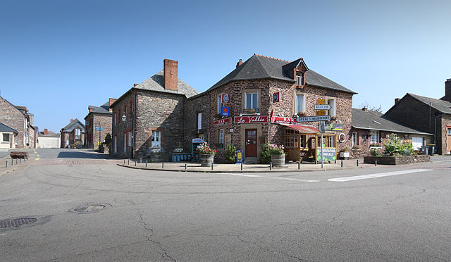
Monterfil (Monterfil)

- commune in Ille-et-Vilaine, France
- Country:

- Postal Code: 35160
- Coordinates: 48° 3' 57" N, 1° 58' 43" E


- GPS tracks (wikiloc): [Link]
- Area: 16.94 sq km
- Population: 1305
- Web site: http://www.monterfil.fr
- Wikipedia en: wiki(en)
- Wikipedia: wiki(fr)
- Wikidata storage: Wikidata: Q223088
- Wikipedia Commons Category: [Link]
- Freebase ID: [/m/03m9pyv]
- Freebase ID: [/m/03m9pyv]
- Freebase ID: [/m/03m9pyv]
- GeoNames ID: Alt: [2992669]
- GeoNames ID: Alt: [2992669]
- GeoNames ID: Alt: [2992669]
- SIREN number: [213501877]
- SIREN number: [213501877]
- SIREN number: [213501877]
- BnF ID: [152571304]
- BnF ID: [152571304]
- BnF ID: [152571304]
- VIAF ID: Alt: [247407624]
- VIAF ID: Alt: [247407624]
- VIAF ID: Alt: [247407624]
- OSM relation ID: [532480]
- OSM relation ID: [532480]
- OSM relation ID: [532480]
- MusicBrainz area ID: [850edf28-3360-44e9-b3dd-a7c1e3239236]
- MusicBrainz area ID: [850edf28-3360-44e9-b3dd-a7c1e3239236]
- MusicBrainz area ID: [850edf28-3360-44e9-b3dd-a7c1e3239236]
- INSEE municipality code: 35187
- INSEE municipality code: 35187
- INSEE municipality code: 35187
Shares border with regions:


Treffendel
- commune in Ille-et-Vilaine, France
- Country:
- Postal Code: 35380
- Coordinates: 48° 2' 24" N, 2° 0' 20" E
- GPS tracks (wikiloc): [Link]
- Area: 18.98 sq km
- Population: 1265
- Web site: [Link]


Saint-Péran
- commune in Ille-et-Vilaine, France
- Country:
- Postal Code: 35380
- Coordinates: 48° 3' 18" N, 2° 3' 22" E
- GPS tracks (wikiloc): [Link]
- Area: 9.37 sq km
- Population: 401
- Web site: [Link]


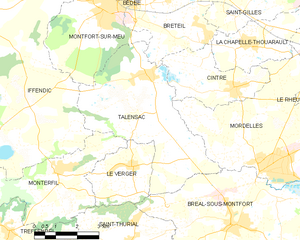
Le Verger
- commune in Ille-et-Vilaine, France
- Country:
- Postal Code: 35160
- Coordinates: 48° 4' 10" N, 1° 55' 59" E
- GPS tracks (wikiloc): [Link]
- Area: 6.87 sq km
- Population: 1445

Talensac
- commune in Ille-et-Vilaine, France
- Country:
- Postal Code: 35160
- Coordinates: 48° 6' 30" N, 1° 55' 42" E
- GPS tracks (wikiloc): [Link]
- Area: 21.61 sq km
- Population: 2486
- Web site: [Link]

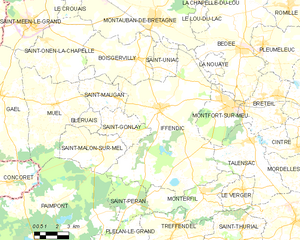
Iffendic
- commune in Ille-et-Vilaine, France
- Country:
- Postal Code: 35750
- Coordinates: 48° 7' 47" N, 2° 2' 5" E
- GPS tracks (wikiloc): [Link]
- Area: 73.66 sq km
- Population: 4456
- Web site: [Link]

Saint-Thurial
- commune in Ille-et-Vilaine, France
- Country:
- Postal Code: 35310
- Coordinates: 48° 1' 45" N, 1° 55' 54" E
- GPS tracks (wikiloc): [Link]
- Area: 18.01 sq km
- Population: 2084
- Web site: [Link]