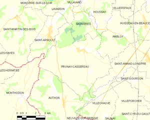
Monthodon (Monthodon)

- commune in Indre-et-Loire, France
- Country:

- Postal Code: 37110
- Coordinates: 47° 38' 59" N, 0° 50' 12" E


- GPS tracks (wikiloc): [Link]
- Area: 33.91 sq km
- Population: 606
- Web site: http://www.monthodon.fr/#
- Wikipedia en: wiki(en)
- Wikipedia: wiki(fr)
- Wikidata storage: Wikidata: Q1170782
- Wikipedia Commons Category: [Link]
- Freebase ID: [/m/03nvfc2]
- GeoNames ID: Alt: [6433058]
- SIREN number: [213701550]
- BnF ID: [15257706x]
- MusicBrainz area ID: [b980b002-46bf-4681-b87c-8f50c96a94eb]
- INSEE municipality code: 37155
Shares border with regions:


Authon
- commune in Loir-et-Cher, France
- Country:
- Postal Code: 41310
- Coordinates: 47° 38' 38" N, 0° 53' 49" E
- GPS tracks (wikiloc): [Link]
- Area: 32.26 sq km
- Population: 710
- Web site: [Link]

La Ferrière
- commune in Indre-et-Loire, France
- Country:
- Postal Code: 37110
- Coordinates: 47° 37' 42" N, 0° 44' 49" E
- GPS tracks (wikiloc): [Link]
- Area: 15.76 sq km
- Population: 305


Les Hermites
- commune in Indre-et-Loire, France
- Country:
- Postal Code: 37110
- Coordinates: 47° 39' 52" N, 0° 45' 10" E
- GPS tracks (wikiloc): [Link]
- Area: 32.6 sq km
- Population: 582
- Web site: [Link]


Saint-Martin-des-Bois
- commune in Loir-et-Cher, France
- Country:
- Postal Code: 41800
- Coordinates: 47° 43' 21" N, 0° 49' 38" E
- GPS tracks (wikiloc): [Link]
- Area: 36.4 sq km
- Population: 601

Prunay-Cassereau
- commune in Loir-et-Cher, France
- Country:
- Postal Code: 41310
- Coordinates: 47° 41' 43" N, 0° 55' 16" E
- GPS tracks (wikiloc): [Link]
- Area: 32.85 sq km
- Population: 623
- Web site: [Link]


Saint-Laurent-en-Gâtines
- commune in Indre-et-Loire, France
- Country:
- Postal Code: 37380
- Coordinates: 47° 35' 14" N, 0° 46' 38" E
- GPS tracks (wikiloc): [Link]
- Area: 31.62 sq km
- Population: 950
Saint-Arnoult
- commune in Loir-et-Cher, France
- Country:
- Postal Code: 41800
- Coordinates: 47° 42' 27" N, 0° 52' 22" E
- GPS tracks (wikiloc): [Link]
- Area: 9.57 sq km
- Population: 318


Le Boulay
- commune in Indre-et-Loire, France
- Country:
- Postal Code: 37110
- Coordinates: 47° 36' 21" N, 0° 51' 28" E
- GPS tracks (wikiloc): [Link]
- Area: 20.1 sq km
- Population: 818
- Web site: [Link]