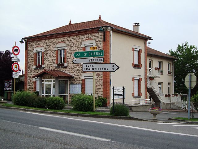
Montrond-les-Bains (Montrond-les-Bains)

- commune in Loire, France
- Country:

- Postal Code: 42210
- Coordinates: 45° 38' 37" N, 4° 13' 50" E


- GPS tracks (wikiloc): [Link]
- Area: 10.11 sq km
- Population: 5290
- Web site: http://www.montrond-les-bains.fr/
- Wikipedia en: wiki(en)
- Wikipedia: wiki(fr)
- Wikidata storage: Wikidata: Q1116307
- Wikipedia Commons Category: [Link]
- Freebase ID: [/m/03nw9tm]
- Freebase ID: [/m/03nw9tm]
- GeoNames ID: Alt: [6434205]
- GeoNames ID: Alt: [6434205]
- SIREN number: [214201493]
- SIREN number: [214201493]
- BnF ID: [152597172]
- BnF ID: [152597172]
- VIAF ID: Alt: [304890312]
- VIAF ID: Alt: [304890312]
- PACTOLS thesaurus ID: [pcrt76d1F9ZHnZ]
- PACTOLS thesaurus ID: [pcrt76d1F9ZHnZ]
- MusicBrainz area ID: [e116a2d0-3a0f-4001-99d2-09b1e51bca34]
- MusicBrainz area ID: [e116a2d0-3a0f-4001-99d2-09b1e51bca34]
- INSEE municipality code: 42149
- INSEE municipality code: 42149
Shares border with regions:


Chalain-le-Comtal
- commune in Loire, France
- Country:
- Postal Code: 42600
- Coordinates: 45° 38' 43" N, 4° 10' 12" E
- GPS tracks (wikiloc): [Link]
- Area: 18.36 sq km
- Population: 710

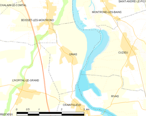
Unias
- commune in Loire, France
- Country:
- Postal Code: 42210
- Coordinates: 45° 36' 18" N, 4° 13' 39" E
- GPS tracks (wikiloc): [Link]
- Area: 5.37 sq km
- Population: 436

Cuzieu
- commune in Loire, France
- Country:
- Postal Code: 42330
- Coordinates: 45° 36' 33" N, 4° 15' 41" E
- GPS tracks (wikiloc): [Link]
- Area: 11.51 sq km
- Population: 1494

Marclopt
- commune in Loire, France
- Country:
- Postal Code: 42210
- Coordinates: 45° 39' 54" N, 4° 12' 34" E
- GPS tracks (wikiloc): [Link]
- Area: 8.43 sq km
- Population: 505

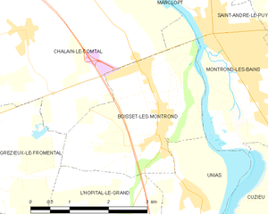
Boisset-lès-Montrond
- commune in Loire, France
- Country:
- Postal Code: 42210
- Coordinates: 45° 37' 16" N, 4° 12' 45" E
- GPS tracks (wikiloc): [Link]
- Area: 8.01 sq km
- Population: 1149


Saint-André-le-Puy
- commune in Loire, France
- Country:
- Postal Code: 42210
- Coordinates: 45° 38' 44" N, 4° 15' 36" E
- GPS tracks (wikiloc): [Link]
- Area: 8.66 sq km
- Population: 1524
- Web site: [Link]