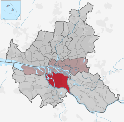
Moorburg (Moorburg)

- suburb in the district Harburg, Germany
 Hiking in Moorburg
Moorburg is a district located in Hamburg, Germany. While it is predominantly an urban area, it offers access to some scenic routes and green spaces suitable for hiking or walking. Here are some aspects to consider if you’re planning a hiking experience around Moorburg and its surroundings:
Local Environment
- Nature Reserves: Nearby natural reserves and parks can provide a good escape for hiking. Places like the Harburger Berge, located south of Moorburg, feature wooded areas and trails.
- Waterways: The Elbe River runs near Moorburg and offers beautiful walking paths along its banks. These trails provide opportunities for both short walks and extended hikes.
Hiking Trails
- Easy Trails: There are numerous easy trails suitable for beginners, perfect for a leisurely hike with family. These can often be found along riverbanks or in local parks.
- Scenic Routes: For a more adventurous experience, you can venture towards the outskirts of Hamburg where you may find longer hiking trails. The Hamburg Trails network includes several scenic routes.
Tips for Hiking in Moorburg
- Check Maps and Guides: Use local maps or online hiking guides to plot your route. Websites like Komoot can provide trail information.
- Proper Gear: Wear appropriate footwear and pack essentials such as water, snacks, a first aid kit, and a phone for navigation.
- Respect Nature: Make sure to follow the principles of Leave No Trace to preserve the natural beauty of the area.
- Weather Conditions: Always check the weather before heading out, as conditions can change rapidly.
Nearby Opportunities
- Harburg Hills (Harburger Berge): Further afield, this area provides a more rugged hiking experience with larger elevation changes and forested paths.
- State Parks: Consider visiting larger parks like Wildpark Schwarze Berge nearby for hiking and wildlife experiences.
While Moorburg itself may not be a hiking hub, its proximity to various natural areas makes it a good starting point for exploring nature in and around Hamburg. Enjoy your hiking adventure!
- Country:

- Postal Code: 21079
- Coordinates: 53° 29' 21" N, 9° 56' 37" E


- GPS tracks (wikiloc): [Link]
- AboveSeaLevel: 5 м m
- Area: 10.0 sq km
- Population: 739
- Wikipedia en: wiki(en)
- Wikipedia: wiki(de)
- Wikidata storage: Wikidata: Q3512
- Wikipedia Commons Gallery: [Link]
- Wikipedia Commons Category: [Link]
- Wikipedia Commons Maps Category: [Link]
Shares border with regions:

Wilhelmsburg
- quarter of the German city of Hamburg
Hiking in Wilhelmsburg
Wilhelmsburg, a district in Hamburg, Germany, is known for its unique blend of nature and urban life. While it may not be a traditional hiking destination like the Alps or national parks, there are still several opportunities for outdoor adventures and exploring scenic routes....
- Country:
- Coordinates: 53° 29' 42" N, 10° 0' 40" E
- GPS tracks (wikiloc): [Link]
- AboveSeaLevel: -2 м m
- Area: 35.3 sq km


Altenwerder
- quarter in the Harburg borough of the Free and Hanseatic city of Hamburg in northern Germany
Hiking in Altenwerder
Altenwerder, a quarter in Hamburg, Germany, isn't typically known as a hiking destination, but there are still outdoor spaces that can provide a pleasant experience for walkers and nature enthusiasts. While the area itself may not have designated hiking trails like more rural locations, there are opportunities for both casual walking and exploring nearby parks or natural environments....
- Country:
- Coordinates: 53° 30' 25" N, 9° 55' 4" E
- GPS tracks (wikiloc): [Link]
- AboveSeaLevel: 3 м m
- Area: 6.8 sq km
- Population: 3
- Web site: [Link]


Francop
- quarter in the Harburg borough, Hamburg, Germany
Hiking in Francop
It seems there might be a misunderstanding regarding the name "Francop." There’s no widely recognized hiking destination or region by that name in popular hiking resources. However, it’s possible you could be referring to a specific locality not well-documented or known by a different name....
- Country:
- Local Dialing Code: 040
- Coordinates: 53° 30' 29" N, 9° 51' 10" E
- GPS tracks (wikiloc): [Link]
- AboveSeaLevel: -2 м m
- Area: 9.1 sq km


Heimfeld
- district of Hamburg, Germany
Hiking in Heimfeld
Hamburg-Heimfeld is a suburban area in the city of Hamburg, Germany, and while it may not be as renowned for hiking as some mountainous regions, it does offer some pleasant options for outdoor enthusiasts. Here are a few highlights for hiking in and around Hamburg-Heimfeld:...
- Country:
- Coordinates: 53° 27' 50" N, 9° 57' 22" E
- GPS tracks (wikiloc): [Link]
- Area: 11.7 sq km
- Population: 21798