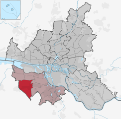
Harburg (Bezirk Harburg)

- borough of the city of Hamburg, Germany
 Hiking in Harburg
Harburg, a district located in the southern part of Hamburg, offers a blend of urban and natural landscapes, making it an interesting area for hiking. While it may not have the rugged wilderness found in more remote hiking areas, there are still plenty of scenic routes and parks to explore.
Hiking Spots in Harburg:
-
Harburger Stadtpark: A large urban park that features walking and running paths, beautiful greenery, and a serene lake. It's a great option for a leisurely hike or a picnic amidst nature without leaving the city.
-
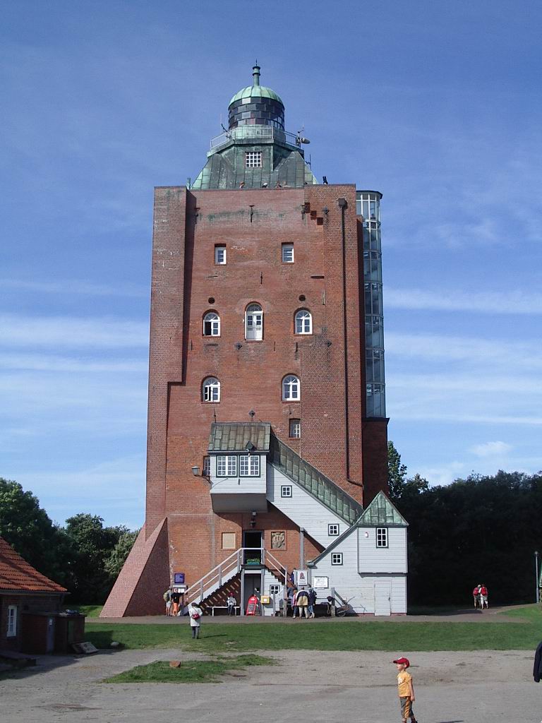
Lüneburg Heath: Although slightly outside of Harburg, Lüneburg Heath is not too far away and is a fantastic area for hiking. Known for its rolling heathland, charming villages, and vast landscapes, it offers well-marked trails suitable for various skill levels.
-
Elbe River Trails: The banks of the Elbe River provide numerous trails and paths that you can explore. Walking along the river offers picturesque views and opportunities to observe wildlife. The paths are generally flat, making them accessible for hikers of all abilities.
-
Harburg Hills (Harburger Berge): This area offers a series of forested hills that provide a more rugged hiking experience. There are several trails that wind through the woods, allowing for a more immersive natural experience. The highest points provide some scenic overlooks.
-
Heuckenlock Nature Reserve: This nature reserve offers a chance to see local flora and fauna up close. It features marked trails and pathways that lead through beautiful landscapes, ideal for nature lovers.
Tips for Hiking in Harburg:
- Weather Preparedness: Always check the weather forecast before heading out, as conditions can change rapidly.
- Footwear: Wear comfortable, sturdy hiking shoes, especially if you plan to explore the forested areas or uneven terrain.
- Hydration and Snacks: Bring plenty of water and snacks to keep your energy up during your hike.
- Local Map/Apps: Utilize local maps or hiking apps to navigate the trails efficiently, especially in less urban areas.
- Respect Nature: Stick to marked trails, and follow local regulations to conserve the natural environment.
Whether you're looking for a simple walk through the park or a more challenging hike in the nearby hills, Harburg and its surroundings offer a variety of options. Enjoy your time exploring this charming district!
- Country:

- Capital: Harburg
- Coordinates: 53° 27' 0" N, 9° 58' 0" E


- GPS tracks (wikiloc): [Link]
- AboveSeaLevel: 10 м m
- Area: 161 sq km
- Wikipedia en: wiki(en)
- Wikipedia: wiki(de)
- Wikidata storage: Wikidata: Q1635
- Wikipedia Commons Gallery: [Link]
- Wikipedia Commons Category: [Link]
- Freebase ID: [/m/01jyk8]
- GeoNames ID: Alt: [2910685]
- VIAF ID: Alt: [190946185]
- OSM relation ID: [28964]
- archINFORM location ID: [7749]
- Facebook Places ID: [108238952534802]
Includes regions:


Eißendorf
- borough of Hamburg, Germany
Hiking in Eißendorf
Eißendorf is a district in the Hamburg area of Germany, and while it’s not typically known as a major hiking destination like some of the natural parks found in Germany, there are certainly some spots and green spaces that can offer a pleasant outdoor experience....
- Country:
- Coordinates: 53° 27' 21" N, 9° 57' 16" E
- GPS tracks (wikiloc): [Link]
- Area: 8.4 sq km
- Population: 24324
- Web site: [Link]


Hausbruch
- place in Harburg district
Hiking in Hausbruch
Hausbruch is a district in the southern part of Hamburg, Germany, and while it may not be known for rugged mountainous terrain or traditional hiking trails, it offers some pleasant walking paths and green spaces that can be explored....
- Country:
- Postal Code: 21149; 21147
- Local Dialing Code: 040
- Coordinates: 53° 28' 0" N, 9° 53' 0" E
- GPS tracks (wikiloc): [Link]
- AboveSeaLevel: 37 м m
- Area: 11.2 sq km
- Population: 16852


Heimfeld
- district of Hamburg, Germany
Hiking in Heimfeld
Hamburg-Heimfeld is a suburban area in the city of Hamburg, Germany, and while it may not be as renowned for hiking as some mountainous regions, it does offer some pleasant options for outdoor enthusiasts. Here are a few highlights for hiking in and around Hamburg-Heimfeld:...
- Country:
- Coordinates: 53° 27' 50" N, 9° 57' 22" E
- GPS tracks (wikiloc): [Link]
- Area: 11.7 sq km
- Population: 21798


Moorburg
- suburb in the district Harburg, Germany
Hiking in Moorburg
Moorburg is a district located in Hamburg, Germany. While it is predominantly an urban area, it offers access to some scenic routes and green spaces suitable for hiking or walking. Here are some aspects to consider if you’re planning a hiking experience around Moorburg and its surroundings:...
- Country:
- Postal Code: 21079
- Coordinates: 53° 29' 21" N, 9° 56' 37" E
- GPS tracks (wikiloc): [Link]
- AboveSeaLevel: 5 м m
- Area: 10.0 sq km
- Population: 739

Neugraben-Fischbek
- quarter of Hamburg, Germany
Hiking in Neugraben-Fischbek
Neugraben-Fischbek is a district located in the southern part of Hamburg, Germany. While it may not be as well-known for hiking as some of the more mountainous regions, it does offer some opportunities for outdoor activities and exploration. Here are some insights into hiking in and around Neugraben-Fischbek:...
- Country:
- Postal Code: 21149; 21147
- Coordinates: 53° 28' 21" N, 9° 50' 9" E
- GPS tracks (wikiloc): [Link]
- AboveSeaLevel: 1 м m
- Area: 22.5 sq km
- Population: 28991
- Web site: [Link]


Wilstorf
- suburb in the district Harburg, Germany
Hiking in Wilstorf
Wilstorf, a small district in the city of Hamburg, Germany, offers a more urban hiking experience compared to remote natural areas. While it may not have extensive hiking trails typical of rural regions, you can still explore some interesting paths and parks nearby. Here are a few tips for hiking in and around Wilstorf:...
- Country:
- Coordinates: 53° 26' 37" N, 9° 59' 3" E
- GPS tracks (wikiloc): [Link]
- Area: 3.5 sq km
- Population: 17104
Shares border with regions:

Hamburg-Mitte
- district of Hamburg, Germany
Hiking in Hamburg-Mitte
Hiking in Hamburg-Mitte offers a unique blend of urban exploration, historical sites, and beautiful green spaces. While the area is predominantly urban, there are several parks and nature areas where you can enjoy some fresh air and scenic views. Here are a few highlights and suggestions for hiking and outdoor activities in Hamburg-Mitte:...
- Country:
- Coordinates: 53° 33' 1" N, 9° 59' 39" E
- GPS tracks (wikiloc): [Link]
- AboveSeaLevel: 11 м m
- Area: 142.2 sq km
- Population: 301550


Stade
- German district of Lower Saxony
Hiking in Stade
Stade, located in Lower Saxony, Germany, offers a range of hiking opportunities that allow you to explore its picturesque natural landscapes, historical sites, and charming small towns. Here are some highlights for hiking in the Stade district:...
- Country:
- Licence Plate Code: STD
- Coordinates: 53° 34' 48" N, 9° 25' 12" E
- GPS tracks (wikiloc): [Link]
- AboveSeaLevel: 1 м m
- Area: 1266.00 sq km
- Population: 201638
- Web site: [Link]


Harburg
- German district in Lower Saxony
Hiking in Harburg
Harburg, a district in the southern part of Hamburg, Germany, offers various hiking opportunities that allow you to explore the beautiful natural landscapes and scenic views of the region. Here are some key points about hiking in Harburg:...
- Country:
- Capital: Winsen
- Licence Plate Code: WL
- Coordinates: 53° 19' 43" N, 9° 58' 11" E
- GPS tracks (wikiloc): [Link]
- AboveSeaLevel: 49 м m
- Population: 250326
- Web site: [Link]