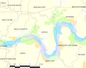
Morcourt (Morcourt)

- commune in Somme, France
- Country:

- Postal Code: 80340
- Coordinates: 49° 53' 31" N, 2° 39' 5" E


- GPS tracks (wikiloc): [Link]
- Area: 7.56 sq km
- Population: 287
- Wikipedia en: wiki(en)
- Wikipedia: wiki(fr)
- Wikidata storage: Wikidata: Q429419
- Wikipedia Commons Category: [Link]
- Freebase ID: [/m/03qms2n]
- GeoNames ID: Alt: [6613790]
- SIREN number: [218005361]
- BnF ID: [152770459]
- VIAF ID: Alt: [124473703]
- GND ID: Alt: [4269546-6]
- Library of Congress authority ID: Alt: [n91097365]
- INSEE municipality code: 80569
Shares border with regions:


Méricourt-sur-Somme
- former commune in Somme, France
- Country:
- Postal Code: 80340
- Coordinates: 49° 54' 21" N, 2° 40' 27" E
- GPS tracks (wikiloc): [Link]
- Area: 7.14 sq km
- Population: 216
- Web site: [Link]


Bayonvillers
- commune in Somme, France
- Country:
- Postal Code: 80170
- Coordinates: 49° 51' 41" N, 2° 37' 37" E
- GPS tracks (wikiloc): [Link]
- Area: 8.1 sq km
- Population: 351

Chipilly
- commune in Somme, France
- Country:
- Postal Code: 80800
- Coordinates: 49° 54' 32" N, 2° 38' 59" E
- GPS tracks (wikiloc): [Link]
- Area: 6.85 sq km
- Population: 177

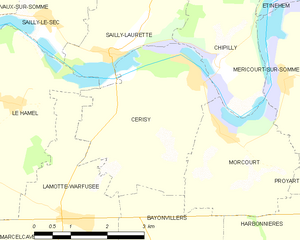
Cerisy
- commune in Somme, France
- Country:
- Postal Code: 80800
- Coordinates: 49° 54' 23" N, 2° 38' 19" E
- GPS tracks (wikiloc): [Link]
- AboveSeaLevel: 68 м m
- Area: 10.94 sq km
- Population: 520

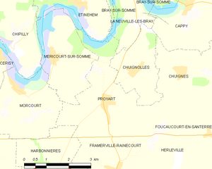
Proyart
- commune in Somme, France
- Country:
- Postal Code: 80121
- Coordinates: 49° 53' 13" N, 2° 42' 26" E
- GPS tracks (wikiloc): [Link]
- Area: 9.86 sq km
- Population: 687

Harbonnières
- commune in Somme, France
- Country:
- Postal Code: 80131
- Coordinates: 49° 50' 56" N, 2° 40' 11" E
- GPS tracks (wikiloc): [Link]
- Area: 15.37 sq km
- Population: 1648