
Mornac-sur-Seudre (Mornac-sur-Seudre)

- commune in Charente-Maritime, France
- Country:

- Postal Code: 17113
- Coordinates: 45° 42' 35" N, 1° 1' 42" E


- GPS tracks (wikiloc): [Link]
- Area: 9.5 sq km
- Population: 824
- Web site: http://www.mairie-mornac-sur-seudre.fr
- Wikipedia en: wiki(en)
- Wikipedia: wiki(fr)
- Wikidata storage: Wikidata: Q933691
- Wikipedia Commons Category: [Link]
- Freebase ID: [/m/03mcj2x]
- GeoNames ID: Alt: [2991746]
- SIREN number: [211702477]
- BnF ID: [152491087]
- OSM relation ID: [121742]
- WOEID: [12667291]
- INSEE municipality code: 17247
Shares border with regions:


Breuillet
- commune in Charente-Maritime, France
- Country:
- Postal Code: 17920
- Coordinates: 45° 41' 34" N, 1° 3' 6" E
- GPS tracks (wikiloc): [Link]
- Area: 19.99 sq km
- Population: 2777
- Web site: [Link]


Le Gua
- commune in Charente-Maritime, France
- Country:
- Postal Code: 17600
- Coordinates: 45° 43' 34" N, 0° 56' 37" E
- GPS tracks (wikiloc): [Link]
- Area: 36.09 sq km
- Population: 2070
- Web site: [Link]


L'Éguille
- commune in Charente-Maritime, France
- Country:
- Postal Code: 17600
- Coordinates: 45° 42' 25" N, 0° 58' 39" E
- GPS tracks (wikiloc): [Link]
- Area: 5.49 sq km
- Population: 879
- Web site: [Link]

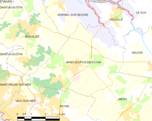
Saint-Sulpice-de-Royan
- commune in Charente-Maritime, France
- Country:
- Postal Code: 17200
- Coordinates: 45° 40' 17" N, 1° 0' 41" E
- GPS tracks (wikiloc): [Link]
- Area: 20.81 sq km
- Population: 3113
- Web site: [Link]