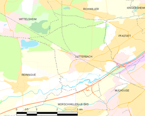
Morschwiller-le-Bas (Morschwiller-le-Bas)

- commune in Haut-Rhin, France
 Hiking in Morschwiller-le-Bas
Morschwiller-le-Bas, located in the Alsace region of France, offers a variety of hiking opportunities for nature lovers and outdoor enthusiasts. While it may be a small town, it has access to beautiful landscapes and trails in the surrounding areas.
Hiking Opportunities:
-
Nearby Nature Reserves: The town is in proximity to several natural parks and reserves, such as the Parc Naturel Régional des Ballons des Vosges, where you can find numerous hiking trails that vary in difficulty.
-
Local Trails: There are several local paths starting from Morschwiller-le-Bas that lead into the countryside and nearby woods. These trails often offer scenic views of the vineyards, forests, and rolling hills typical of the Alsace region.
-
Connecting to Larger Trails: From Morschwiller-le-Bas, you can connect to larger regional hiking trails, including the GR5 (Grande Randonnée 5), which runs through the Vosges mountains and across multiple regions in France.
Hiking Tips:
-
Check Trail Maps: Use local maps or hiking apps to identify well-marked trails and plan your hike accordingly.
-
Seasonal Considerations: The best times for hiking are usually in the spring and fall when the weather is milder. Be aware that winter can bring snow and ice in the region, which may require specialized gear.
-
Hydration and Supplies: Carry enough water, snacks, and a first-aid kit, as amenities may not be readily available on the trails.
-
Respect Nature: Stay on marked paths, and be considerate of wildlife and fellow hikers to preserve the natural beauty of the area.
What to Expect:
-
Scenery: Expect to see a variety of flora and fauna, with picturesque views of vineyards and the Vosges Mountains in the background.
-
Cultural Stops: Along the trails, you might find charming villages, vineyards, and historical sites to explore, offering a cultural experience alongside your hiking adventure.
Hiking in and around Morschwiller-le-Bas can be a delightful way to experience the natural beauty and cultural richness of the Alsace region. Enjoy your hike!
- Country:

- Postal Code: 68790
- Coordinates: 47° 44' 9" N, 7° 16' 14" E


- GPS tracks (wikiloc): [Link]
- Area: 7.55 sq km
- Population: 3667
- Wikipedia en: wiki(en)
- Wikipedia: wiki(fr)
- Wikidata storage: Wikidata: Q148741
- Wikipedia Commons Category: [Link]
- Freebase ID: [/m/03m4l7h]
- Freebase ID: [/m/03m4l7h]
- GeoNames ID: Alt: [2991713]
- GeoNames ID: Alt: [2991713]
- SIREN number: [216802181]
- SIREN number: [216802181]
- BnF ID: [152719200]
- BnF ID: [152719200]
- VIAF ID: Alt: [304524916]
- VIAF ID: Alt: [304524916]
- PACTOLS thesaurus ID: [pcrtnP8N9pro8G]
- PACTOLS thesaurus ID: [pcrtnP8N9pro8G]
- INSEE municipality code: 68218
- INSEE municipality code: 68218
Shares border with regions:

Lutterbach
- commune in Haut-Rhin, France
Hiking in Lutterbach
Lutterbach, a small town in the Grand Est region of France, is not widely known for hiking but can serve as a good base for exploring nearby natural areas and trails. Here’s what you might expect and some recommendations for hiking in and around Lutterbach:...
- Country:
- Postal Code: 68460
- Coordinates: 47° 45' 35" N, 7° 16' 50" E
- GPS tracks (wikiloc): [Link]
- Area: 8.56 sq km
- Population: 6331
- Web site: [Link]

Reiningue
- commune in Haut-Rhin, France
Hiking in Reiningue
Reiningue is a small commune in the Grand Est region of France, close to the border with Germany. While it may not be as widely recognized as a hiking destination, the surrounding region offers some beautiful natural landscapes and hiking opportunities....
- Country:
- Postal Code: 68950
- Coordinates: 47° 45' 2" N, 7° 13' 53" E
- GPS tracks (wikiloc): [Link]
- Area: 18.54 sq km
- Population: 1965
- Web site: [Link]

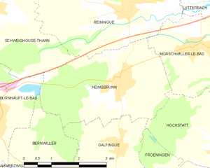
Heimsbrunn
- commune in Haut-Rhin, France
Hiking in Heimsbrunn
Heimsbrunn is a small commune located in the Grand Est region of France, specifically in the Haut-Rhin department. It offers some beautiful hiking opportunities, particularly for those looking to explore the scenic landscapes of the Vosges region. While Heimsbrunn itself is a quieter area, it is well-situated near more extensive hiking trails and natural attractions....
- Country:
- Postal Code: 68990
- Coordinates: 47° 43' 35" N, 7° 13' 35" E
- GPS tracks (wikiloc): [Link]
- Area: 10.59 sq km
- Population: 1302


Hochstatt
- commune in Haut-Rhin, France
Hiking in Hochstatt
Hochstatt is a small town in Germany that may not be widely known for its hiking trails, but the surrounding regions offer some beautiful landscapes and outdoor opportunities. While the immediate area may have limited dedicated hiking paths, there are several nearby locations that are worth exploring for hiking enthusiasts....
- Country:
- Postal Code: 68720
- Coordinates: 47° 42' 7" N, 7° 16' 33" E
- GPS tracks (wikiloc): [Link]
- Area: 8.55 sq km
- Population: 2095


Didenheim
- former commune in Haut-Rhin, France
Hiking in Didenheim
Didenheim is a small village located in France, near the German border, and is part of the Alsace region. While it may not be as well-known as some of the larger hiking destinations, the surrounding area offers beautiful landscapes and opportunities for hiking enthusiasts....
- Country:
- Postal Code: 68350
- Coordinates: 47° 43' 8" N, 7° 18' 3" E
- GPS tracks (wikiloc): [Link]
- Area: 4.44 sq km
- Population: 1691
- Web site: [Link]


Mulhouse
- commune in Haut-Rhin, France
Hiking in Mulhouse
Mulhouse, located in the Alsace region of northeastern France, is surrounded by a varied landscape ideal for hiking enthusiasts. While Mulhouse itself may be more urban, it serves as a convenient base for exploring nearby natural areas, particularly the Vosges Mountains to the west and the Rhine River valley to the east. Here are some highlights and tips for hiking around Mulhouse:...
- Country:
- Postal Code: 68100–68200
- Coordinates: 47° 44' 55" N, 7° 20' 21" E
- GPS tracks (wikiloc): [Link]
- AboveSeaLevel: 240 м m
- Area: 22.18 sq km
- Population: 110370
- Web site: [Link]