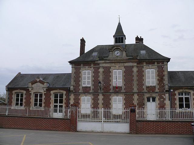
Mortemer (Mortemer)

- commune in Oise, France
- Country:

- Postal Code: 60490
- Coordinates: 49° 34' 14" N, 2° 40' 34" E


- GPS tracks (wikiloc): [Link]
- Area: 6.56 sq km
- Population: 221
- Wikipedia en: wiki(en)
- Wikipedia: wiki(fr)
- Wikidata storage: Wikidata: Q1174270
- Wikipedia Commons Category: [Link]
- Freebase ID: [/m/03qgnfj]
- GeoNames ID: Alt: [6438847]
- SIREN number: [216004291]
- BnF ID: [15267670z]
- INSEE municipality code: 60434
Shares border with regions:


Courcelles-Epayelles
- commune in Oise, France
- Country:
- Postal Code: 60420
- Coordinates: 49° 34' 4" N, 2° 37' 39" E
- GPS tracks (wikiloc): [Link]
- Area: 6.38 sq km
- Population: 203
- Web site: [Link]

Cuvilly
- commune in Oise, France
- Country:
- Postal Code: 60490
- Coordinates: 49° 33' 12" N, 2° 41' 43" E
- GPS tracks (wikiloc): [Link]
- Area: 8.61 sq km
- Population: 627


Orvillers-Sorel
- commune in Oise, France
- Country:
- Postal Code: 60490
- Coordinates: 49° 34' 41" N, 2° 42' 27" E
- GPS tracks (wikiloc): [Link]
- Area: 8.51 sq km
- Population: 534


Hainvillers
- commune in Oise, France
- Country:
- Postal Code: 60490
- Coordinates: 49° 35' 34" N, 2° 41' 1" E
- GPS tracks (wikiloc): [Link]
- Area: 2.96 sq km
- Population: 80


Rollot
- commune in Somme, France
- Country:
- Postal Code: 80500
- Coordinates: 49° 35' 29" N, 2° 39' 14" E
- GPS tracks (wikiloc): [Link]
- Area: 12 sq km
- Population: 750

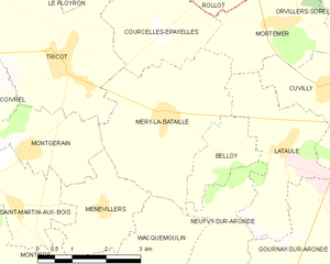
Méry-la-Bataille
- commune in Oise, France
- Country:
- Postal Code: 60420
- Coordinates: 49° 32' 45" N, 2° 37' 46" E
- GPS tracks (wikiloc): [Link]
- Area: 11.26 sq km
- Population: 635
Lataule
- commune in Oise, France
- Country:
- Postal Code: 60490
- Coordinates: 49° 32' 24" N, 2° 40' 49" E
- GPS tracks (wikiloc): [Link]
- Area: 7.37 sq km
- Population: 111