Méry-la-Bataille (Méry-la-Bataille)

- commune in Oise, France
- Country:

- Postal Code: 60420
- Coordinates: 49° 32' 45" N, 2° 37' 46" E


- GPS tracks (wikiloc): [Link]
- Area: 11.26 sq km
- Population: 635
- Wikipedia en: wiki(en)
- Wikipedia: wiki(fr)
- Wikidata storage: Wikidata: Q750674
- Wikipedia Commons Category: [Link]
- Freebase ID: [/m/03qg4wt]
- GeoNames ID: Alt: [6438823]
- SIREN number: [216003921]
- BnF ID: [15267632d]
- INSEE municipality code: 60396
Shares border with regions:


Courcelles-Epayelles
- commune in Oise, France
- Country:
- Postal Code: 60420
- Coordinates: 49° 34' 4" N, 2° 37' 39" E
- GPS tracks (wikiloc): [Link]
- Area: 6.38 sq km
- Population: 203
- Web site: [Link]


Belloy
- commune in Oise, France
- Country:
- Postal Code: 60490
- Coordinates: 49° 32' 8" N, 2° 39' 15" E
- GPS tracks (wikiloc): [Link]
- Area: 2.98 sq km
- Population: 94


Mortemer
- commune in Oise, France
- Country:
- Postal Code: 60490
- Coordinates: 49° 34' 14" N, 2° 40' 34" E
- GPS tracks (wikiloc): [Link]
- Area: 6.56 sq km
- Population: 221

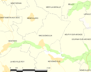
Wacquemoulin
- commune in Oise, France
- Country:
- Postal Code: 60420
- Coordinates: 49° 30' 10" N, 2° 37' 0" E
- GPS tracks (wikiloc): [Link]
- Area: 6.66 sq km
- Population: 300
- Web site: [Link]

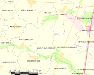
Neufvy-sur-Aronde
- commune in Oise, France
- Country:
- Postal Code: 60190
- Coordinates: 49° 29' 46" N, 2° 39' 42" E
- GPS tracks (wikiloc): [Link]
- Area: 7.31 sq km
- Population: 280
- Web site: [Link]


Tricot
- commune in Oise, France
- Country:
- Postal Code: 60420
- Coordinates: 49° 33' 40" N, 2° 35' 20" E
- GPS tracks (wikiloc): [Link]
- Area: 11.91 sq km
- Population: 1504


Montgérain
- commune in Oise, France
- Country:
- Postal Code: 60420
- Coordinates: 49° 32' 13" N, 2° 34' 30" E
- GPS tracks (wikiloc): [Link]
- Area: 4.91 sq km
- Population: 184

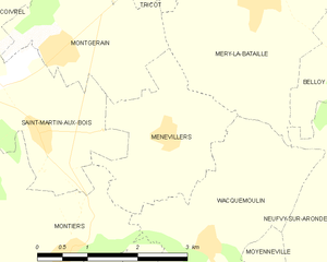
Ménévillers
- commune in Oise, France
- Country:
- Postal Code: 60420
- Coordinates: 49° 31' 21" N, 2° 36' 18" E
- GPS tracks (wikiloc): [Link]
- Area: 4.88 sq km
- Population: 108
Lataule
- commune in Oise, France
- Country:
- Postal Code: 60490
- Coordinates: 49° 32' 24" N, 2° 40' 49" E
- GPS tracks (wikiloc): [Link]
- Area: 7.37 sq km
- Population: 111