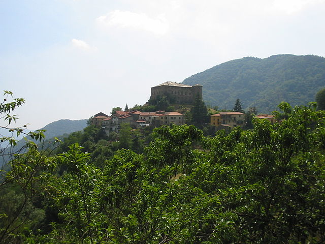
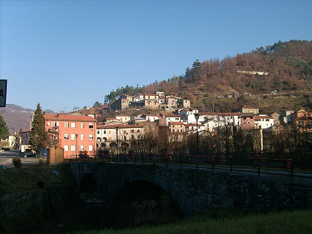
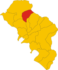
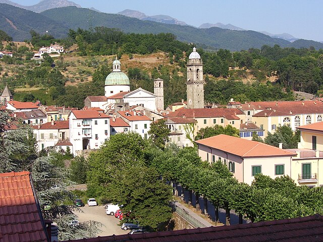
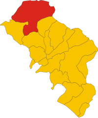
Mulazzo (Mulazzo)
.svg)
- Italian comune
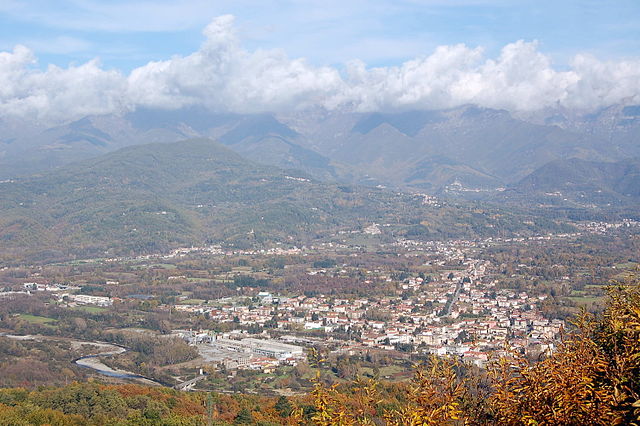
 Hiking in Mulazzo
Mulazzo is a charming village located in the province of Massa-Carrara in Tuscany, Italy. It is situated in the Apuan Alps, which offers stunning landscapes and a variety of hiking opportunities. Here’s an overview of what you might expect when hiking in this beautiful area:
Trails and Routes:
-
Variety of Difficulty Levels: The trails around Mulazzo cater to different skill levels, from easy walks suitable for families to more challenging hikes for experienced trekkers.
-
Scenic Views: Many trails offer breathtaking views of the Apuan Alps and the surrounding valleys. The diverse landscapes include lush forests, rocky outcrops, and panoramic viewpoints.
-
Historical and Cultural Sites: While hiking, you may encounter ancient ruins, churches, and other historical sites, as this area has a rich history intertwined with nature.
Recommended Hikes:
-
Mulazzo to the Apuan Alps: This route provides a gradual ascent into the mountains, with plenty of spots to take breaks and enjoy the scenery.
-
Sentiero del Fiume: A trail that follows the course of the local river, showcasing the unique landscape around Mulazzo and offering opportunities for birdwatching and photography.
-
Rocca di Mulazzo: A hike that combines nature with history, leading you to the remains of the ancient castle overlooking the village.
Tips for Hikers:
-
Weather Considerations: The weather in the Apuan Alps can change rapidly, so it's important to check forecasts before heading out. Dress in layers and be prepared for varying conditions.
-
Footwear: Proper hiking boots with good traction are essential. Many trails feature rocky and uneven terrain.
-
Hydration and Snacks: Carry sufficient water and snacks, as some trails may not have easy access to facilities.
-
Trail Maps: Although many trails are marked, it’s beneficial to have a detailed map or a GPS device for navigation.
-
Respect Nature: Follow the Leave No Trace principles to preserve the natural beauty of the area.
Local Resources:
-
Visitor Centers: Local tourist information centers can provide maps, guides, and advice on the best trails according to your interests and abilities.
-
Guided Tours: If you prefer a more guided experience, consider joining a local hiking group or tour that can offer insights into the flora, fauna, and history of the region.
Hiking in Mulazzo provides a perfect blend of outdoor exploration and cultural immersion, making it a wonderful destination for hiking enthusiasts. Enjoy your adventure in Tuscany!
- Country:

- Postal Code: 54026
- Local Dialing Code: 0187
- Licence Plate Code: MS
- Coordinates: 44° 19' 1" N, 9° 53' 26" E


- GPS tracks (wikiloc): [Link]
- AboveSeaLevel: 351 м m
- Area: 62.51 sq km
- Population: 2425
- Web site: http://www.comunemulazzo.ms.it
- Wikipedia en: wiki(en)
- Wikipedia: wiki(it)
- Wikidata storage: Wikidata: Q52238
- Wikipedia Commons Category: [Link]
- Freebase ID: [/m/0gl9y9]
- GeoNames ID: Alt: [6538548]
- VIAF ID: Alt: [157270671]
- OSM relation ID: [43005]
- WOEID: [719208]
- TGN ID: [1045629]
- UN/LOCODE: [ITMUL]
- ISTAT ID: 045012
- Italian cadastre code: F802
Shares border with regions:

Calice al Cornoviglio
- Italian comune
Hiking in Calice al Cornoviglio
Calice al Cornoviglio, located in the Liguria region of Italy, is a charming village surrounded by the stunning landscapes of the Apuan Alps and close to the Cinque Terre National Park. It's a perfect spot for hikers looking for a mix of coastal and mountain trails, rich in natural beauty and cultural heritage....
- Country:
- Postal Code: 19020
- Local Dialing Code: 0187
- Licence Plate Code: SP
- Coordinates: 44° 14' 35" N, 9° 50' 11" E
- GPS tracks (wikiloc): [Link]
- AboveSeaLevel: 402 м m
- Area: 33.75 sq km
- Population: 1105
- Web site: [Link]

Rocchetta di Vara
- Italian comune
Hiking in Rocchetta di Vara
Rocchetta di Vara is a charming village located in the Liguria region of Italy, nestled in the hills of the Val di Vara. This area is known for its picturesque landscapes, lush greenery, and diverse hiking trails that appeal to all levels of hikers....
- Country:
- Postal Code: 19020
- Local Dialing Code: 0187
- Licence Plate Code: SP
- Coordinates: 44° 15' 4" N, 9° 45' 26" E
- GPS tracks (wikiloc): [Link]
- AboveSeaLevel: 220 м m
- Area: 32.66 sq km
- Population: 701
- Web site: [Link]

Filattiera
- Italian comune
Hiking in Filattiera
Filattiera is a charming village located in the province of Massa-Carrara, in the Tuscany region of Italy. Nestled in the Apuan Alps, it offers a variety of hiking opportunities that cater to different skill levels, along with stunning natural scenery and cultural sites....
- Country:
- Postal Code: 54023
- Local Dialing Code: 0187
- Licence Plate Code: MS
- Coordinates: 44° 20' 0" N, 9° 56' 0" E
- GPS tracks (wikiloc): [Link]
- AboveSeaLevel: 213 м m
- Area: 48.78 sq km
- Population: 2285
- Web site: [Link]
Pontremoli
- Italian comune in Tuscany
Hiking in Pontremoli
Pontremoli, a charming town in the Lunigiana region of Tuscany, Italy, offers a variety of hiking opportunities for outdoor enthusiasts. Nestled in the Apennine Mountains, it is surrounded by stunning natural landscapes, rich history, and vibrant culture. Here are some key points to consider for hiking in and around Pontremoli:...
- Country:
- Postal Code: 54027
- Local Dialing Code: 0187
- Licence Plate Code: MS
- Coordinates: 44° 22' 34" N, 9° 52' 48" E
- GPS tracks (wikiloc): [Link]
- AboveSeaLevel: 236 м m
- Area: 182.48 sq km
- Population: 7193
- Web site: [Link]


Tresana
- Italian comune
Hiking in Tresana
Tresana, located in the Lunigiana region of Tuscany, Italy, is a picturesque area that offers a variety of hiking opportunities. Nestled between the Apuan Alps and the Apennines, it is characterized by beautiful landscapes, charming villages, and rich history....
- Country:
- Postal Code: 54012
- Local Dialing Code: 0187
- Licence Plate Code: MS
- Coordinates: 44° 14' 0" N, 9° 57' 0" E
- GPS tracks (wikiloc): [Link]
- AboveSeaLevel: 112 м m
- Area: 44.45 sq km
- Population: 1999
- Web site: [Link]

Villafranca in Lunigiana
- Italian comune
Hiking in Villafranca in Lunigiana
Villafranca in Lunigiana is a charming town located in the northern part of Tuscany, Italy, nestled in the beautiful Lunigiana region, which is characterized by its stunning natural landscapes, rich history, and medieval architecture. The area offers a variety of hiking opportunities for all levels of outdoor enthusiasts....
- Country:
- Postal Code: 54028
- Local Dialing Code: 0187
- Licence Plate Code: MS
- Coordinates: 44° 17' 44" N, 9° 57' 0" E
- GPS tracks (wikiloc): [Link]
- AboveSeaLevel: 138 м m
- Area: 29.32 sq km
- Population: 4727
- Web site: [Link]


Zeri
- Italian comune
Hiking in Zeri
Zeri is a beautiful area located in the Tuscany region of Italy, known for its stunning landscapes, rich biodiversity, and serene environment. It lies in the province of Massa-Carrara and is a great destination for hikers seeking both natural beauty and cultural experiences....
- Country:
- Postal Code: 54029
- Local Dialing Code: 0187
- Licence Plate Code: MS
- Coordinates: 44° 21' 0" N, 9° 46' 0" E
- GPS tracks (wikiloc): [Link]
- AboveSeaLevel: 708 м m
- Area: 73.66 sq km
- Population: 1057
- Web site: [Link]