Mun (Mun)

- commune in Hautes-Pyrénées, France
- Country:

- Postal Code: 65350
- Coordinates: 43° 17' 3" N, 0° 16' 12" E


- GPS tracks (wikiloc): [Link]
- Area: 4.81 sq km
- Population: 105
- Wikipedia en: wiki(en)
- Wikipedia: wiki(fr)
- Wikidata storage: Wikidata: Q1325879
- Wikipedia Commons Category: [Link]
- Freebase ID: [/m/03nv6bd]
- Freebase ID: [/m/03nv6bd]
- GeoNames ID: Alt: [2991204]
- GeoNames ID: Alt: [2991204]
- SIREN number: [216503268]
- SIREN number: [216503268]
- BnF ID: [15270757j]
- BnF ID: [15270757j]
- INSEE municipality code: 65326
- INSEE municipality code: 65326
Shares border with regions:


Aubarède
- commune in Hautes-Pyrénées, France
- Country:
- Postal Code: 65350
- Coordinates: 43° 16' 19" N, 0° 14' 16" E
- GPS tracks (wikiloc): [Link]
- Area: 4.85 sq km
- Population: 293

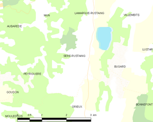
Sère-Rustaing
- commune in Hautes-Pyrénées, France
- Country:
- Postal Code: 65220
- Coordinates: 43° 15' 44" N, 0° 17' 39" E
- GPS tracks (wikiloc): [Link]
- Area: 5.29 sq km
- Population: 131

Luby-Betmont
- commune in Hautes-Pyrénées, France
- Country:
- Postal Code: 65220
- Coordinates: 43° 17' 45" N, 0° 17' 32" E
- GPS tracks (wikiloc): [Link]
- Area: 7.16 sq km
- Population: 102
Osmets
- commune in Hautes-Pyrénées, France
- Country:
- Postal Code: 65350
- Coordinates: 43° 18' 19" N, 0° 15' 56" E
- GPS tracks (wikiloc): [Link]
- Area: 4.88 sq km
- Population: 81


Peyriguère
- commune in Hautes-Pyrénées, France
- Country:
- Postal Code: 65350
- Coordinates: 43° 15' 17" N, 0° 15' 42" E
- GPS tracks (wikiloc): [Link]
- Area: 4.17 sq km
- Population: 25


Lamarque-Rustaing
- commune in Hautes-Pyrénées, France
- Country:
- Postal Code: 65220
- Coordinates: 43° 16' 44" N, 0° 17' 41" E
- GPS tracks (wikiloc): [Link]
- Area: 2.79 sq km
- Population: 57
Chelle-Debat
- commune in Hautes-Pyrénées, France
- Country:
- Postal Code: 65350
- Coordinates: 43° 18' 18" N, 0° 13' 47" E
- GPS tracks (wikiloc): [Link]
- Area: 8.69 sq km
- Population: 213