Nesle (Nesle)

- commune in Somme, France
- Country:

- Postal Code: 80190
- Coordinates: 49° 45' 29" N, 2° 54' 36" E


- GPS tracks (wikiloc): [Link]
- Area: 7.72 sq km
- Population: 2376
- Web site: http://www.ville-nesle.fr
- Wikipedia en: wiki(en)
- Wikipedia: wiki(fr)
- Wikidata storage: Wikidata: Q585873
- Wikipedia Commons Category: [Link]
- Freebase ID: [/m/0812gg]
- GeoNames ID: Alt: [2990741]
- SIREN number: [218005510]
- BnF ID: [15277061j]
- VIAF ID: Alt: [156397191]
- Library of Congress authority ID: Alt: [nr98015159]
- INSEE municipality code: 80585
Shares border with regions:

Billancourt
- commune in Somme, France
- Country:
- Postal Code: 80190
- Coordinates: 49° 44' 11" N, 2° 53' 36" E
- GPS tracks (wikiloc): [Link]
- Area: 4.95 sq km
- Population: 174

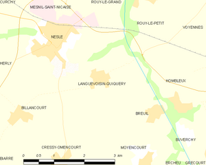
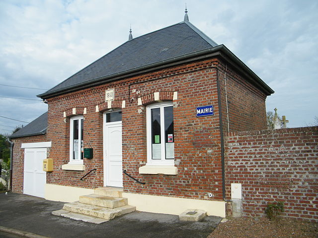
Languevoisin-Quiquery
- commune in Somme, France
- Country:
- Postal Code: 80190
- Coordinates: 49° 44' 52" N, 2° 55' 52" E
- GPS tracks (wikiloc): [Link]
- Area: 4.83 sq km
- Population: 186
- Web site: [Link]


Mesnil-Saint-Nicaise
- commune in Somme, France
- Country:
- Postal Code: 80190
- Coordinates: 49° 46' 43" N, 2° 55' 18" E
- GPS tracks (wikiloc): [Link]
- Area: 6.8 sq km
- Population: 564


Herly
- commune in Somme, France
- Country:
- Postal Code: 80190
- Coordinates: 49° 45' 21" N, 2° 52' 24" E
- GPS tracks (wikiloc): [Link]
- Area: 3.75 sq km
- Population: 46

Curchy
- commune in Somme, France
- Country:
- Postal Code: 80190
- Coordinates: 49° 46' 35" N, 2° 51' 33" E
- GPS tracks (wikiloc): [Link]
- Area: 9.63 sq km
- Population: 293


Rouy-le-Grand
- commune in Somme, France
- Country:
- Postal Code: 80190
- Coordinates: 49° 46' 31" N, 2° 57' 32" E
- GPS tracks (wikiloc): [Link]
- Area: 3.81 sq km
- Population: 109
- Web site: [Link]


Rouy-le-Petit
- commune in Somme, France
- Country:
- Postal Code: 80190
- Coordinates: 49° 46' 23" N, 2° 56' 56" E
- GPS tracks (wikiloc): [Link]
- Area: 3.27 sq km
- Population: 117