Neufvy-sur-Aronde (Neufvy-sur-Aronde)

- commune in Oise, France
- Country:

- Postal Code: 60190
- Coordinates: 49° 29' 46" N, 2° 39' 42" E


- GPS tracks (wikiloc): [Link]
- Area: 7.31 sq km
- Population: 280
- Web site: http://www.neufvysuraronde.fr
- Wikipedia en: wiki(en)
- Wikipedia: wiki(fr)
- Wikidata storage: Wikidata: Q1336833
- Wikipedia Commons Category: [Link]
- Freebase ID: [/m/03qg7ck]
- GeoNames ID: Alt: [6438859]
- SIREN number: [216004440]
- BnF ID: [152676850]
- INSEE municipality code: 60449
Shares border with regions:


Belloy
- commune in Oise, France
- Country:
- Postal Code: 60490
- Coordinates: 49° 32' 8" N, 2° 39' 15" E
- GPS tracks (wikiloc): [Link]
- Area: 2.98 sq km
- Population: 94

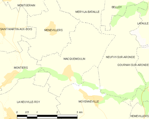
Wacquemoulin
- commune in Oise, France
- Country:
- Postal Code: 60420
- Coordinates: 49° 30' 10" N, 2° 37' 0" E
- GPS tracks (wikiloc): [Link]
- Area: 6.66 sq km
- Population: 300
- Web site: [Link]


Moyenneville
- commune in Oise, France
- Country:
- Postal Code: 60190
- Coordinates: 49° 29' 26" N, 2° 38' 11" E
- GPS tracks (wikiloc): [Link]
- AboveSeaLevel: 78 м m
- Area: 7.19 sq km
- Population: 631
- Web site: [Link]


Gournay-sur-Aronde
- commune in Oise, France
- Country:
- Postal Code: 60190
- Coordinates: 49° 29' 33" N, 2° 40' 27" E
- GPS tracks (wikiloc): [Link]
- Area: 14.71 sq km
- Population: 584

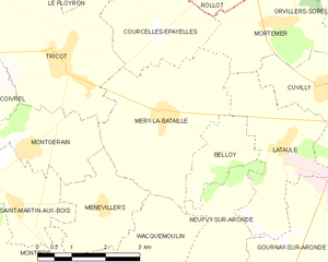
Méry-la-Bataille
- commune in Oise, France
- Country:
- Postal Code: 60420
- Coordinates: 49° 32' 45" N, 2° 37' 46" E
- GPS tracks (wikiloc): [Link]
- Area: 11.26 sq km
- Population: 635
Lataule
- commune in Oise, France
- Country:
- Postal Code: 60490
- Coordinates: 49° 32' 24" N, 2° 40' 49" E
- GPS tracks (wikiloc): [Link]
- Area: 7.37 sq km
- Population: 111