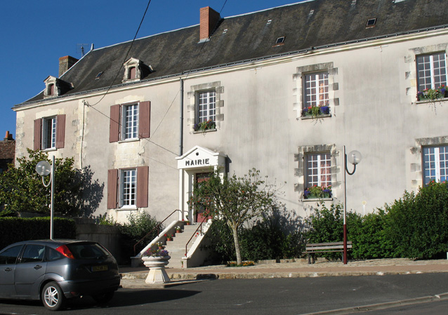
Neuilly-le-Brignon (Neuilly-le-Brignon)

- commune in Indre-et-Loire, France
- Country:

- Postal Code: 37160
- Coordinates: 46° 58' 29" N, 0° 47' 21" E


- GPS tracks (wikiloc): [Link]
- Area: 22 sq km
- Population: 306
- Web site: http://www.neuillylebrignon.fr
- Wikipedia en: wiki(en)
- Wikipedia: wiki(fr)
- Wikidata storage: Wikidata: Q737178
- Wikipedia Commons Category: [Link]
- Freebase ID: [/m/03nvch8]
- GeoNames ID: Alt: [2990624]
- SIREN number: [213701683]
- BnF ID: [152577198]
- PACTOLS thesaurus ID: [pcrty2VBGByHPB]
- INSEE municipality code: 37168
Shares border with regions:


Abilly
- commune in Indre-et-Loire, France
- Country:
- Postal Code: 37160
- Coordinates: 46° 56' 28" N, 0° 43' 40" E
- GPS tracks (wikiloc): [Link]
- Area: 30.27 sq km
- Population: 1148
- Web site: [Link]

Cussay
- commune in Indre-et-Loire, France
- Country:
- Postal Code: 37240
- Coordinates: 47° 1' 28" N, 0° 47' 20" E
- GPS tracks (wikiloc): [Link]
- Area: 25.81 sq km
- Population: 578


Descartes
- commune in Indre-et-Loire, France
- Country:
- Postal Code: 37160
- Coordinates: 46° 58' 25" N, 0° 41' 52" E
- GPS tracks (wikiloc): [Link]
- Area: 38.08 sq km
- Population: 3600
- Web site: [Link]


Le Grand-Pressigny
- commune in Indre-et-Loire, France
- Country:
- Postal Code: 37350
- Coordinates: 46° 55' 13" N, 0° 48' 10" E
- GPS tracks (wikiloc): [Link]
- Area: 39.55 sq km
- Population: 940
- Web site: [Link]


Paulmy
- commune in Indre-et-Loire, France
- Country:
- Postal Code: 37350
- Coordinates: 46° 58' 56" N, 0° 50' 22" E
- GPS tracks (wikiloc): [Link]
- Area: 25.97 sq km
- Population: 232