Neuvy-Pailloux (Neuvy-Pailloux)

- commune in Indre, France
- Country:

- Postal Code: 36100
- Coordinates: 46° 53' 10" N, 1° 51' 37" E


- GPS tracks (wikiloc): [Link]
- Area: 41.81 sq km
- Population: 1223
- Wikipedia en: wiki(en)
- Wikipedia: wiki(fr)
- Wikidata storage: Wikidata: Q662596
- Wikipedia Commons Category: [Link]
- Freebase ID: [/m/03nv9fm]
- GeoNames ID: Alt: [2990483]
- SIREN number: [213601404]
- BnF ID: [15257444n]
- PACTOLS thesaurus ID: [pcrtqJRmwI7xJF]
- INSEE municipality code: 36140
Shares border with regions:


La Champenoise
- commune in Indre, France
- Country:
- Postal Code: 36100
- Coordinates: 46° 56' 24" N, 1° 48' 6" E
- GPS tracks (wikiloc): [Link]
- Area: 44.34 sq km
- Population: 279


Thizay
- commune in Indre, France
- Country:
- Postal Code: 36100
- Coordinates: 46° 53' 53" N, 1° 54' 40" E
- GPS tracks (wikiloc): [Link]
- Area: 16.65 sq km
- Population: 238


Saint-Aoustrille
- commune in Indre, France
- Country:
- Postal Code: 36100
- Coordinates: 46° 56' 19" N, 1° 55' 16" E
- GPS tracks (wikiloc): [Link]
- Area: 19.47 sq km
- Population: 213

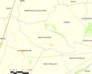
Saint-Valentin
- commune in Indre, France
- Country:
- Postal Code: 36100
- Coordinates: 46° 57' 6" N, 1° 51' 53" E
- GPS tracks (wikiloc): [Link]
- Area: 24.9 sq km
- Population: 283
- Web site: [Link]


Montierchaume
- commune in Indre, France
- Country:
- Postal Code: 36130
- Coordinates: 46° 51' 48" N, 1° 46' 33" E
- GPS tracks (wikiloc): [Link]
- Area: 37.2 sq km
- Population: 1607
Diors
- commune in Indre, France
- Country:
- Postal Code: 36130
- Coordinates: 46° 49' 35" N, 1° 48' 53" E
- GPS tracks (wikiloc): [Link]
- Area: 25.44 sq km
- Population: 778


Sainte-Fauste
- commune in Indre, France
- Country:
- Postal Code: 36100
- Coordinates: 46° 51' 26" N, 1° 51' 55" E
- GPS tracks (wikiloc): [Link]
- Area: 23.07 sq km
- Population: 276
- Web site: [Link]